There are many rocks in the riverbeds in eastern Taiwan, a result of the brittle quality of the land. "To cut down one tree in the east is equivalent to cutting down three in the west," is how botanists often describe it.
This cause and effect relationship can be traced back to the birth of Taiwan.
About 1.8 million years ago, Taiwan "fortuitously" popped through the surface of the ocean as a result of the pressures of the earth's plates. Even today it continues to rise at a rate of about five centimeters per year. The continually rising earth's crust has left the rivers correspondingly lower, cutting back and forth across geologic layers. With high mountains and deep gorges, plus frequent typhoons and harsh storms cutting away, the soil has been repeatedly eroded, so the geologic structure is inherently "extremely brittle."
The East Lacks an Ecological Protection Belt: "It's difficult to retain the resources of the land," says botanist Chen Yu-feng, thus describing in a nutshell Taiwan's terrain. Fortunately, "flora has come and fleshed it out, giving the soil new life."
Natural vegetation grows slowly in barren soil, which makes it difficult for the land to renew itself, and, over tens of millions of years, it repeatedly collapses and is reconstituted, only then becoming a complex, stable forest ecological system. And only then is it capable of fulfilling the function of land preservation. Chen Yu-feng explains that the forests which have been able to overcome Taiwan's harsh land are called "special flora which has adapted to an unstable ground quality over a long period of time." in botany. One of its most important features is that "it is very difficult to restore an area to the original condition after the surface has been stripped away, and this will initiate a long-term, intensive chain reaction."
Today's erosion of the bed of the Chingshui river, threatening the lives and property of downstream residents, is precisely this kind of chain reaction following the destruction of the plant life and surface of the land.
This is especially the case in the main area of human settlement east of the Central Mountain Range, the Hua-Tung (Hualien-Taitung) Valley, which is a mere three to seven kilometers wide. Taking the Sanmin area for example, within 8.4 kilometers to the west, the land rises from 500 meters above sea level to 3,300 meters, or an average of a rise of one meter for every three meters west that you go. The average incline in eastern Taiwan is over 40 degrees: "A topographic slope the likes of which is rarely seen" is how Taiwan's Green Legend describes it.
A Riverbed as High as a Smokestack? The dramatic drop in elevation causes the rivers and streams to erode the land more rapidly, and the HuaTung Valley has a limited hinterland, giving it almost no ecological protection belt to speak of. The soil is thus simply sloshed down around the villages and towns in the valley at the foot of the mountains. The complete eradication of Tungmen Village two years ago and of Hungyeh Village last year are tragic testimony.
The Coastal Mountain Range to the east of the Hua-Tung Valley blocks the eroded soil from flowing out to the sea, so it continually accumulates downstream, building up the riverbeds ever higher. Even the railroad tracks are annually displaced by the sand and stone, and must be raised every year. The Taiwan Railroad Administration has got tired of the problem, and, planning for the long haul, is calling for a tunnel through the riverbed.
This is the reason why scholars unanimously argue that much more careful and comprehensive planning should be set out before developing the eastern part of the island. Unfortunately, the harm done to the land in the east has still not been brought to a halt. Chao Kuo-chao, director of the Sixth Work Office of the Mountain Agricultural Resources Development Bureau, which has responsibility for land management and flood control in Hualien, says perplexedly that even before the "old wounds" can be healed upstream, new injuries--excessive deforestation--are being incurred on the slopes midstream and downstream.
The special nature of a mountainous area in the past made it difficult for agriculture to get a foothold on the east coast. But a by-product of the slopes today is to open up the road for them: "People often open production roads, and go up the mountains to plant day lilies, mushrooms, betelnuts, tea . . . so that they can never get ahead," states Chao Kuo-chao. For example, going along the Hualien-Taitung coastal road today, both sides are covered with betelnut trees.
A professor of civil engineering from the University of Washington in the US who has been to Taiwan believes that Taiwan's land and water protection engineering technology is by no means inferior to the West's. But the high frequency of water and flood related disasters in Taiwan are because, besides innate geographic conditions, "the authorities do not strictly control mountainside-over-development, and the people don't obey the law." Chao Kuo-chao frankly admits that today's problems are a tough nut to crack indeed. Last year the Amei River, located to the east of the Hsiu-kuluan River, and which originates in the Coastal Mountain Range, flooded over because of excessive silt buildup downstream. This year, the central, provincial, and county governments are preparing to spend NT$100 million to deal with this tiny, lessthan-10-kilometer-long stream.
The Foolish Old Man Who Moved the Mountain? How to deal with the cascading flow of soil and stone is an urgent problem. "You can't just keep making the dikes correspondingly higher every year. Hualien alone has 27 streams and rivers of various sizes!" exclaims Chao Kuo-chao. The cumulative impact of decades of logging is that virtually not a single stream in the eastern part of Taiwan has been fortunate enough to avoid massive erosion.
The common desire of the people of eastern Taiwan is to transport the rocks to the major cities in west Taiwan to be used as construction materials. But the transportation costs of transporting the east's stone and soil west are extravagant. In his term of office, former provincial governor Chiu Chuang-huan suggested building a stone pier at Pali in Taipei, moving the rocks by boat from Hualien Harbor. But this met the resistance of Pali residents who said it would destroy the scenery, and the plan died in the womb.
The geologic structure of the east and west coasts is vastly different, and just off the east coast there is a sea trench eight or nine thousand meters deep--so deep it couldn't be filled even if the whole Central Mountain Range could be sliced off and dumped in. Thus there is no hope of generating new land or reclaiming land from the sea by casting the rocks into the Pacific. "To do it that way would be too much of a waste of the stone and soil," says Huang Ta-pang, director of the Eastern Regional Office of the Provincial Bureau of Mines.
Even if they do just dump the rock into the Pacific, a direct stumbling block for soil and water protection workers is that they will be like "the foolish old man who moved the mountain." To move all of the soil and stone from east Taiwan's rivers elsewhere will unfortunately take not only as much patience as the old fool, but the old man only wanted to move one mountain, and if you want to move all the sediment from Hualien's waters, "I'm afraid you'd have to do it for 90% of the 27 rivers and streams," warns Chao Kuo-chao.
[Picture Caption]
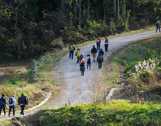
The east coast geology is weak, making the erosion problem even more serious. The photo shows a home in Tungmen Village after it was buried in sand and rocks the year before last. (photo by Diago Chiu)
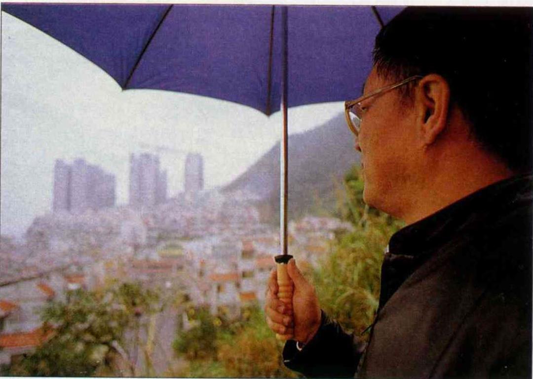
Chu Bong Foo is concerned about the future of Chinese culture.
@List.jpg?w=522&h=410&mode=crop&format=webp&quality=80)