Maps as works of art
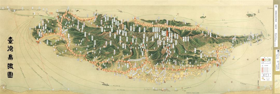
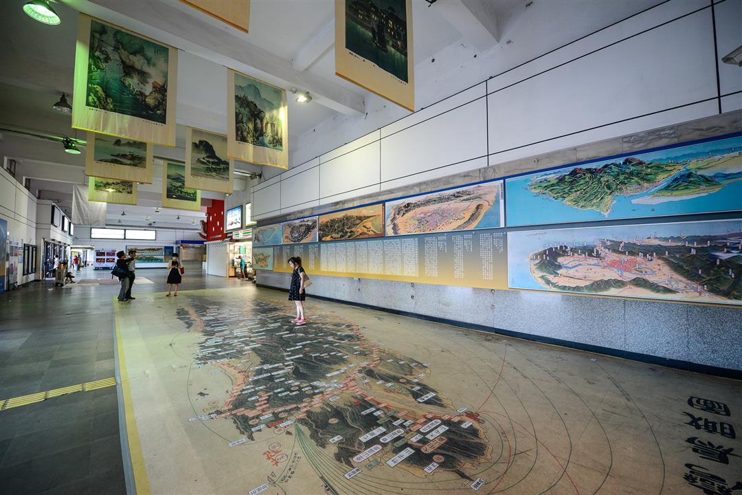
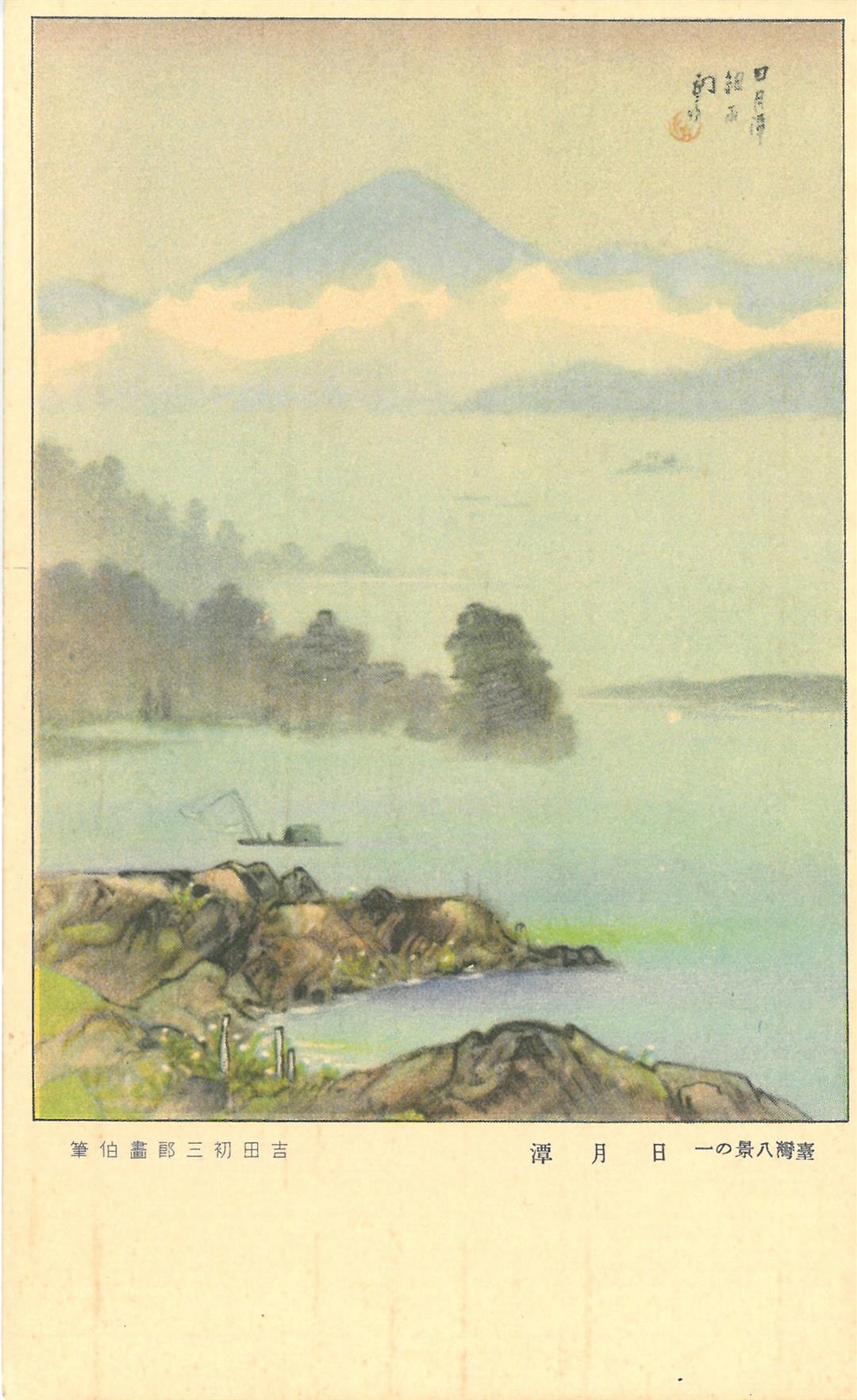
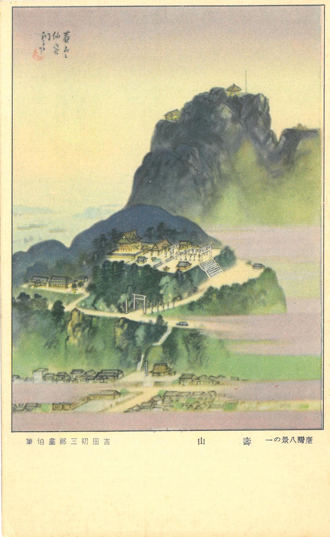
When you enter the exhibition space at the Keelung Old Train Station, above your head you’ll see 1930s depictions of the “Eight Wonders of Taiwan” suspended from the ceiling in an orderly row, 20 maps hung along the walls, and a giant print of a map entitled A Bird’s-Eye-View of All Taiwan laid out on the floor. Each illustration seems to have many stories to tell.
The original maps were drawn by two Japanese painters, Hatsusaburo Yoshida and Tsunemitsu Kaneko, assisted by their apprentices, and were completed in the years 1933 to 1935. The artists began their work in the early 1930s at the invitation of the office of the Japanese governor-general for the purposes of an exhibition marking 40 years of Japanese rule in Taiwan. They traveled throughout the island, making preparatory sketches and drawings for dozens of maps which show the geography and topography of Taiwan as well as famous sites of interest.
The painters and their apprentices combined principles of Western perspective with the traditional Japanese ukiyo-e style (most famously used in the so-called “paintings of the floating world”) to create richly colorful projections. “These are dramatically different from the maps people use today,” explains Alphonso Chang. “In contemporary terms we would describe these maps as ‘aerial views.’ The term ‘bird’s-eye-view’ is self-explanatory—the world as seen from the point of view of a creature in mid-air—but these maps were drawn from imagined points in the air. There were no accurate measurements of distance, nor were the maps drawn to scale.”
It is worth remembering that these maps were components of an effort by Japan to demonstrate to the world its achievements as the colonial power in Taiwan. Inevitably certain ideas and aspects were given special emphasis when they were drawn.
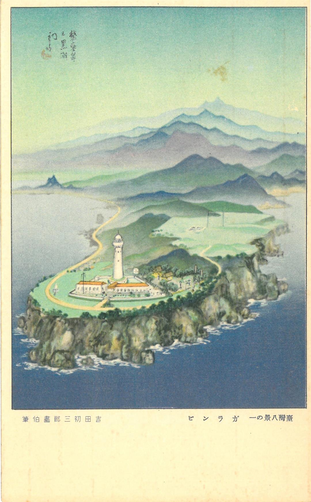
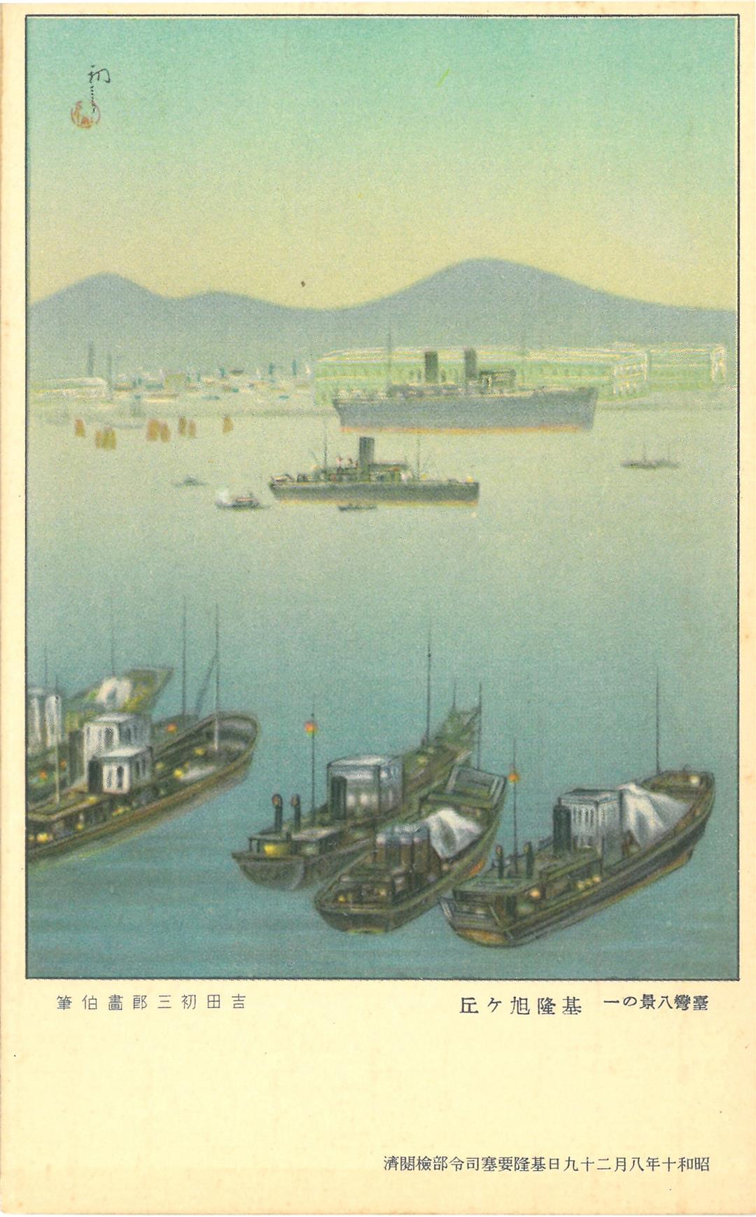
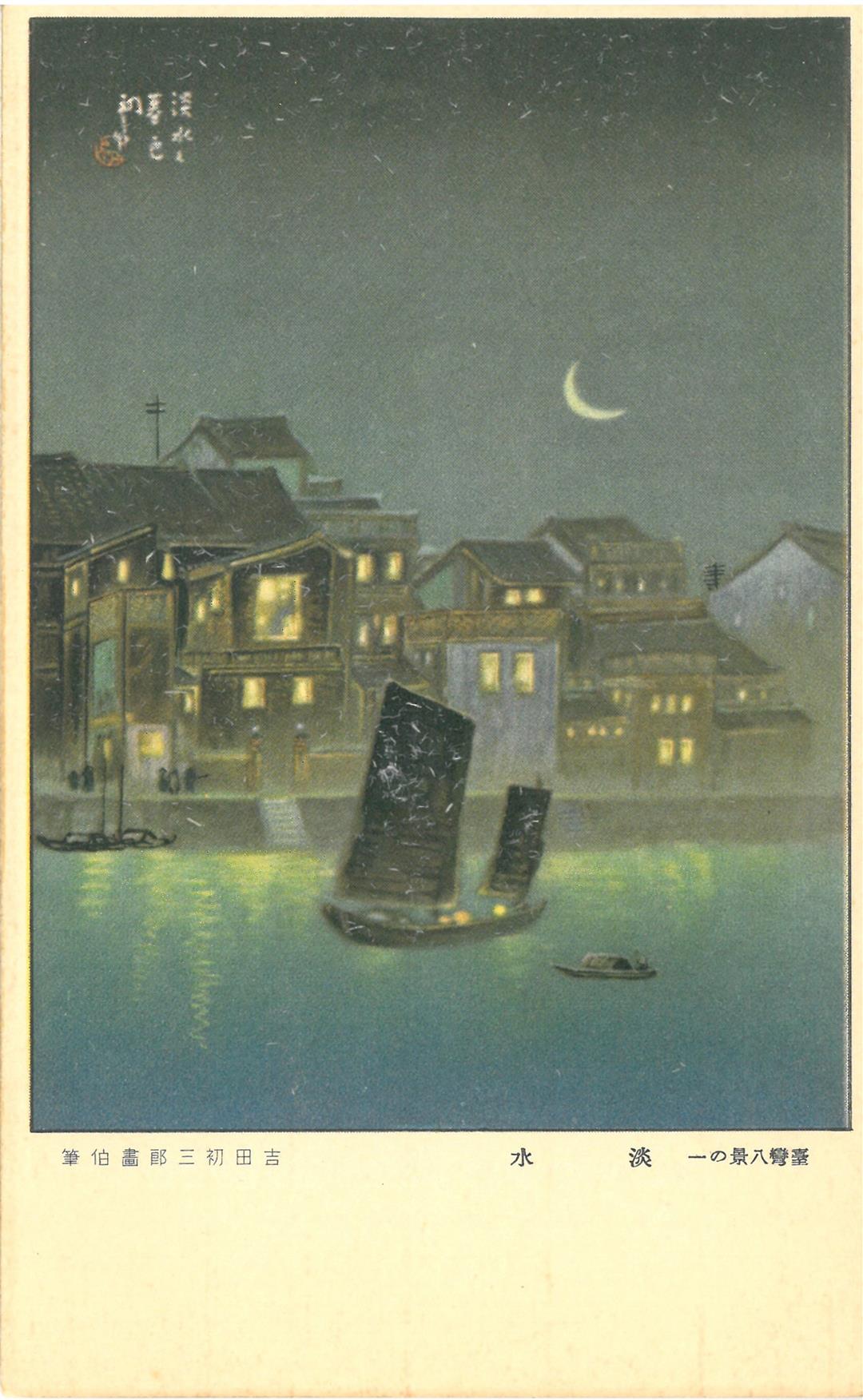
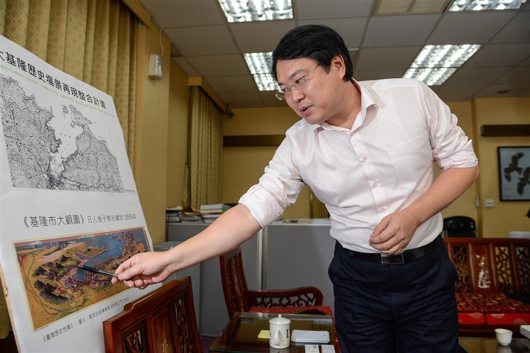
Take for example A Bird’s-Eye-View of All Taiwan, which is laid out on the floor of the hall. It is drawn with Taiwan set horizontally in the ocean, from the perspective of a point in the air off the western coastline of the island. Notes clearly point out all the main mountain ranges and rivers from north to south, and in amongst the ridgelines you can see the Lanyang Plain (modern Yilan), the Eastern Rift Valley (in modern-day Hualien and Taitung), and the broad Western Plain that runs all the way from south to north. The map also has circled notations indicating the major agricultural, fishery, forestry, and mineral products of each location, including seafood, tea, cypress, rice, flax, salt, sugar cane, aragonite, and coral. Especially interesting from a cultural point of view is that it also clearly marks each and every cold springs and hot springs area, which have always been popular recreational destinations for Japanese both in their home islands and abroad.
Aiming to give visitors a genuine sense of place, Alphonso Chang arranged the exhibition in such a way that there is a correspondence between the complete map of Taiwan on the floor, the regional maps on the walls, and the illustrations of the “Eight Wonders of Taiwan” hung from the ceiling. As you pass through the exhibition, walking across the map of Taiwan, whether you start from the right side or the left side of the island, as you progress step by step it seems like you are also in a three-dimensional space.
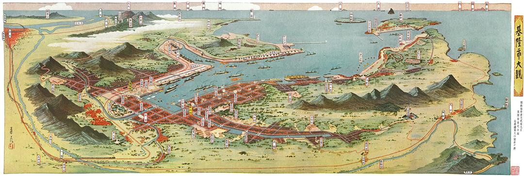
If, for example, you begin your visit at Fugui Point, the northernmost point of Taiwan and not far from Keelung itself, on the wall is the map A Panoramic View of Keelung City, while suspended from the ceiling above is a depiction of Mt. Xuqiu, a landmark hill in the city. Moving toward Taipei, on the wall are maps called Major Points of Interest in Danshui Prefecture” and A Panoramic View of Taipei,” with Danshui River scenery hanging overhead. Continue your stroll to Taichung City on the floor map, and on the wall is Major Points of Interest in Taichung City, with Sun Moon Lake above. As you make a circuit around the island, local maps and their corresponding scenery fill the eye. It is really worth moving as slowly as possible, to give both the eye and the memory a little more time to absorb all the information along the way.
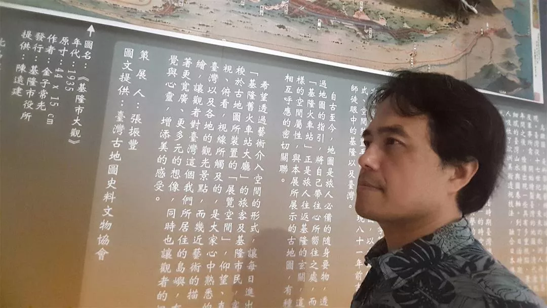
Alphonso Chang , an expert in Taiwan’s culture and history, was the curator behind the exhibition of historic maps in the Keelung Old Train Station. (courtesy of the Association for Taiwan Antique Maps and Cultural Relics)