Maps in the vanguard
"Le Gendre became a Taiwan expert and sent people out to make a great many maps and pictures of Taiwan. This map does not look like much but it was tied to Taiwan's future destiny," points out Wei Te-wen. The map shows a clear demarcation line to the east of the Central Mountain Range indicating this area was not under the control of the Qing Dynasty. Le Gendre himself had recommended that the US invade Taiwan but his suggestion was not taken up. He later resigned his post and prepared for the trip home, a trip that took him by Japan. There he was made an adviser to the Japanese foreign minister and worked on the plans for the later invasion of Taiwan by the Japanese.
Le Gendre argued that whenever shipwrecked foreign sailors were killed by Aborigines the Qing court avoided responsibility by using the excuse that "government control does not extend to the Aboriginal areas." The Japanese were able to make a major issue out of this and advocate invasion on the basis that the Aborigines were inhabiting a "no-man's-land."
In 1871, Aborigines killed 54 Okinawan sailors at Payao Bay, Hengchun. The Japanese took this as a pretext for an armed incursion into Taiwan: using Le Gendre's map, they sent in 3,000 troops to invade the Ssuchung River area of Pingtung. But after three months the area had not yet been taken and there had been more than 50 battle casualties, with another 500 soldiers dying of fever. The Japanese foreign minister asked Le Gendre to negotiate with the leading Qing courtier Li Hongzhang. The Qing court, having no stomach for tackling a situation across the sea in Taiwan, paid an indemnity of 400,000 taels of silver to the Japanese for their withdrawal.
"The Japanese had been defeated yet they returned home as a victorious army. The key had been Le Gendre. Thus to understand Taiwan's destiny, you have to first understand the map he made and the role he played," says Wei Te-wen. Whether the actual longitude and latitude lines on the map are accurate is of secondary importance. The information behind the map is extremely rich and one can glimpse its influence.
"I have often thought that foreign maps of Taiwan were sure to start with the ocean, including depth soundings, where ships can harbor, and how military ships can be sailed over. This kind of information depends on actual measurements. Since Japan intended to invade Taiwan, they must have had these kinds of maps." This is a suspicion Wei Te-wen held throughout his many years of studying Taiwan maps.
By way of explanation, Wei takes out a complete map of Taiwan from 1895, translated by a Japanese. The Qing that year had been defeated in the Sino-Japanese War and ceded Taiwan to Japan. Previous to this, the Japanese had spent a good deal of effort in collecting maps of Taiwan made by Westerners. This particular map, A Detailed Field Survey Map of Taiwan, made by a British navy lieutenant, clearly indicates Taiwan's natural harbors at Keelung, Tanshui, Anping, and Takou (Kaohsiung). "Even the Qing court didn't have maps like this at that time. Why did the Japanese publish this detailed map of Taiwan harbors? It is clear the Japanese had been harboring ulterior motives for a long time."
Getting it accurate
Looking back at the relationship between China and Taiwan through the history of maps, the earliest Chinese depiction of Taiwan appeared during the Ming dynasty in 1592 on a map of seacoast defenses. Clearly shown on this map were some small islands off Keelung and the Tanshui River. At that time Taiwan was referred to by the Ming as the "lesser Ryukyu kingdom."
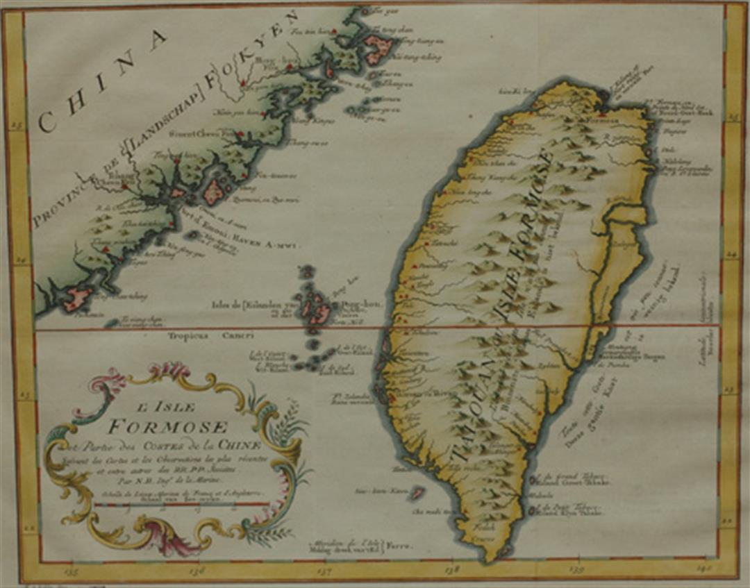
In 1624 the Dutch colonized Taiwan and for 38 years the Dutch East India Company operated a trading station at Anping in Tainan. They employed a large number of cartographers and possessed accurate descriptions and drawings of Taiwan geography and mineralogy covering the entire island. Because the East India Company regarded maps as commercial and colonial secrets, they were placed in archives and not published until 1724.
When in 1662 Zheng Chenggong occupied Xiamen and Kinmen the Dutch allied with the Qing to attack him, utilizing this map, the Pas-kaart van de Chineesche Kust, Langs de Provincien Quantung en Fokien, als ook het Eyland Formosa (Nautical Chart of the Chinese Coast: Guangdong, Fujian and the Island of Formosa), and forcing Zheng back to Taiwan.
This important map is on the cover of Formosa, The NMTH Collection of Western Maps Relating to Taiwan, 1600-1900 and is worth perhaps NT$1 million on the antiquarian map auction market today. It may be the most expensive old Taiwan map there is.
In addition to providing military intelligence data, maps, after the industrial revolution, provided extremely good information about Taiwan's topography and location, very close to what we have today, owing to the increased accuracy of mapping instruments plus the influx of diplomatic personnel, businessmen, missionaries and scientists to the island.
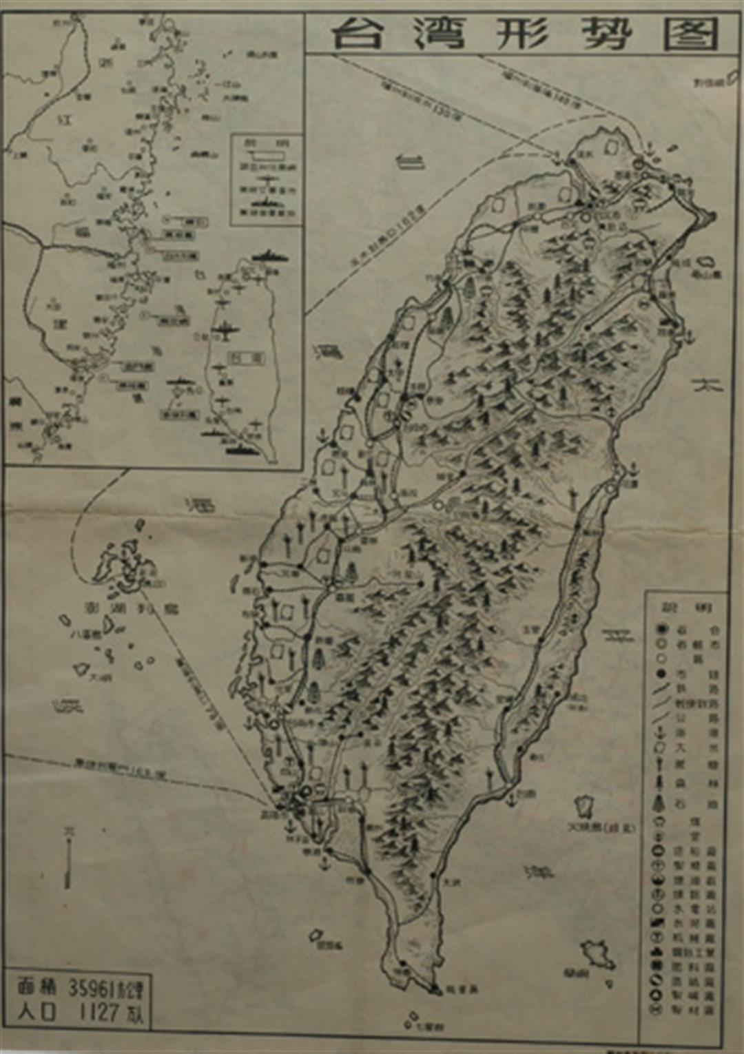
Many years of specialized map study have accustomed Wei Te-wen to seeing, through pictorial images, how outsiders understood Taiwan. He is even in possession of a situation map of Taiwan published by the Chinese People's Liberation Army in 1962 with information on troop stationing, harbors and oil depots from south to north, witness to the high level of cross-strait tension existing at the time.
The thousands of old maps collected by Wei Te-wen contain the stories unfinished in historical texts. These old hand-made printed maps spanning four centuries are normally lying in wooden map cases at the office or at home in acid-neutral mat board frames to prevent yellowing. It takes time and effort to keep the collection together but Wei holds to his principle that he "will never allow these old maps to become scattered again" in his efforts to add a new page to Taiwan history, so little covered in textbooks.

@List.jpg?w=522&h=410&mode=crop&format=webp&quality=80)
@List.jpg?w=522&h=410&mode=crop&format=webp&quality=80)


@List.jpg?w=522&h=410&mode=crop&format=webp&quality=80)