One geology, many landforms
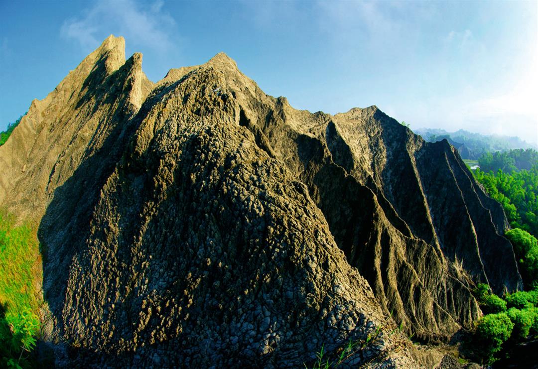
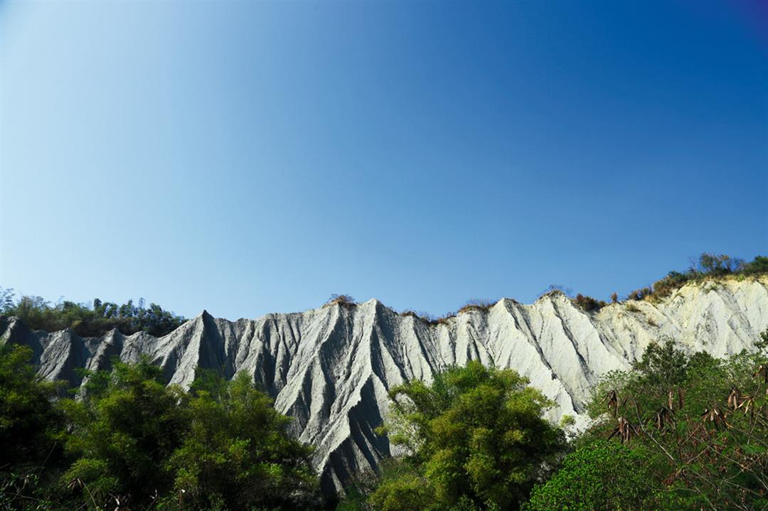
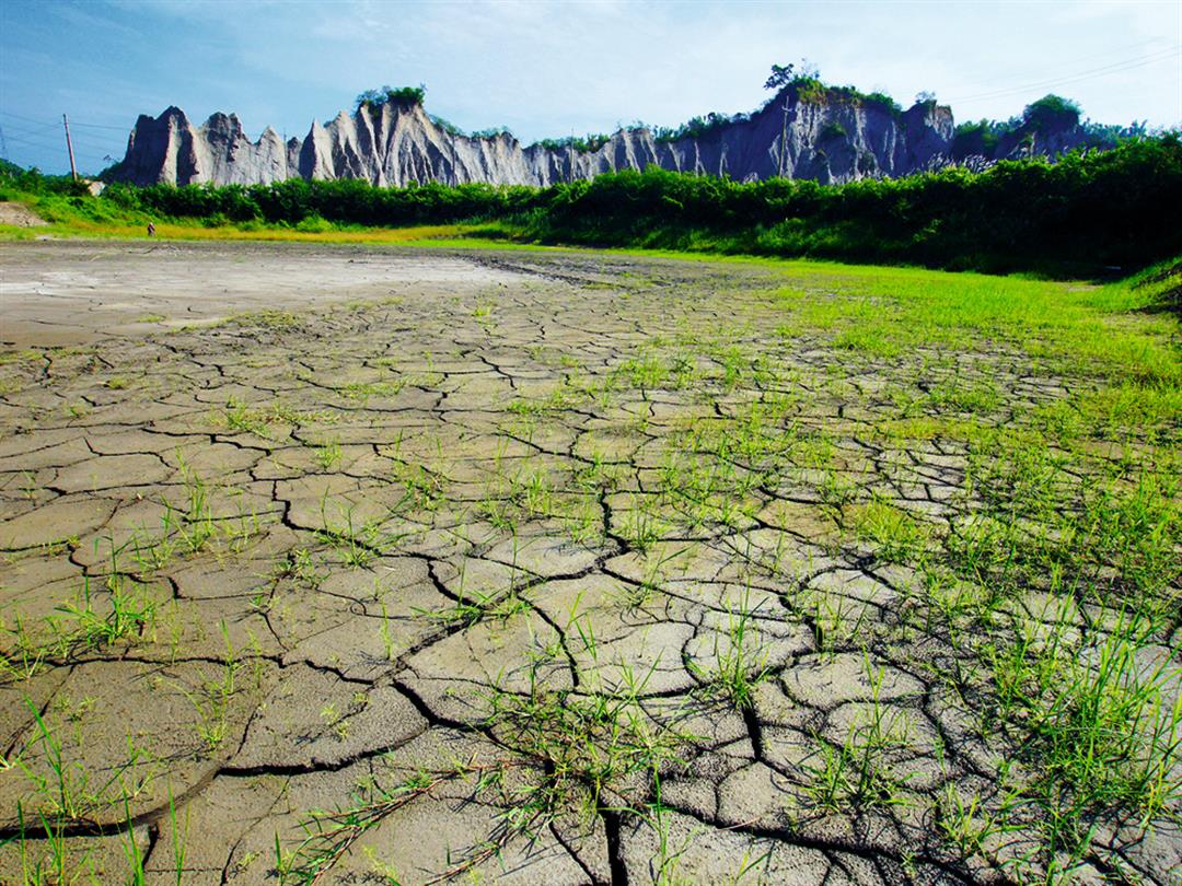
The Gutingkeng mudstone is greenish grey and geologically young. Having never been buried deeply enough to be subject to high pressures, it is only weakly lithified. With mudstone’s weak cementation and low water permeability, it softens into mud when exposed to water. This mud cracks and flakes when dry. And the high salt content of what was once marine silt makes it hard for plants to grow.
Besides these geological conditions, climate is also an important factor that shapes the appearance of Moon World. Due to southwesterly air currents and tropical low pressure zones from July to September, there are often heavy rains. The exposed mudstone is eroded by the rain, which flows downward from the slopes as runoff, creating gullies and ravines on the hillsides.
However, with so little vegetation cover to absorb water in the area, why are there so few landslides in Moon World?
“Most landslides occur in hilly or mountainous areas where there are large differences in elevation across the terrain, and are caused by excessive water content in the soil. But with mudstone’s low permeability and the smaller differences in elevation in the terrain of this region, landslides are rare. That said, flooding in this area is not uncommon,” says Chyi Shyh-jeng, professor of geology at National Kaohsiung Normal University.
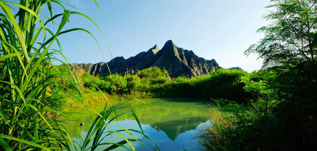
Due to both soil type and climate, Moon World is worn away by wind in the dry season and by rain in the rainy season. Battered by this repeating cycle of wet and dry, the surface flakes away, eroding into forms such as knife-edge peaks, caves, natural bridges, pinnacles, mud cracks, and V-shaped valleys. And the Erren River, which also scours the area, forms typical river landscapes such as meanders, oxbow lakes, and river terraces.
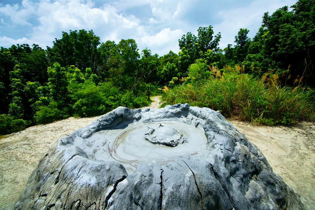
The mud volcanoes of the Gutingkeng Formation are well-known sights. Of these, the Wushanding cone volcanoes are the most impressive.
@List.jpg?w=522&h=410&mode=crop&format=webp&quality=80)