In the eye of the beholder
So, it seems, the north coast still gets the most votes from members of the scholarly community.
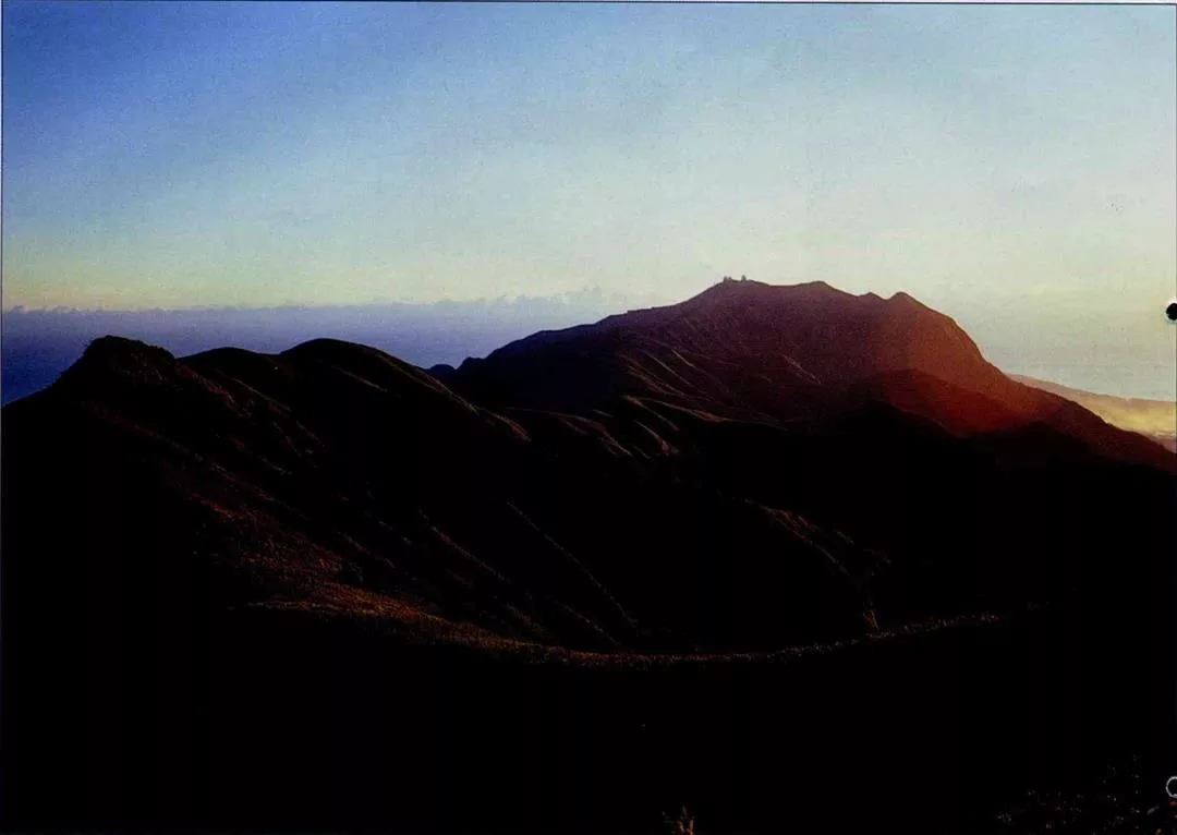
"In early morning, before sunup, when the rays of the sun are just beginning to filter in, the Tatun mountain group is a majestic sight. The sunlight first flashes on the verdant topmost peaks like lanterns being lit. Then, like the opening of a stage curtain, the light unveils the mountains gradually, until the entire chain appears." This is how Huang Juei-hsiang excitedly describes the unforgettable impression the mountains made on him over two decades ago when he sailed into Keelung harbor after completing his military service in Matsu.
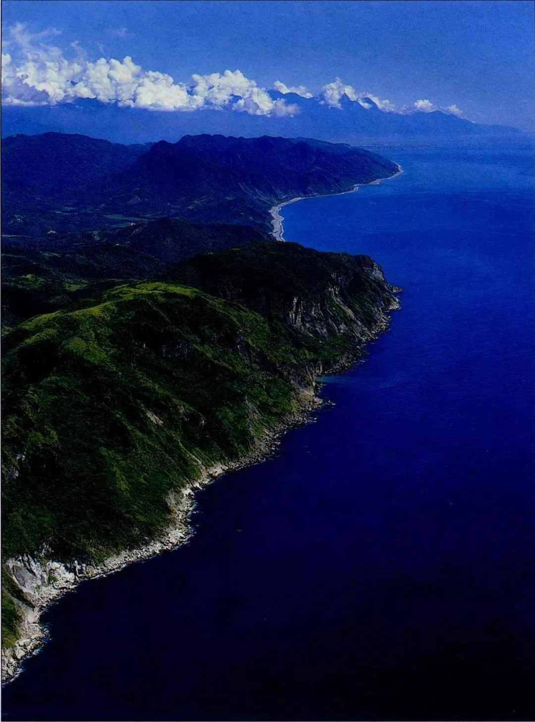
Liu Ko-hsiang served in the navy, and has done ecological survey work in the islets around Pengchia Island. Looked at from the ocean, he says, the volcanic mountains of the Tatun group appear to be perfectly rounded and smooth, presenting a markedly different picture from the craggy peaks of southern Taiwan. For Portuguese mariners who had already been through the Straits of Malacca and past Luzon Island it is Taiwan's northern scenery that must have seemed especially remarkable and fresh.
Although we have Ming era charts showing the sea route as passing along the northern coast of Taiwan past the Tatun Mountains and then turning left at the islands around Keelung to head up to Okinawa, it stands to reason that ships following this route would not have seen the northeast coast of Taiwan, which is to the east of Keelung. Yet the Belgian historian Vertente contended that it was precisely the blue peaks of the northeast coast that caused Portuguese sailors to sigh, "Formosa."
No matter whether you are talking about the Tatun Mountains or the tail end of the Huoshan and Hsuehshan Mountains toward Keelung, anyone looking from a ship at sea would not have seen some narrow, specific little point. Perhaps we will never be able to figure out which place it was that inspired "Formosa," but the most reasonable explanation still seems to be that ships were passing Taiwan's northern edge. This theory also says something about the unique aesthetic of this region's coastline.
"Look at the special features of European geography--the Alps, the Pyrenees... They are marked by jutting stone. And Portugal itself is a mishmash of forest and rocky slopes. The overall lush and verdant effect of Taiwan's northern coast would have been an unusual sight to Europeans," avers teaching assistant Chi Shih-ching of the Department of Geography at National Taiwan Normal University.
Looking at the other parts of the world on the same latitude as Taiwan, in Africa there is the Sahara desert, while in North America are the "badlands" around the US-Mexico border. But Taiwan's northern coast is covered with a range of vegetation. "You have to give the northeast seasonal winds the credit for that," says Huang Juei-hsiung.
Because the north and northeast coasts face directly into the seasonal northeasterly winds, the area is soaked in rain for the better part of the year, allowing vegetation to flourish. And of course 400 years ago this area was still completely undeveloped, so the primeval forest was intact.
Paradise lost
In fact, as far as many scholars are concerned, it doesn't really matter which part of Taiwan those Portuguese seamen saw first. "Today, what 'Formosa' should stand for is a good, clean environment," suggests Huang Juei-hsiang. The most important thing about tracking down the historical Formosa is to allow us to see what has changed over the past four centuries.
Today, when ships approach the mouth of the Tanshui River and pass the Tatun mountains, are their crews still moved to utter words of praise?
Look today at the mouth of the Tanshui, which long ago inspired Mackay to spend his life in Taiwan. These days apartment buildings crowd the slopes of the hills in the surrounding districts of Pali, Tanshui, and Kuantu, and about the only green spaces visible are decorative lawns in front of the houses.
And the Tatun mountains at which Mackay gazed in wonder from a distance have been through an even longer period of development, as Lu Li-chang, director of guide services at Yangmingshan National Park, explains: At the end of the 17th century, during the early years of the Qing dynasty, You Yonghe, a native of Zhejiang, started to gather sulfur here. At that time, the Tatun mountains were still covered with intact primeval forest, and the only residents were a few aborigines scattered next to rivers. Later, the Qianlong emperor (1736-1796), fearing that local bandits would use the sulfur to make gunpowder, ordered that the forests around the sulfur springs be burned away to deny the bandits any hiding places.
Next came waves of immigrants from the Quanzhou and Changzhou regions of Fujian, who undertook large-scale transformation of northern Taiwan. They cut irrigation ditches to tap the mountain rivers, cut down the trees for building materials, and engaged in slash-and-burn agriculture. In order to make furniture, they planted bamboo widely. In addition, they planted huge tracts of tea and daqing (used to make dyes) for export, leading to further deforestation. Settlers also transplanted acacia trees from Hengchun in southernmost Taiwan to cultivate for firewood. Thus the area's original low altitude vegetation was almost completely replaced, and the area of primeval forest rapidly declined.
In the 19th century, with the popularity of Indian and Ceylonese teas, and the invention of manmade dying agents, prices fell for local teas and daqing lost its market. Land that had been used for these two crops was left fallow, and was soon overgrown with wild grass. That is how the local residents came to call this stretch of peaks Tsaoshan, meaning "the Grass Mountains."
In the Japanese occupation area, in an effort to protect the water resources of the northern Taiwan area, the authorities restricted development in the Grass Mountains and promoted large-scale reforestation. The Grass Mountains rapidly became a forested area of "black pine" (Pinus thunbergii), "Ryukyu pine," Formosan sweet gum (Liquidumbar formosana Hance), and fir trees. And for the visit of the heir to the Japanese throne to Taiwan, the roads were lined with cherry trees.
Today, there are only a few small areas, within the jurisdiction of a national park, where one can see the primeval forest that was so "Formosa" to observers 400 years ago.
Fortunately, about ten years ago most of the Tatun mountain chain was included in the scope of the Yangmingshan National Park. With legislation passed to conserve the local environment, at least the current state of the area's ecology can be sustained, waiting for an opportunity to return it to its original condition.
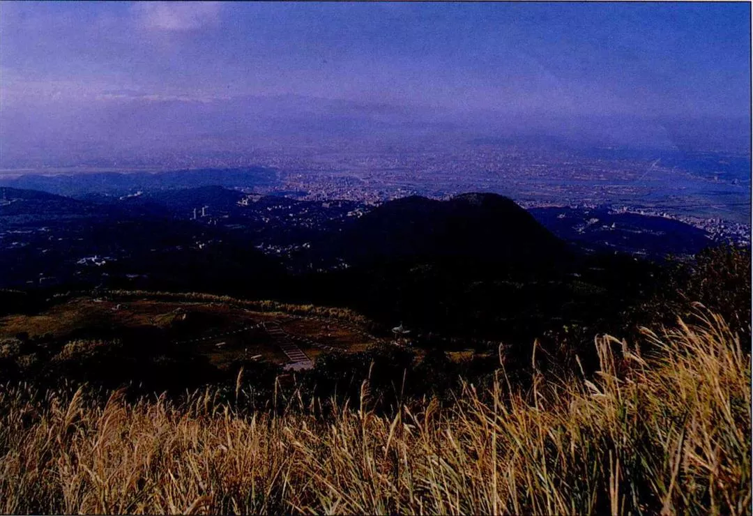
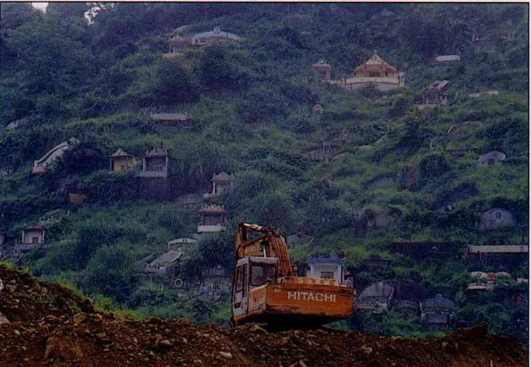
The area of primeval forest in the Tatun Mountains was dramatically reduced by land clearance for the planting of cash crops. It was only after these crops lost their economic viability and the land was left fallow that the vanguard of vegetation--wild grass--could grow back. (photo by Hsueh Chi-kuang)


@List.jpg?w=522&h=410&mode=crop&format=webp&quality=80)


@List.jpg?w=522&h=410&mode=crop&format=webp&quality=80)