There are about 50,000 people living in the East Coast Scenic Area, of whom roughly 35,000 are Ami aboriginal people. Since the Ami are the main residents, naturally the whole east coast has that special "Ami-ence."
People who grow up by the sea are by nature open and easygoing. If you don't believe it, just check out these words from an Ami folk song: "The Ami people plant crops each day/ We fear not the sunlight, we fear not the wind and rain/ Collecting shells by the seashore, catching shrimp in the streams/ Each day happy beyond compare."
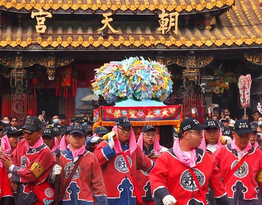
The main ceremonies of the Ami people are the "Sea Festival" held each June and the "Harvest Festival" each July and August. Travelling to the east in January as we did for this article, we missed the opportunity to attend those. But, since a local election is fast approaching, we ran into plenty of county assembly and mayoral hopefuls out trying to build up their name recognition by holding dinners in tents by the side of the road.
The East Coast Highway is squeezed into a narrow passage between the coastline and the mountains. It is the only trunk road in eastern Taiwan, so there's never any problem of getting lost. In addition, the Hualien Bus Company and the Ting Tung Bus Company have regular routes that stop at all the tourist sites, so all you need to do is figure out the times they run, plan ahead a bit, and use the local transportation. This way of travelling is well worth recommending.
Those who are fed up with urban traffic congestion find that driving the east coast roads is a pleasure. On one side are verdant promontories, and on the other is blue sea. What could be nicer than winding you way through this colorful scenery, especially when there are no red lights along the way!
However, though you needn't worry about traffic lights, you may just run across a dog blocking the road. In Hualien and Taitung, which are the two counties that make up eastern Taiwan (and are sometimes abbreviated as "Huatung"), not only do the people move slower, the dogs are pretty laidback as well. Their sense of awareness is not sharp like that of city dogs, and they often just wander around the streets, or even take a snooze in the middle of the road. Drivers have to watch their speed to keep from giving the critters a nasty wake-up call.
Another thing that's really different from the city is the scene when kids get out of primary school. You won't find any of those urban traffic jams --caused by parents driving up in their sedans and motorcycles to meet the children--here down east. Instead, the pupils form a line and walk joyfully along the streets single file, while a teacher slowly rides a scooter alongside like a shepherd seeing the flock safely along.
The most common plant life in these parts are the betel nut and coconut trees. Each day at dusk, under the last rays of the fading sun, with the trees cut into the picture and their long shadows cast back over the rice fields, the result is a tranquil and enchanting natural work of art.
Betel nuts are also an indispensable part of the local diet. When visitors come to the door, it's not tea that they get, but betel nuts. Even many of the local Han Chinese are part of the "red lip brigade"(an appellation derived from the stains left by the bright magenta betel juice).
This is the season when they harvest oranges, papaya, and "Buddha's head" fruit in "Huatung," and everywhere you can see the fruits of their labors. As for the renowned watermelon of Taitung County, the vines have only just been planted, and the dry riverbeds are carpeted with green melon plants. The green peaks behind them are embellished with yellow soap nut trees carelessly placed, making for an altogether special feeling.
All along the trail here, perhaps the most intriguing thing has been the architecture. Traditionally the Ami people built their long, rectangular homes with grass roofs and bamboo walls. Now most of the traditional structures have been replaced with steel and concrete abodes. Yet the rest pavilions and bathrooms that the Scenic Area administration has built at various locales are as true as possible to the traditional form. Although these are actually steelbeamed concrete buildings just covered with a layer of bamboo, this is only to take equal account of both the exterior appearance and interior needs.
There are already a number of two story houses along the sides of the roads in the villages. The colors and styles are all different, each displaying the creativity and character of the owner. They are thus far more interesting than the stacks of identical apartment buildings that make up a typical city block. Generally speaking, the local buildings are in fresh, bright colors, and the walls and masonry, set against the natural background of green and blue, are quite eye-catching.
The topography and scenery down east also differs greatly from Western Taiwan.
The poet Hsiang Yang has described a certain place in Hualien in a laudatory piece as a "sleeping silkworm," where "mountains, streams, ocean, and rivers are all forced together in a single place. "In fact, this would be an apt description for all of the scenery in Hualien and Taitung.
The east coast is part of a "national" grade scenic area. Starting in the north at the mouth of the Hualien River, the designated area runs southward as far as Little Yehliu; on the west it is bounded by the coastal mountain range running north-south parallel to the Central Mountain Range; and in the east it runs into the Pacific Ocean. Within this perimeter there are twenty rivers which run down from the highlands eastward to the sea. It truly is a place with mountains, streams, ocean, and rivers.
The Huatung area is located right at the juncture of the Eurasian land mass and the Pacific plate. Because of this, geographic shifts have been especially intense. The coastal mountain range is the result of countless years of pushing and pulling, collisions and pressure.
These geographic movements have continued up to the present. There are frequent earthquakes in the Huatung area. Moreover, it appears that the earth's surface is moving upwards at different speeds in different places. According to studies, the rate of movement is two centimeters per year in theYuli-Chihshang area, where the rise is fastest.
Further, according to Wang Hsin, a professor in the Department of Geography at National Taiwan University, the sea bottom on the Pacific coast slopes off much more steeply than on the west coast(which faces the Taiwan Strait). Add to this that most typhoons come ashore on the east coast, and the result is that the east suffers much more severe erosion from the elements than the oceanfront on the opposite side does.
Overall, then, the rising elevation of the earth's crust and the erosion caused by the sea have created the unique scenery that is the east coast.
The East Coast Scenic Area is more than 170 kilometers of coastline, and is the finest location for seeing all manner of erosion topography.
The flat sea terrace is the main area for settlement and farming along the eastern seaboard. Sea terraces, which were originally part of the coastline or even were covered by seawater, have been created by being pushed upward by the movement of the earth and also by erosion. These geological forms are most frequently seen in the central and southern sections of the coast, with the sea terrace being broadest at Tulan, Chengkung, and Changpin.
The seashore is the main focus of recreation in the Scenic Area. Most of the beaches on the east coast are "rock beaches" with stones larger than two millimeters. This is quite different from the sandy beaches characteristic of other parts of the island.
Another special feature of the eastern coast is the sharply rising coral reefs and rock platforms. There are many types of colorful channels and caves cut into the coral reefs by erosion.
Below are several of the main scenic locales in eastern Taiwan, where you can see the topography and scenery discussed earlier.
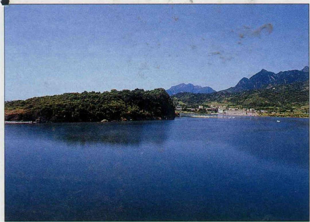
Taking the bird's eye view downward from the Pachi Observation Deck, the entire Chichi Bay spreads out before your eyes. In the north the mountains, where the soil is hard rock, run flush against the water, so there is almost no hinterland to speak of. As you turn toward Chichi, the bay dips inland. This is because the land around Chichi was originally very soft soil of the Pali Bay terrace, so it was easily washed away.
Chichi Bay is the only place on the east coast with a sand beach. Behind the bay is sea terrace topography.
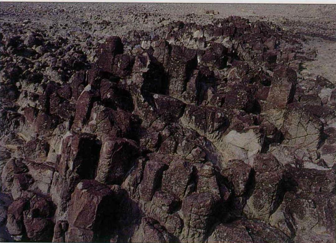
The "cave group" at Shihtiping is a very special feature of this area. Besides sea caves created by erosion from the sand carried in by the waves, there are also very distinctive "barrel caves."
Most caves are caused by the downward collapse of the ground. "Barrel caves," however, stand straight up and down on the surface just like a barrel.
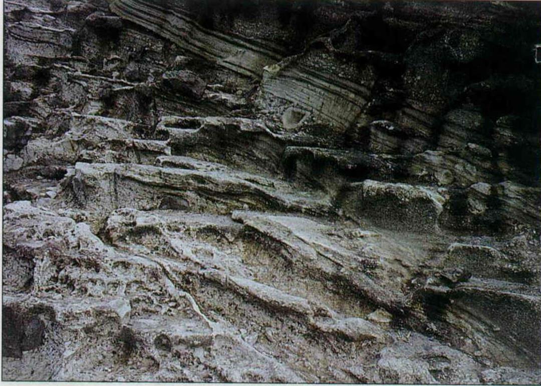
Located at the extreme eastern point of Shihtiping is the 17-meter high "Shihti One-faced Mountain." Constituted of white pebbles, it glitters brightly in the sunshine, and is the most obvious landmark in Shihtiping.
The side of the One-faced Mountain facing the sea is sheer cliff, while the side facing inland has a natural staircase on which one can climb to the top of the hill (Shihti means "rock stairs"). From the cross-section of the ground you can see clearly the grey-black strata made by volcanic rock and the grey-white tuff layers stacked alternately. Differences in the resistance of the layers to erosion, plus the gradual lowering of sea level, have created layers of stairs.
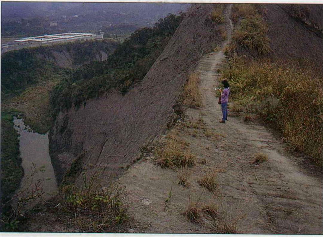
The "Father Doesn't Acknowledge His Own Son" Cliff is located on the outside of the Hsinchi Tunnel, and you can still see the old pathway across it. According to gazetteers of the Hualien-Taitung region, this precipice as known by this name because "those walking across it are in a constant struggle, and even the relationship between father and son is difficult to maintain, so that they no longer acknowledge one another...." This should give you some idea of the peril of this bluff.
Below the cliff are two caves cut out by sea erosion, one of which can be seen from the side of the road.
Takangkou is located on the north side of the mouth of Hsiukuluan River; Chingpu is to the south. You can clearly see the mouth of the river from both places, yet you can't necessarily see the Hsiukuluan emptying out into the sea. How could that be? That's because the Hsiukuluan empties out into the sea at different places depending upon the season.
The mouth of the Hsiukuluan River is divided into northern and southern exit points by Hsipulan Island (aka Shihchiu Island). In the winter the northeast seasonal winds blow strong and harsh, pushing sand and rocks into the northern outlet to the sea. The water thus flows out through the southern exit point. In the summer come the southeast seasonal winds, which blow silt into the southern outlet, so that the Hsiukuluan River heads north for the summer.
And don't overlook the little Shihchiu Island stuck in the middle of all this. Thanks to its gift of obstructing the river water, the island has retained a virtually intact tropical forest, which is very rare.
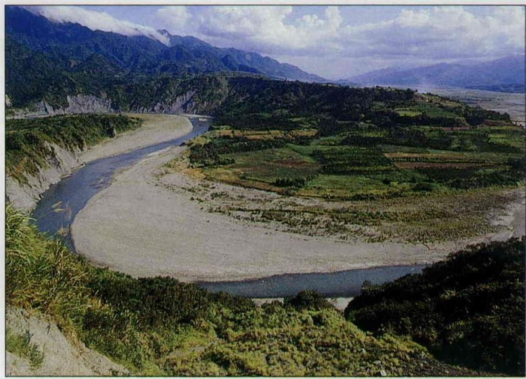
The section of the Hsiukuluan which runs from Juisui to Takangkou is a great place for white water rafting. The river flows through narrow gorges and shallows which are quite scenic. Especially in the Chimei area of the river, there are many unusually shaped inlets and rock walls, some resembling elephants, some tigers.... The local people call this the "Images of All Living Things." The effect of the green river rushing through the pure white jade-like stone is beautiful, so the area is also graced by the name "Hsiuku Gurgling Jade."
Although we happen to be here in winter, which is not the season for white-water rafting, there's no reason to feel regret. Travelling along the Jui-Kang Highway, not only can you appreciate the beauty of the Hsiukuluan River, there are lots of geological sights to be taken in along the way!
At about the point marked as 4.9 kilometers along the highway, there is an excellent place to see the sights, from which you can see the Hsiehtehwu terrace off in the distance. You can clearly see how the flow of the river has been promoting a process of constant deepening and widening, and you can see layer after layer of river terrace piled up on the slopes.
As the name suggests, the stones here appear ebony colored, though in fact, it would be more accurate to describe them as purplish-red. This stone is a type of peroxine and and exite.
Raven Stone Point's topography is a variety of basalt, and the textures of the pillar shapes are highly developed. Although not on the same scale as in the Penghu Islands, this is the only other place in Taiwan with this type of topography.
Raven Stone Point is not an especially busy tourist spot. Besides the locals and the odd geologist, few travellers stop here. Therefore there is no pollution or destruction. It is said that sea grasses grow on the stones in the summer, attracting a great deal of sea life, and making for quite a busy gathering.
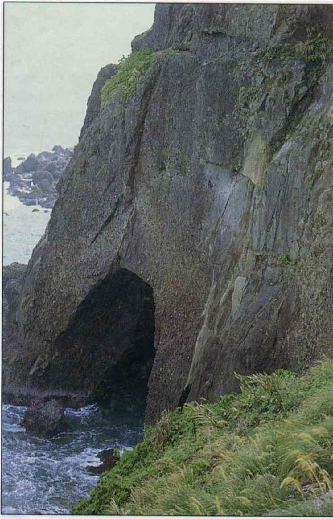
The Eight Immortals Grotto is a group of chambers formed by sea erosion. There's nothing unique of course about the nature of the caverns, but only here can you find sixteen caves all in one place.
The caverns are placed both high and low, and are of varying sizes. The higher the elevation of the chamber, the earlier it was formed. The larger the cave, the longer the sea spent in it. These caves are proof that the surface of the ocean has been getting lower over the past tens of thousands of years. Looking for instance at Kunlun Cave, the highest of the group, the bottom of the hollow is now 130 meters above sea level, which means that sea level has dropped at least by that much over time.
The credit for the fact that these caves are still intact after all this time goes to the nature of the rock, which is very hard Tulan Mountain agglomerate rock. Its particular resistance to erosion has permitted the caverns to avoid collapse.
Despite all this, it isn't geology that gives the Eight Immortals Grotto area its fame, but rather the archaeological sites of prehistoric settlement. Archaeologists have uncovered Stone Age artifacts in at least three of the caves. These are thus far the earliest indications of settlement in Taiwan, which scholars have christened "Changpin Culture."
According to Liu Yi-chang, an associate researcher at the Institute of History and Philology of Academia Sinica, at the same time as Changpin Culture was developing,northern China had already entered the Neolithic Age, while those living in Taiwan were still living as hunter-gatherers, accepting their fate as nature dictated.
Although most of the artifacts have been moved to National Taiwan University for safekeeping, so there are absolutely no relics to be seen in the caves themselves, you need only use a little imagination to recreate the life of these prehistoric peoples as they took shelter from the wind and rain in these caves, catching the fish and crustaceans in the sea to keep themselves alive. If you can think this way, then the caves come alive.
There are wooden bridges between the caves, so that it's easy to go spelunking. It only takes about an hour to do a complete circuit. Unfortunately most of the caves have been occupied and turned into temples, so that the natural scenery has been destroyed, greatly reducing its attractiveness.
In highlands along the side of Taiwan Provincial Highway Number 11, you can see a "Stone Parasol" standing upright on the sea terrace. The stone has been worn away into the shape of an umbrella due to the fact that the coral at the top is more resistant to erosion. It is said that there used to be a trio of these parapluies, but two of them have collapsed from continued wearing away.
The Three Immortals Platform was originally a promontory, but was eventually hacked off by erosion, creating an offshore island. It is about 300 meters from the shore, and is connected by a bridge with eight pillars. Before the bridge was completed in 1989, people had to wait until low tide to cross over to the island to play.
There are three hills set onto the island. There is an amusing legend that the Eight Immortals were crossing the sea, and that three of them were so delighted with the spot they refused to leave. The three hills are magical metamorphoses of these deities.
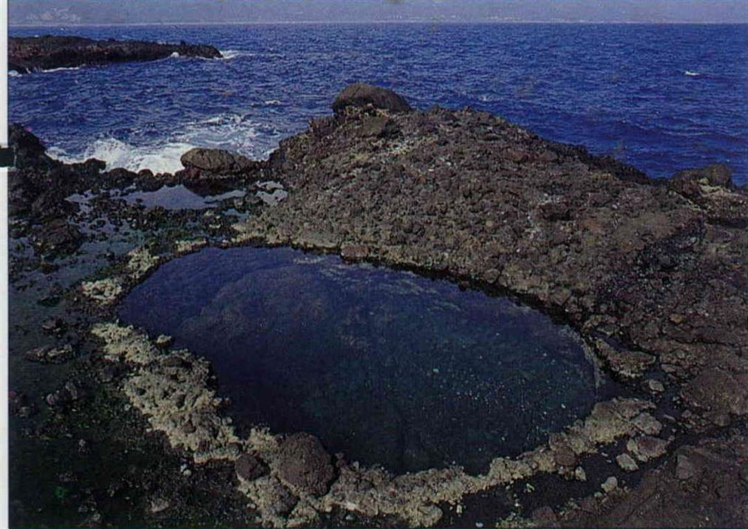
The deepest cave on the island is four meters, with a diameter of about five meters,an unusually large size. Even more unusual is that the cave collects water all year round, and the water, with many fish and shrimp wandering about, is clear enough to see to the bottom. Tradition has it that this is the crystal water pond in which one of the Three Immortals bathed.
There is a sea cave below the escarpment of the easternmost mound that cuts clean through. Although there is a footpath through the cave, it is so pitch black that you can't see your fingers in front of your face; fortunately there is quite a clear light at the end of the tunnel. You have to grope your way through the dark, and it's pretty good for building up your courage as well. But be sure to remember not to yell out inside the cave, as you will disturb the birds which make their nests in the cavern walls.
There is a lighthouse on the center, and tallest, of the hills, with a stairway to climb to the top. Though the view is grand, it can be treacherous when the ocean winds blow in.
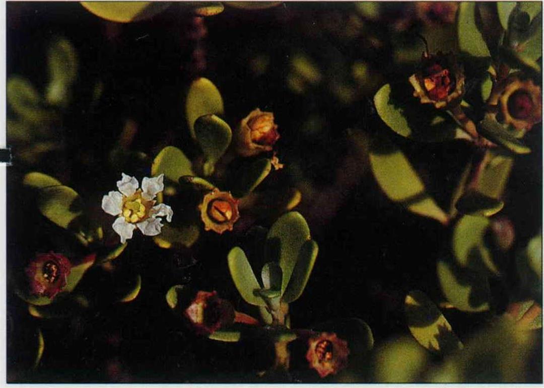
The island also has many types of coastal vegetation, including rare silvery messerschmidia, downy sophora, Lanyu indigo, and so on, as well as Taiwan kelp and screwpine. Perhaps these plants are not so easy to identify, but no matter, you can get by if you just remember the special features of sea plant life: Most coastal vegetation has thick leaves and fine down to ward off the harsh wins and bright sunlight, and to reflect the sunlight away so as to reduce evaporation.
You can find the most fascinating and colorful river terrace geology in the deep gorge at Taiyuan.
As the land rose continually, the rivers correspondingly cut their way deeper into the ground, multiplying the tendency of rivers to cut deeper beds. The Mawuku River that runs through the Taiyuan Basin has left behind a full seven levels of river terrace. It looks just like a natural amphitheater, and is thus also renowned as the "Theater River Terrace."
There is yet another extremely rare geographic feature. Two branches of the Mawuku River, the Luoan River and the Pei River, are soon to experience the phenomenona of a "river interception." The two rivers have already cut their way to within one meter of each other, and perhaps a "river interception" could happen with just a typhoon. The local people call the Luoan waterway the "Heaven River," while the Pei is known as the "Earth River," so it turns out that there will be a day when heaven and earth meet.
Lulien Island was formed by accumulation built up by volcanic eruptions, and it is shaped like a ship's anchor. So--no surprise-- it is also known as "Anchor Island."
The island is about 500 meters off the mainland, and they are connected by a sandbank (the name Lulien literally means"connected to the land"). When the water coming from the two sides meets over the sandbar, it explodes in a foamy white wave, giving the appearance of a white belt tied across the emerald sea. Twice a month during low tide, you can "walk across the water" over the sandbank.
Little Yehliu is the southernmost point for recreation in the East Coast Scenic Area. Because part of the topography here is similar to that of Yehliu, a famous coastal site in northern Taiwan, it is called "Little Yehliu."
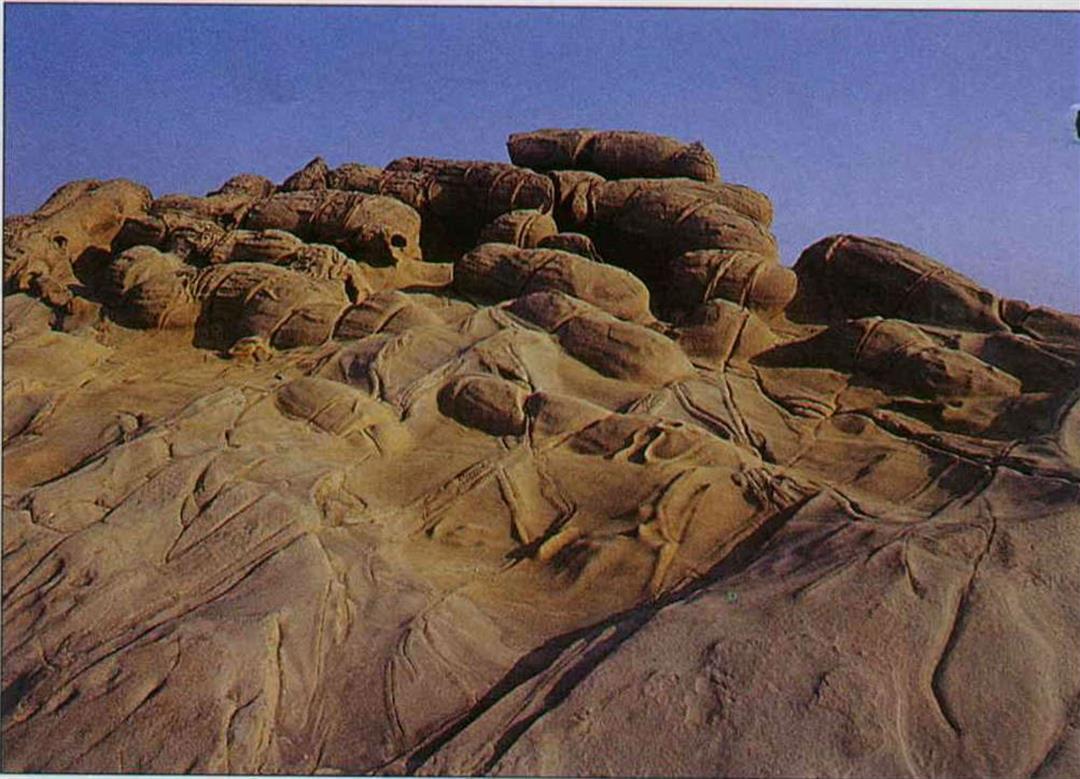
Little Yehliu is located along the coast on the northern side of the mouth of the Pinan River, and is about one kilometer in length measuring north-south. The main composition of the land is alternating thick layers of sandstone and thin layers of shale. Because the rock strata runs virtually perpendicular to the sea, and the different layers have different resistance to erosion, it has given birth to all manner of shapes and sights created by sea erosion.
The "tofu rock," which looks like chunks of tofu piled one on top of the other, is a product of seawater wear and tear. The surface of the "hornet's nest rock" is covered with large and small indentations and crevices which are, however, the work of burrowing crustaceans. There are also "mushroom rocks," with large tops and narrow feet, which are yet another product of the variability in resistance to the elements; "crooked spines," created by a lack of symmetry; and much more.
The scenic and recreational areas of the East Coast Scenic Area have been planned out to the last detail. They will have everything from parking lots made with cinderblocks to wooden or stone walkways to beautifully designed rest pavilions and bathrooms.
Besides the recreational areas which have already been mapped out, there will also be observation platforms, parking lots, and restrooms setup up at the most beautiful scenic areas. There will be nineteen rest pavilions large and small along the way, where travellers can stop and take in the breathtaking scenery at the same time as they catch their breath.
It is especially worth pointing out that the restrooms in the recreational areas are very clean, which should change the impression most people have of public facilities. Nevertheless, to keep this last bit of pure land eternally pristine, visitors will have to cooperate.
Let's hope that the next time we visit the east coast the scenery hasn't changed a bit.
[Picture Caption]
p.10
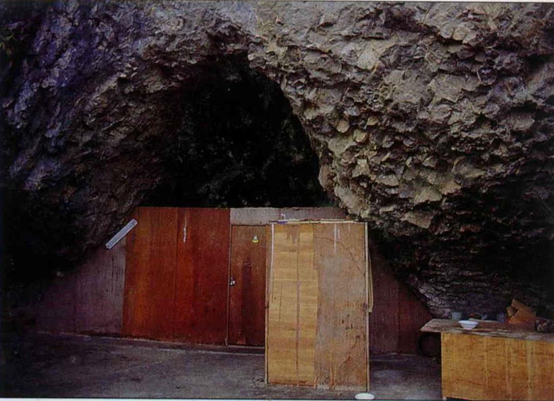
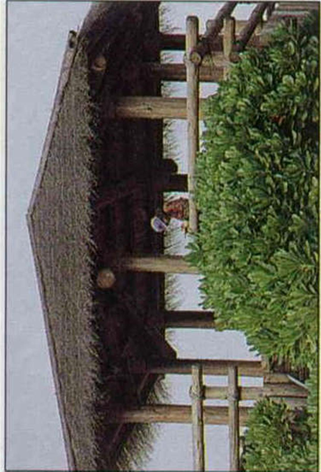
Traditional Ami architecture includes a little porch in front of the house; there are not many examples of traditional architecture left today.
p.10
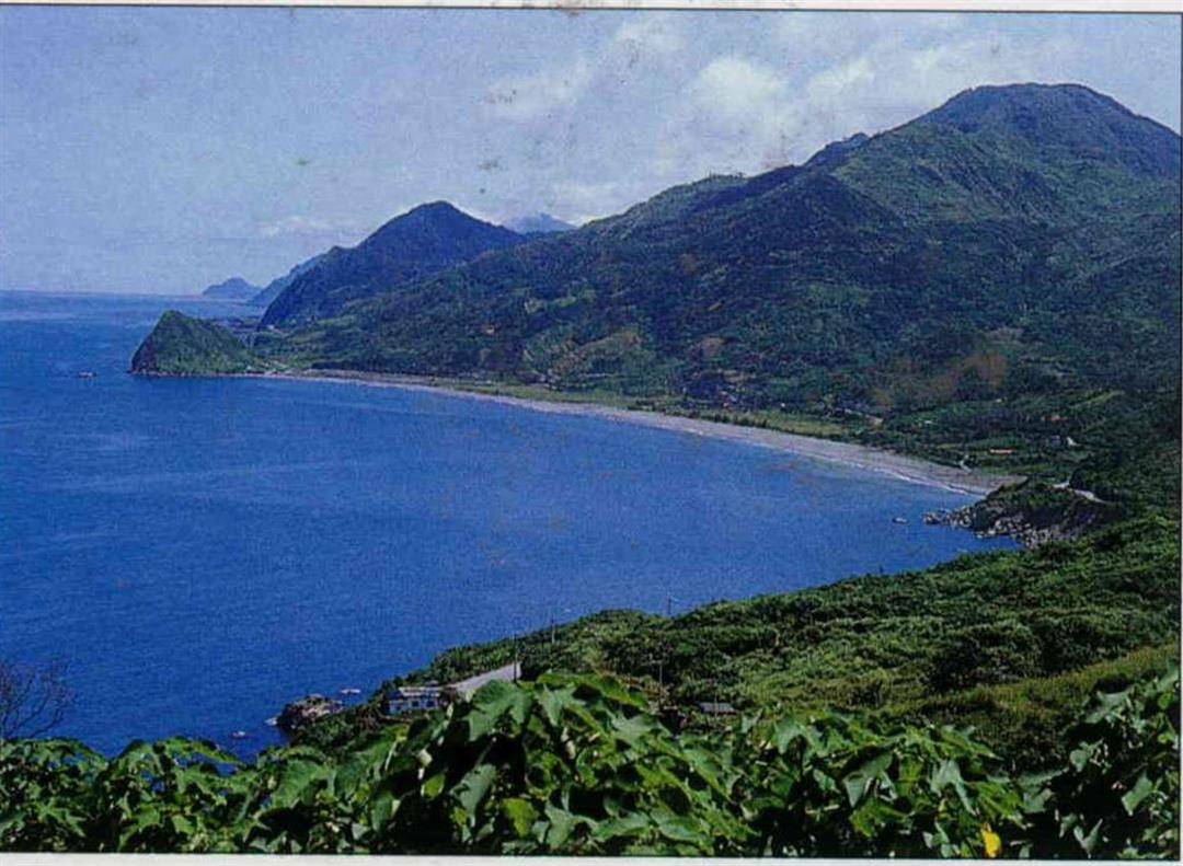
(right) The main attractions here are blue skies, emerald interesting rock seas, and formations.
p.12
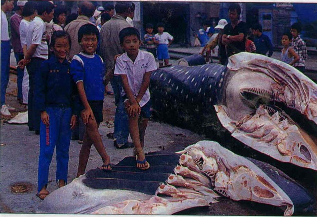
Hanging out around the harbor and watching the adults handle the fish; life sure is different growing up in a fishing village.
p.12
The east coast is a must-see for tourists; many of the local vendors have foreign language labels on their packaging for the benefit of visitors.
p.13
You can see sites like this--which light up the eyes of city dwellers--anywhere you go in the countryside.
p.19
The Harvest Festival, held each year in July and August, is the most important event for the Ami people.
p.20
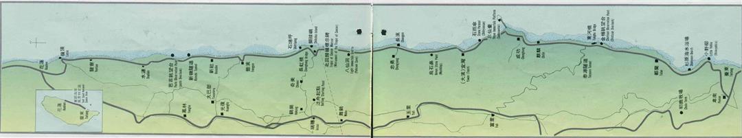
Major Sites on the East Coast
Travel Information
Food and Lodging: Taitung City and Hualien City offer the widest range of accommodations. Outside them, the best food and hotels can be found in Chengkung Township. The second best conditions are probably in Takangkou, and in Chingpu.
Fengpin and Changpin offer a small number of respectable establishments. All along the coast may be found many small villages which may or may not have accommodations, Juisui, and Kuangfu are generally the most reliable.
Public Transportation: Three bus companies service the Hualien-Taitung area: the Taichi, Hualien and Tingtung companies. The frequency of excursions is not great, so plan in advance. The three companies' departure and arrival stations often overlap, which can be used to advantage. Each bus company begins service around 6:00 AM, and ends around six or seven in the evening.
Private Transportation: All the scenic spots along the eastern coast are along route 11, about 170 km in length. The Jui-Kang and Kuangfeng highways, both running East to West,are also excellent thoroughfares; traffic is minimal except on holidays. All major towns have service stations.
Planning an Itinerary: Most major travel destinations are south of Shihtiping. For this reason, it is best to lay an emphasis on visiting the central and southern portions of the east coast, whether traveling by private vehicle or by public transport. Be sure to plan for a journey of at least three days and two nights.
Private Car Itinerary: Day 1: From Hualien, travel through Lingting, Shuilien, Chichi Bay, arriving in Fengpin to view coastal scenery. Take the Kuangfeng highway to Kuangfu; visit the Taipalang ruins. Travel to Juisui to view the Dancing Crane pillars and the tea growing area. Overnight in Juisui.
Day 2: Take the Jui-Kang highway, view the special geological topography along the Jui-Kang highway and Hsiukuluan River. Peruse the long arched bridge, the Hsiuku "Gurgling Jade" and Shihchiu Island. Head north to Shihtiping, then south to the Eight Immortals Grotto. Overnight in Chengkung.
Day 3: Rise early and go to watch the sunrise at the Three Immortals Platform; cross the bridge to see the special plant life and the caves. Turning south, enter Taiyuan to see the monolith of the Chilin culture and the seven-tiered river terrace. Return to the main highway at Tulan; visit the stone coffins and stone walls, a Class 3 national relic. Admire the special topography of Little Yehliu, and enjoy the road into Taitung City.
Public Bus Itinerary: Day 1: From Hualien, travel through Lingting, Shuilien, Chichi Bay, arriving in Fengpin to view coastal scenery. Visit Shihtiping to take in the caves and the rock stairs. Continue to Chingpu; walk to Shihchiu Island; visit the Shihti fisheries. Takangkou and Chingpu have restaurants and hotels.
Day 2: Visit the Eight Immortals Grotto and the ruins of Changpin culture. Visit Chungyung and the Chichi culture ruins. Later, climb the Three Immortals Platform. Overnight in Chengkung.
Day 3: Go to Tunghe; admire the Tunghe Bridge. Change buses to Taiyuan; see the river terraces. At the park to the side of the Taiyuan bridge, see the monolith of the Chilin culture.Return to the main highway at Tulan; visit the stone coffins and stone walls, a Class 3 national relic. Admire the special topography of Little Yehliu, and enjoy the road into Taitung City.
Notes: For information call the Little Yehliu office of the East Coast Scenic Area: (089) 281-237. White-water rafting is available, and takes a full day. The Ami Harvest Festival is held in August and September in Chimei or Yiwan.
Shuilien: You can see artifacts in the distance from the Yi-chang Middle School here.
Pachi Observation Point: Looks out over Chichi Bay.
Hsinchi Tunnel: A cliff with an old trail and erosion caves.
Hsinshe: Source of stone coffins (since moved to Taipei).
Fengpin: An important town on the east coast.
Taipalang: The legendary place of origin of the Ami people.
Shihtiping: A cave group and a natural stone staircase.
Shihchiu Island: An island dividing the Hsiukuluan River; has a wide variety of plant life.
Changhung Bridge: Good view of "Gurgling Jade" whitewater.
Chimei: Rafting rest stop; scene of Ami Harvest Festival.
Jui-Kang Highway: Interesting geological features all along the route.
Dancing Crane: A pair of stone pillars; also site of the "Heavenly Crane" tea growing area.
Eight Immortals Grotto: Sixteen sea erosion caves; site of important Stone Age culture; Class 1 national historic site.
Chungyung: Chilin culture stones can be found around the village.
Raven stone Point: Basalt pillars.
Yiwan: Ami settlement; famous for traditional festivals and dance.
Three Immortals Platform: Island with erosion caves and gullies, coastal vegetation; very popular.
Chengkung: Largest town and fishing port in area.
Chilin: Site of discovery of "Chilin culture."
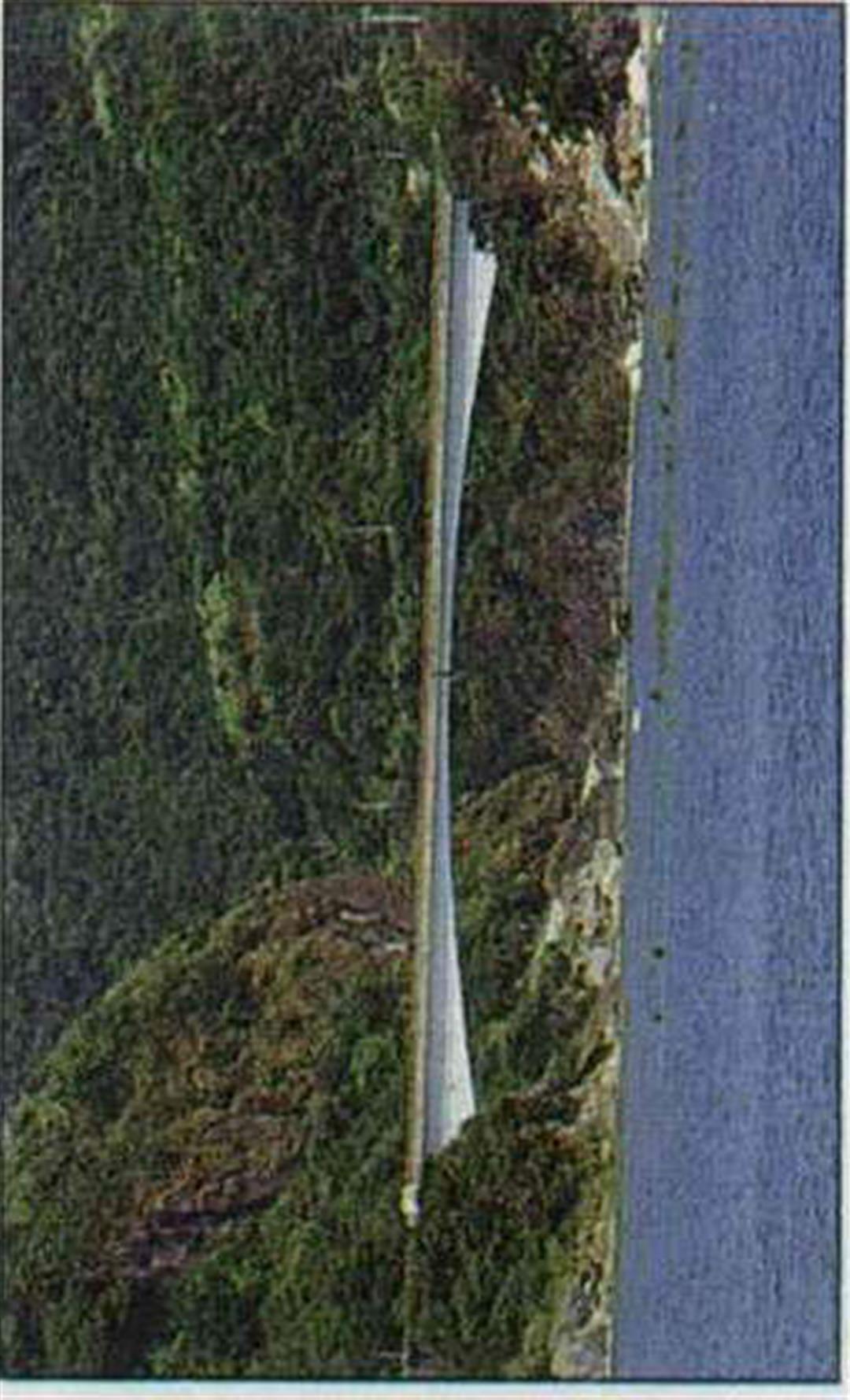
Tungho Bridge: Unique design.
Talyuan: Most famous for seven-level river terraces.
Chintsun Observation Point: Views of coral formation and Lulien Island.
Tulan: Stone coffins and walls in the forest area are a Class 3 national relic; site of future park.
Shanyuan Beach: The only sand beach on east coast; planned recreation area.
Little Yehliu: Highly complex erosion topography; "hornets' nest rock"; "tofu rock"; "one-faced mountain"; etc.
Peinan: Site of "Peinan culture"; future site of Museum of Prehistoric Culture.
(製表 . 鄭 元 慶 Table by Cheng Yuan-ching)
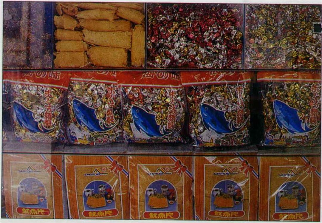
The east coast is a must-see for tourists; many of the local vendors have foreign language labels on their packaging for the benefit of visitors.
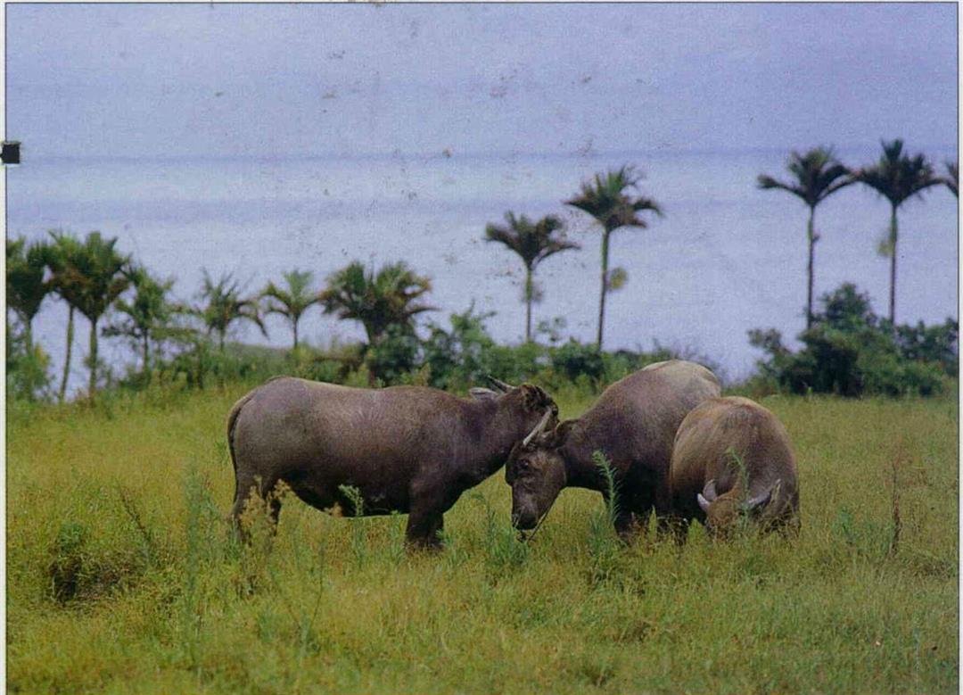
You can see sites like this--which light up the eyes of city dwellers--anywhere you go in the countryside.
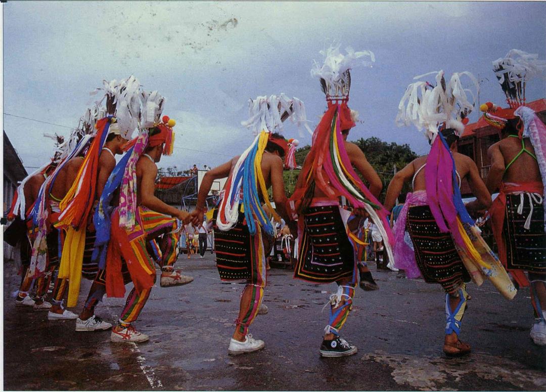
The Harvest Festival, held each year in July and August, is the most important event for the Ami people.
Major Sites on the East Coast.
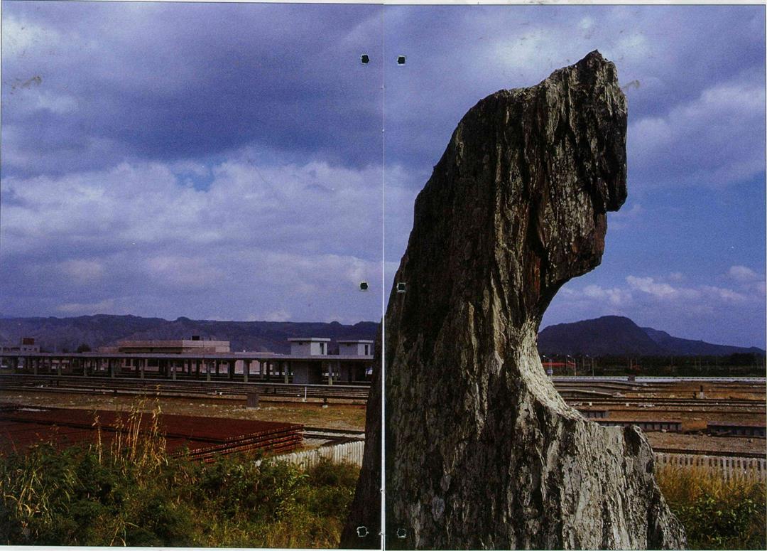
(left) This Peinan Culture stone pillar stands alone on a hillock behind the New Taitung Train Station, at the site of the future National Taiwan Prehistoric History Museum.
@List.jpg?w=522&h=410&mode=crop&format=webp&quality=80)

@List.jpg?w=522&h=410&mode=crop&format=webp&quality=80)
@List.jpg?w=522&h=410&mode=crop&format=webp&quality=80)