A survey map details the location, size, and boundaries of each lot of land, so it is intimately tied into people's interests and rights. However, because of the ravages of wars and changes in the land itself, land maps of Taiwan must be extensively redrawn. In fact, this task was begun 21 years ago. . . .
Case one: There are four neighboring households in Hsintien City, Taipei County. Unfortunately, the land re-survey discovers that the property was originally divided into five lots. That means that someone has the ownership rights over a piece of that land, but no actual control of the land. What now?
Case two: A certain container shipping company in Keelung occupies three-plus hectares of land. But after the re-survey, the property is shrunk by half. The landlord goes into a panic, having lost tens of thousands of dollars overnight.
Every time there is a land re-survey, some come out ahead, while others lose. Those in the latter category think that a re-survey is nothing but "government trouble-making." Everyone was getting along just fine until the re-survey, and now there are disputes! Yet, despite the risk of "making trouble," there is no choice but to do the re-survey. The reason is simple: The old survey maps, used for so many years, are literally bent all out of shape.
Maps like wrinkled blankets
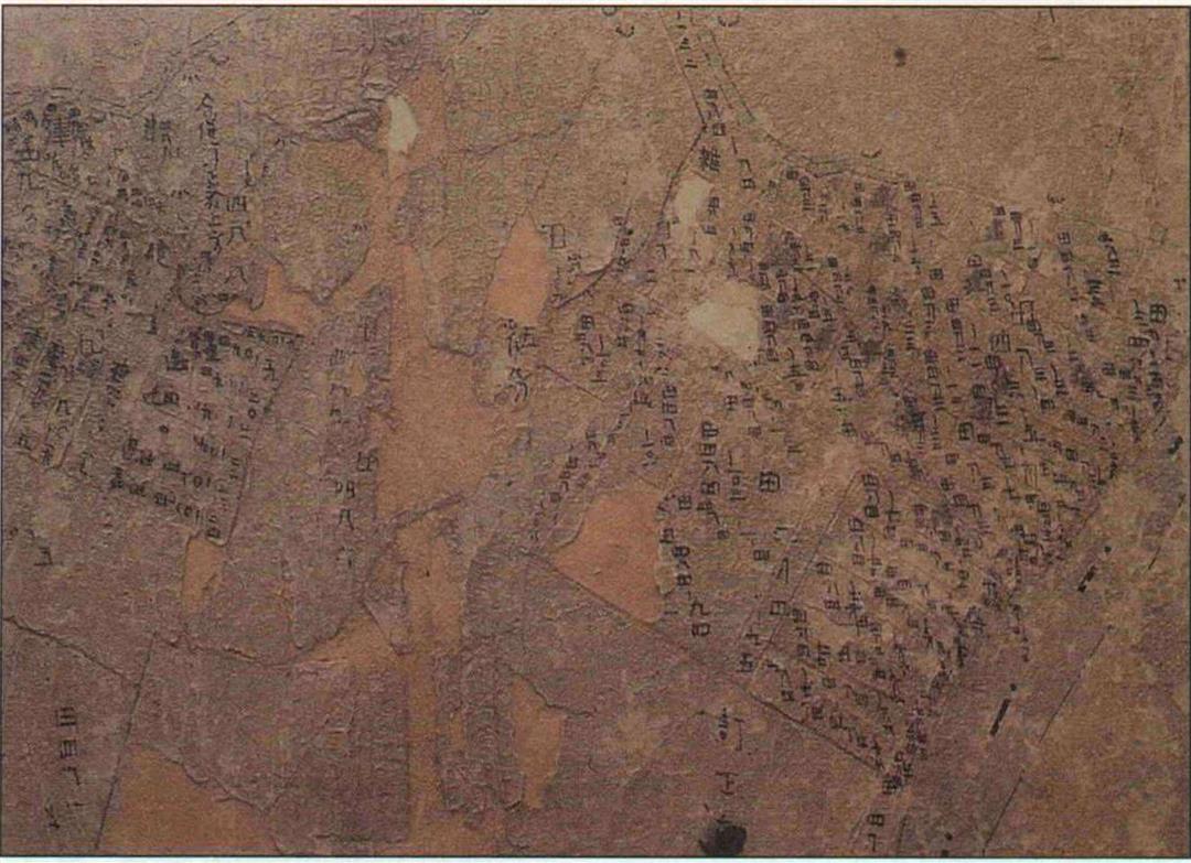
We want to see an actual survey map, so Chen Wen-chuan, director of the Office of Surveying at the Hsintien land registry, delicately unfolds a map with a hoary sounding heading: "Tapinglin, Hsintien Village, Wenshan Prefecture." This chart is a full 90 years old. Though it has been reinforced and sealed in plastic, the yellowed paper was already wrinkled and full of holes. And the paper fibers had, through the years, inevitably become stretched.
"A thin line like this means 15 centimeters when translated into real property," says Chen, pointing to an obscured boundary line on the map. "If the paper is wrinkled and folded, it is even harder to estimate the errors." It's really a case of "miss by an inch, miss by a mile."
Despite the ragged condition of these charts-ridiculed as "blanket maps"-they have legal standing in defining the location, size, and ownership of land. If land is to be sold, divided, or amalgamated, local land registries must act on the basis of these maps and land registration records. You can imagine that relying on these old charts to re-measure or determine boundaries can often produce bitter disputes.
And it is not only individual citizens who suffer because the land records are unreliable-national land use planning is also adversely affected. Last October, in a report entitled "National Land Use Plan Restructuring," Minister of the Interior Lin Cheng-feng noted: Of the bottlenecks obstructing national land use planning, besides the lack of a coherent land policy, another major problem is the lack of complete survey data.
Starting from the boundaries
In the agricultural age, land survey information was mainly used for government taxation purposes. After the arrival of the industrial era, land mapping has become indispensable: It is essential for any kind of construction, infrastructure, urban planing, or regional planning. Chang Yuan-hsu, director of the Department of Land Administration at the Ministry of the Interior, states a maxim: "For any economic or defense planning, land policy is at the forefront. And for any land use policy, surveying is at the forefront."
In fact the importance of land surveying has long been understood. In the Zhou dynasty a full minister was responsible for charting the land. Two thousand years ago Mencius declared: "Benevolent government begins with the clarification of boundaries. If the boundaries are clear, and the land division policy a good one, then the people will have a place to settle down and be stable."
When Liu Bang, founder of the Han dynasty, conquered Xianyang, capital of the Qin dynasty, while all the other officers were looting gold and jewels, Xiao He was quietly gathering up the records and documents of the Qin. After the Han was in place, these documents allowed the emperor to know in detail "all strategic locations, how many people there are and their strengths and weaknesses, and the difficulties of the people."
In the Three Kingdoms Period, when Liu Bei took charge of Shu, there had been an eight-year-running legal dispute over the Qing River plain; he promptly settled it using original maps from government records. In the Ming dynasty, missionaries brought Western surveying techniques to China, and the Qing emperor Kangxi ordered Jesuits to survey and map the capital Beijing, after which he instructed them to do the same for every province in the country.
Given the obvious importance of accurate land maps, then, why has Taiwan still been using maps made way back in the Japanese occupation era? Looking back into history, Taiwan's survey maps have indeed been ill-fated, and were exposed twice to the perils of war.
Two wars worth of damage
The two earliest large-scale land surveys of Taiwan were undertaken towards the end of the Qing dynasty and early in the Japanese occupation period. These were both made with an eye to tax collection.
In 1884, Liu Mingchuan became governor of Taiwan, and set to work to reform local government. It was necessary to first survey the land in order to ensure a firm tax base. After five years of effort a partial clarification of land boundaries had been achieved, and newly made maps showed walled cities, villages, and counties.
When the Japanese first took over Taiwan in 1895, they thought to use Liu's maps as the basis of tax collection. But these charts had been lost or scattered during the Sino- Japanese War of 1894-95, so could not be used. Thus a new land survey was begun in 1898. Over the course of five years, more than 770,000 hectares of land were demarcated, thus completing the largest survey mapping project of the occupation era.
Even that was incomplete, however, as it only covered plains land, accounting for only about 54% of Taiwan's total surface area. State-owned land like mountains and wilderness "slipped through the net," pending later field surveys.
But again war intervened. During WWII, the original survey maps, kept in the Governor-General's offices, were destroyed by Allied bombing. Fortunately, each local land office had a mounted copy of its area. Thereafter these copies became the most important land survey data.
After retrocession in 1945, because of shortages of manpower, materials, and finances, it was decided that the Japanese era maps would "temporarily" be used as the basis for land registration. It's just that this "temporary" period lasted 30 years!
Land sakes, what a mess!
Over the years following retrocession, the government implemented a series of land redistribution policies: the 37.5% rent limitation, land to the tiller, and equal land rights. After the economy began to take off, land use and development escalated, dividing land into smaller and more complicated lots. The maps kept in each locality were constantly being called upon to decide cases. But it was common to discover that these old maps were in many ways no longer adequate.
The old copies were in bad condition. And there were no original maps to redraw the copies. Sometimes, because land division had not been properly registered, there were cases of "land on the map but not in the books," "land in the books without land on the map," inconsistencies between the actual land area and the map, and so on. "Often the map, the registration book, and the actual lot itself were all different from each other. It was really a mess!" says senior surveying scholar Liu Yen-you, shaking his head.
Take for example the Hsintien case noted at the beginning of this article. It is possible that there were mistakes originally made delineating the land, so that each house was not built in the right spot, but each encroached on the neighbor's land, until finally the actual land situation no longer fit the survey map. Now this has been discovered, but the houses have already been built, so the only thing to do is to go through mediation for a settlement.
And what of the container company case? The landlord refused at first to accept the re-survey result, and hired a private firm of his own. The outcome was the same-his land was cut by about half. It is inferred that when using the triangulation method to measure the original lot, the workmen perhaps neglected to divide by two when calculating the area. The landlord has had no choice but to accept the result.
Professional nomads
Land may at any time be altered by natural or man-made means, so there has never been any such thing as a "permanent map," and all survey maps have to be updated. However, there have been very few cases of comprehensive nationwide re-surveys. In Europe and the US, adjustments are made on a regular, local basis. And as for having to re-survey because the old maps have been lost or have decayed, Taiwan is probably a lone example.
In 1976, the Ministry of the Interior formally began a nationwide re-survey project; it was supposed to be completed in three stages over 13 years. First priority was given to land identified by cities or counties as having the original records either destroyed or seriously inconsistent, or where major infrastructure projects required government acquisition of land. After requests were filed and approved, the then "General Survey Team" (predecessor to today's Land Survey Bureau-LSB-of the Land Department of the Taiwan Provincial Government) went to undertake an on-site survey.
The LSB has nearly 1000 staff scattered across Taiwan. These people are like professional nomads, moving to wherever the surveying takes them. When work is completed in one place, they move on to the next.
After the 13-year plan had reached its end, while survey work had been completed on schedule in Taipei and Kaohsiung municipalities, progress in Taiwan Province lagged far behind. Less than half the total lots had been surveyed, accounting for only 14.7% of total land area. Thus the Ministry of the Interior took up the task again, launching a new 20-year program in 1990.
Lots of work still undone
Why was work so far behind? "Land re-surveying is like maintaining an old building," says LSB director Tseng Te-fu, who just took over the reins at his agency last year. He says, "You cannot alter the structure, so it is actually more difficult than building a new building from scratch." When the dilapidated old maps-which still have legal standing-are brought out and compared to the actual land, the process of adjusting is a very complex one.
Moreover, every time that land use has changed, surveying and mapping has gotten that much harder. Thus, for example, where farmland has been rezoned for construction, it has often been sold off to several different owners, dividing the land up into ever smaller lots. Moreover, each county and city-trying to "apply the medicine directly to the wounds"-chose urban locations with the highest density and greatest turnover of property rights to re-survey first. While urban sites are not large in area, they are divided into many tiny lots, so that there is a sharp difference between their proportion as expressed in terms of lots vs. that as expressed in terms of area.
This is clear from a comparison of two examples. Shoufeng Rural Township had 692 hectares of land needing re-surveying, divided into 4700 lots. Meanwhile, Chungho City in Taipei County had only 83 hectares to redraw, but divided into 5391 lots!
Land registration is the hard part
In any case, measuring and mapping, after all, are just passive recording of data. The real problem, says LSB vice-director Li Juei- ching, is in fact in the "preparatory work for surveying-land registration investigation."
Li says that the measuring of the land itself is not all that difficult. Of course, the old "graphical cadastral survey" method was relatively time-consuming and tiring. A plane table was used for surveying. The distance between two points was measured with a tape measure or measuring stick. The measured distance was drawn onto mapping paper at a fixed scale. Then, using "area by triangle," the area was calculated. Indeed, not only was this time consuming, it was also error prone.
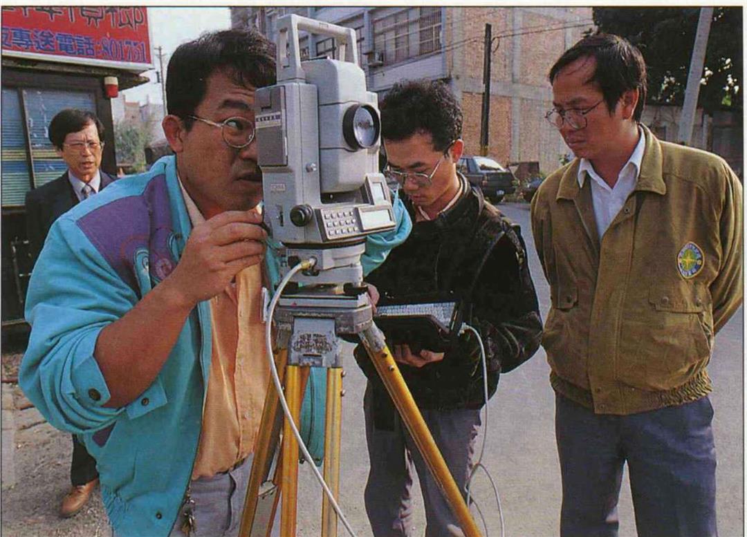
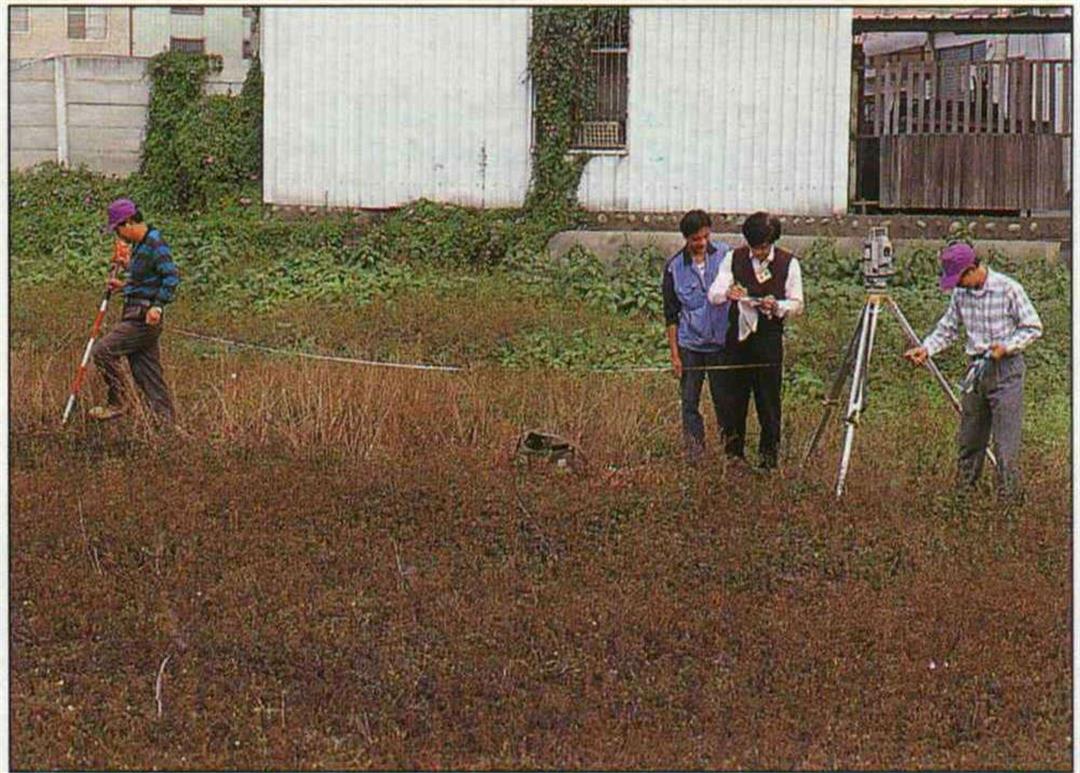
But today, Li explains, after the adoption of total computerization and the numerical cadastral survey method in 1989, surveying can be done quickly and accurately with a total station theodolite. The angle and the distance are entered into the computer, and it can automatically calculate the locations of the boundary points. In fact, the maps themselves can be drawn with a computer plotter.
But only a person can determine a boundary-defining the land that is registered to be surveyed. According to regulations, both neighbors must be present. If someone is not clear what their boundary is, the surveyors must consult the original survey maps to help in identifying the boundary.
"It's generally easier in apartment buildings," says Tsai Li-hsin, director of the Hsintien work station, pointing at a high-rise. Usually the door opens onto a street, there are walls on each side, and the two households on each floor divide the stairwell between them. "Only when the fire lane has been put to other use does the demarcation become more complicated."
As for empty lots or agricultural land, wherever possible natural boundaries (brooks, field dividers) or previously established boundary markers or poles are employed. However, boundary sticks can be moved or lost for various reasons, so sometimes boundary determination becomes more difficult.
A no longer passive public
There is another difficulty with urban surveying. A high-rise can have hundreds of residents, and each one of the owners must sign off for the process to be completed. These days, with everybody working in the daytime, surveyors frequently end up ringing doorbells of empty apartments. But if they go at night, skeptical residents will wonder, "Who ever heard of a civil servant working at night?" and refuse to sign anything. Says Tsai Li-hsin, "You can explain until you're blue in the face and it still doesn't convince them."
"In the past, it was the surveying itself that took all the time and effort. Now the problems come in the land registration and ownership survey," relates Huang Yu-chung, head of the LSB's First Survey Team. Comparing past to present, he says that people used to be simpler and more passive, and have more respect for anything "official," so they were more likely to accept re-survey results.
"But it's different these days," he sighs. It's not only land prices that have risen, but public consciousness as well: If land owners have any qualms about the survey, they will refuse to put in boundary posts or to sign off on the survey; sometimes they even prevent the surveyors from doing their work.
Sitting on time bombs
After the survey, with all its tribulations, reaches a certain stage, the staff cease their outdoor work and return to their offices to review the results; they prepare for the annual public release of the results in local land registries every April 1. At this time the "hot potato" is passed to these local land administrators.
"Every time the results are announced, for a half year thereafter, our office looks like a farmers' market, with crowds milling about and a constant babble of voices," laughs Chen Wen-chuan of the Hsintien land registry, shaking his head as he thinks of the scene. Sometimes, carried away by a fit of anger, citizens will curse the staff or pound on the tables.
"The biggest problems come when someone's land is reduced in size-that's what people find hardest to accept," points out LSB director Tseng Teh-fu. Landowners who end up with less feel as if their rights have been infringed. Most of the time they either suspect that there was an error in the surveying, or that the surveyors are acting in collusion to benefit some other person.
It is typically the case that people have nothing to say if their neighbors also find their actual property less than they had previously assumed. But when one person loses while his neighbor gains, that person is not going to accept the result. Some even expect that the government will compensate them for having less property than they originally thought they had.
This land is your land. . . .
After pained explanations and persuasion, most people who come to protest end up "dissatisfied, but resigned." If they still have doubts, they can take their case to a "boundary dispute mediation committee." Those who remain unconvinced can appeal for a remeasurement from the local land registry. If they are still not satisfied, they must file an appeal with the Executive Yuan or else go to court. Most all land administrators, from the lowest local surveyor to the director of the Provincial Land Department, have been sued at some time.
One oft-cited case of how far disputes can go pitted two neighbors in the area of the Wankuo Theater in Hsimenting who fought over a space only as wide as a brick. Each of them sought out help from elected officials-I see your three city councilors and I raise you a legislator!-and they sued each other in court; the dispute has yet to be resolved after many years.
Of course not only Chinese act this way; citizens in other countries also go to court or take action if they feel they have lost out by a land survey. Chinese Culture University geography professor Liu Cheng-chou (also director of the land registration and surveying training class) says, "Koreans are famous for being tough. I've heard that there some land surveyors have even been beaten up!" This seems to be a fate that survey workers have to live with.
"It's a family affair"?
Yet re-surveying is not always painful. Besides planting boundary markers for each lot of land, taking the opportunity to reorganize land demarcation and lot numbers, and combining lots that don't need separate handling, survey workers can, along the way, also clarify and repair urban planning boundary posts, laying a more secure foundation for urban planning.
Moreover, sometimes re-surveying ends up being decisive in bringing an end to years of rivalry by clarifying boundaries. Such disputes often arise from the division of an estate among heirs. Though civil servants are no doubt tempted to quote the old adage, "even the best official can't resolve a family affair," they are gratified whenever they can resolve a dispute.
Wang Ting-ping, a technician in the Department of Land Administration, tells of a case in point. Five years ago, when working on the Shuili re-surveying district, they came across two brothers who had long before been embroiled in a bitter lawsuit, so bitter that one had even cut off an arm of his rival. Although the surveyors were very hesitant to reopen the dispute, in order to complete their duties as civil servants they just put their heads down and plowed ahead, notifying the two to come out and identify their boundary. As expected, each of the two had his own version. But at least now there was a formal record that could be taken to a mediation committee for a compromise solution, thus allowing the surveyors to get through this risky "mission impossible."
Taking the blame for history
It is very common for property to be reduced on the land registration maps after a re-survey. Surveying scholar Liu Yen-you says that while one main reason is that the owners may have simply set their boundaries incorrectly, an even more common cause is the imprecision of early surveying techniques. At the time the surveys were made, the margin of error was two percent. Re-surveying uncovers problems, but it also puts the land officials in the position of having to accept blame for these "errors left by history."
Of these situations where "what was wrong before is right now," Chen Wen-chuan avers that the most thorny are those involving land acquired for public works. He even suggests that it would be worth reassessing and amending current law.
For example, for land acquired for highways or mass transportation, precedent has it that private citizens are not called upon to declare the boundaries, which are instead determined by civil servants. But if a re-survey is done only after the land has been acquired, and the result is that the government's property is expanded and the citizen's reduced, according to the law the original owner has no right to inquire into the matter.
"Of course citizens who lose out are furious," says Chen with a wry laugh of exasperation. They condemn the "bandit government that steals land," or even accuse the survey workers of corruption and greed. Although it almost always turns out that the fault was in incorrect old land charts, with new surveying methods being far more accurate, still Chen suggests that current regulations be altered so that citizens can be adequately compensated.
Witness to earth-shaking change
Besides carrying historical "burdens," re-surveying is also facing the problem of trying to keep up with Taiwan's changing land. Many huge construction projects are transforming the land before our very eyes. Does this mean that surveys will be obsolete by the time they come out? In other words, how can surveying keep up with the pace of change in Taiwan?
"In fact it's not that bad," says Li Juei- ching of the LSB. Re-surveying simply records the most current land situation, and maps are then sent to local land registries for safekeeping. If the land is re-divided, combined, or re-demarcated, then registration of these changes will be handled at the registry.
Surveying is consequently a cumulative task, which leaves an objective record of change. Over the last 20 years survey workers have borne witness to the "earth-shaking" changes in land use in Taiwan. "The oldest urban areas haven't changed that much," explains Li Juei-ching, "but change has been very rapid on the edges of urban areas. There either the government steps in and includes the land in urban planning, or it gets covered with newly built high-rises."
Over the last 20 years, enormous manpower and material has been poured into re-surveying the 54% of Taiwan charted all those years ago by the Japanese; the time has flown by and the work is still not completed. And what about that other 46%-originally unregistered forest, mountain land, or wilderness? After nearly a century of change, how is that to be surveyed?
In fact, some forest and wilderness surveys had been done even in the Japanese occupation era. In 1947, this work was taken over by the newly established "Wilderness General Survey Team" ("wilderness" being defined as any land not registered). Currently the LSB is also conducting surveys and registration of state-owned forest land. Also, a lot of formerly unregistered "wilderness" has been incorporated into city plans, and it is being taken care of as part of the re-surveying process. In the future, when private ownership rights are established, the land can be transferred from one owner to hundreds with only a change in registration required. There will be no need to waste time and effort re-surveying.
Redrawing the map of Taiwan
In order to speed re-surveying work, the LSB has already imported the most advanced "global positioning system" technology to do "control surveying." In addition, computerization is the inevitable trend. Besides studying ways to automate outdoor surveying work, the agencies in charge are also entering old maps into the computer to create a comprehensive database. In the future it may even be possible to call up land registration maps at home through the Internet.
Two decades of re-surveying work is drawing to a close. But the work of drawing the new maps has just begun. Tseng Te-fu hopes to complete maps of the major cities under provincial jurisdiction-Keelung, Hsinchu, Taichung, Chiayi, and Tainan-by 1998 or 1999. After that will come mapping of the cities within county jurisdictions. Bit by bit Taiwan will "get on the map."
(Claire Liu/photos by Pu Hua-chih/tr. by Phil Newell)
p.32
Survey maps left behind from the Japanese occupation era have not been able to withstand the rigors of time, and are scarred with flaws; thus re-surveying is essential. (photo courtesy of the Land Survey Bureau, Taiwan Provincial Government)
p.33
I want to build on my land. Landowners ask the land registry to come and re-establish the boundaries of their property.
p.34
During the Qing dynasty, Taiwan governor Liu Mingchuan did a land survey and produced "fish scale" maps. This is what Hongshuigou Town (in today's Ilan County) looked like. (photo courtesy of the Taiwan Branch of the National Central Library)
p.35
The Ta-an District of Taipei, 1955. At that time the surveyors used plane table instruments; work was slow and arduous. (photo courtesy of the Land Survey Bureau)
Surveying equipment is constantly being improved. This "antique" theodolite was very "instrumental" in surveys in the 1950s and 60s.
p.36
The latest in automated outdoor surveying technology: A palm-sized computer is hooked up to the surveying instrument. Not only can it record the data, it can automatically reconfirm and make geometric calculations. It is truly a surveyors' "magic box."
p.38
The Global Positioning System identifies any location on the planet through signals sent by satellites. It saves time and effort, and is not affected by weather conditions; it's currently the most advanced technology for doing "control surveying."
p.39
Meadows covered over in high rises, fields paved with roads-these are common sights in Taiwan. "Land for planned highway" signs are "paving the way" for future acquisition of land for public works. (photo by Diago Chiu)
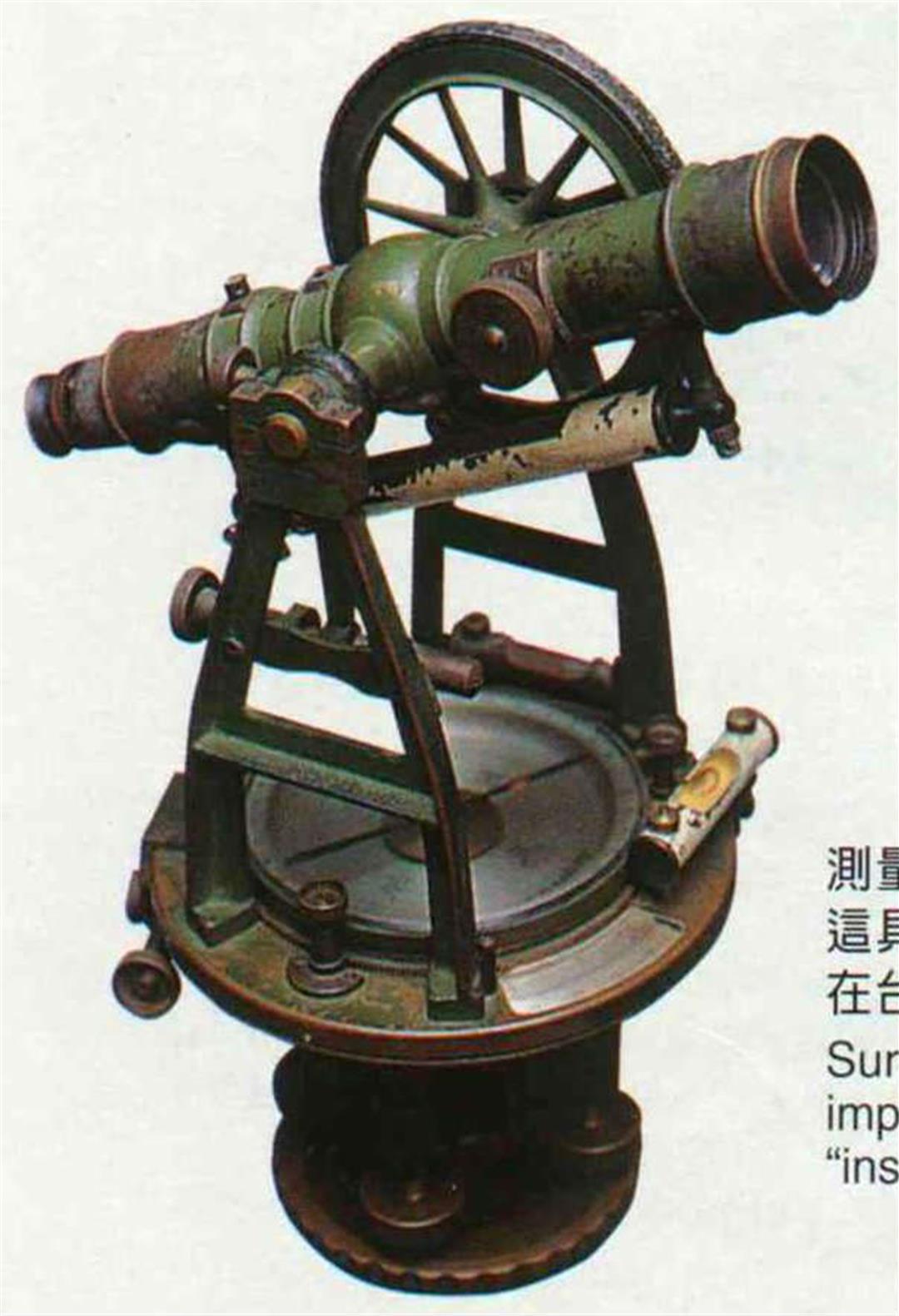
Surveying equipment is constantly being improved. This "antique" theodolite was very "instrumental" in surveys in the 1950s and 60s.
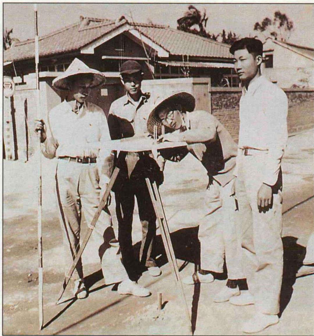
The Ta-an District of Taipei, 1955. At that time the surveyors used plane table instruments; work was slow and arduous. (photo courtesy of the Land Survey Bureau)
The latest in automated outdoor surveying technology: A palm-sized compu ter is hooked up to the surveying instrument. Not only can it record the data, it can automatically reconfirm and make geometric calculations. It is truly a surveyors' "magic box.".

The Global Position ing System identifies any location on the planet through signals sent by satellites. It saves time and effort, and is not affected by weather conditions; it's currently the most advanced technology for doing "control surveying.".
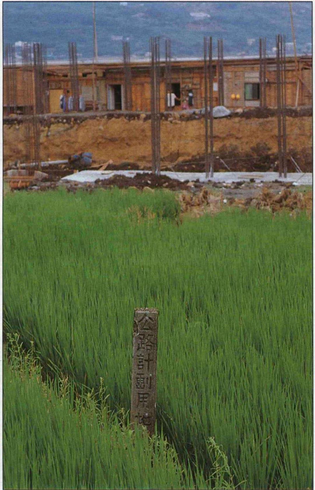
Meadows covered over in high rises, fields paved with roads--these are common sights in Taiwan. "Land for planned highway" signs are "paving the way" for future acquisition of land for public works. (photo by Diago Chiu)

@List.jpg?w=522&h=410&mode=crop&format=webp&quality=80)
@List.jpg?w=522&h=410&mode=crop&format=webp&quality=80)


@List.jpg?w=522&h=410&mode=crop&format=webp&quality=80)