Typhoon Nelson had a poor sense of timing. On August 22nd this year, the storm appeared off Taiwan, with the civil service entrance examinations scheduled for the next day. To hold the test or not to, that was the question, and all hung on the word of the Central Weather Bureau, that least-trusted of public agencies. They urged postponement, and the rain poured and the wind blew down many a tree, but one Bureau meteorologist admits, "We were staring at Nelson, wanting to issue a bulletin, but still felt pretty undecided. The heavens are hard to predict."
Typhoons are extremely volatile. Twenty-four hours is ample time for them to change position, direction, rain and wind levels and make a complete mockery out of the bulletin issued the day before. The Weather Bureau's success this August stemmed from Nelson's relatively steady course and recent improvements in forecasting techniques. Typhoon Wayne two years ago looked certain to hit Taiwan, and the government declared a holiday in advance. The storm then naturally changed direction, leaving people a beautiful day off, with clear skies and a gentle breeze.
The Weather Bureau does not mind such cases. Owing to the damage done by a storm to an unprepared community, they and other weather bureaus prefer to predict on the pessimistic side to avoid unnecessary disaster. The reports are regularly listened to with concern by many people, such as farmers, fishermen, travel agents, and older people, perhaps because their bodies are more sensitive to the changes in temperature and air pressure.
Fundamentally speaking, weather is composed of cloud layers, fronts, and masses of hot and cold air. These elements interact and produce our weather. Predicting the weather requires careful study of past conditions and analysis of the present situation, but there still remain many types of meteorological phenomena that we have yet to encounter. Information regarding weather crosses all national boundaries, and Taiwan regularly uses reports from mainland China, the Soviet Union, Japan, and countries in Southeast Asia to predict its own situation.
The first scientific tool used to predict the weather was radar. Radar sends radio waves into the atmosphere, and the interaction of the waves with cold fronts informs meteorologists of the location and extent of the precipitation. Taiwan has two radar stations, at Hualien in the east and Kaohsiung in the west.
Yet no matter how many measurements of what kind are taken, we can only get a partial picture of any given weather condition. In 1960, a giant step was taken, however, with the launching of the first weather satellite. The satellites are relatively simple devices, being equipped with two cameras constantly taking pictures of the world below, and at present six are in orbit around the earth.
There are two types of weather satellites. Four travel in a latitudinal orbit, 36,000 kilometers above the earth, and have a speed roughly equivalent to that of the earth's rotation. Each can see about a quarter of the world's surface, and when their pictures are combined, scientists receive a worldwide picture of the weather. The other two proceed along longitudinal paths from pole to pole, flying at an altitude of 850 kilometers and passing over Taiwan every six hours. The photos they send cover a smaller area but are clearer than the ones produced by the other sort.
Useful as they are, satellites are not enough. They photograph from extremely high altitudes, and owing to the curve of the earth, do not present a totally accurate picture of what is taking place below. Moreover, they only photograph the top cloud layer, while typhoon cloud formations only reach 20 kilometers high, meaning the weather seen from on high and that experienced on the ground may be two very different things. Wind, geography, and humidity also influence the weather, and information from satellites, radar, and surface stations must be combined to form an accurate picture.
Taiwan, surrounded by ocean, assaulted by fronts from all directions, and shaped by an uneven terrain, gives its meteorologists all they can handle. Weather can change quickly and radically. Larger fronts are relatively easy to predict, but "little things" often aggravate weathermen here. "Little things" prefer to make their appearance in spring and fall, when the Weather Bureau falls well short of its usual 85% accuracy level.
Typhoons, a stiff test for any weather bureau, often visit the Western Pacific, with an average of 15 per year, of which 3.5 come to Taiwan. July, August, and September are the peak months, when the sun's heat evaporates an unusual amount of water, which becomes an ever-accumulating cloud formation. The earth's rotation influences their direction, as do weather patterns further north in the northern hemisphere. The result is a whirling, counterclockwise mass of wind and rain.
Most typhoons begin between the 5th and 10th parallels, with Guam being a frequent starting point in the Western Pacific. When the wind speed there exceeds 60 kilometers per second, the Joint Typhoon Warning Center gives the storm a name and a typhoon is born. Names are chosen from a selection of 84, of which three are relatively new. A former trio became major disasters, and rather than tempt fate, the Center decided to exchange names.
The Weather Bureau, established thirty years ago, issues bulletins every six hours, which prevents surprise storms, but before that, people could only watch the sky. Typhoons themselves contain strong, upward, cloud-creating air currents, which makes for downward currents at the storm's perimeter. As a result, typhoons are often preceded by clear skies and rosy sunsets. In addition, the normal summer southerly wind changes, first to a northeasterly and then to a northerly. Ocean waves become longer than usual. In autumn, however, these changes happen as a matter of course, and predicting typhoons becomes much more difficult.
People in the past had many theories about typhoons, and while some have been disproven, two have been confirmed by modern science. The first theory holds that if the typhoon does not end with a southerly wind, it will soon return. Storms move in a west-to-east direction in a counterclockwise rotation, bearing out the truth of this old adage. The second says that thunderstorms mean no typhoon. The edge of the typhoon, as said before, features downward air currents, preventing the accumulation of clouds and rain. If a period of rain in late summer, however, is interrupted suddenly by gorgeous blue skies with gentle breezes, a storm may be on the way.
As man tries to better understand and even control the weather, the weather itself is changing. Drought in Africa, rising temperatures in equatorial waters, and flooding in Northeast Asia have bedeviled scientists, who see the past 15 years as departing considerably from normal weather patterns. One theory holds that rising consumption of coal, gas, and oil have put so much carbon dioxide into the atmosphere that heat from the earth's surface which previously dissipated into space now is trapped, making the earth a warmer place. Another interpretation takes precisely the opposite view, that the earth is headed for a new ice age, which will turn North America and Europe into huge glacial masses. Neither concept at present provides much assistance for the weatherman, whose task each year grows more difficult.
(Translated by Mark Halperin)
[Picture Caption]
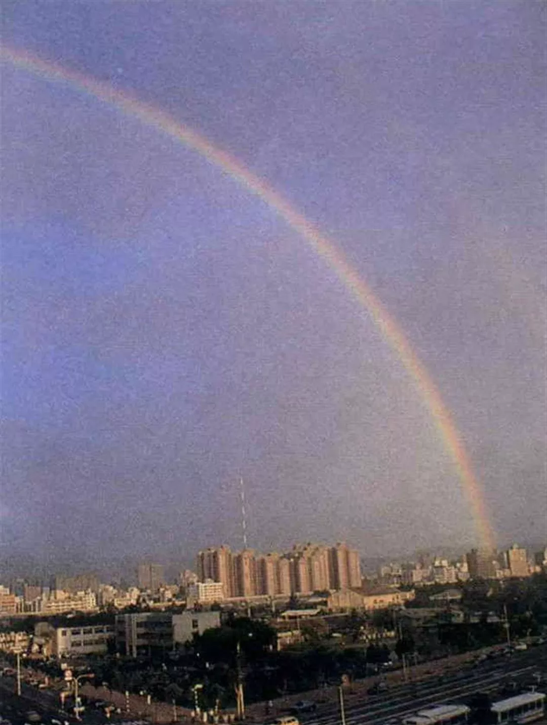
A beautiful rainbow after a heavy rain. (Photo by Hsia Yi-sheng)
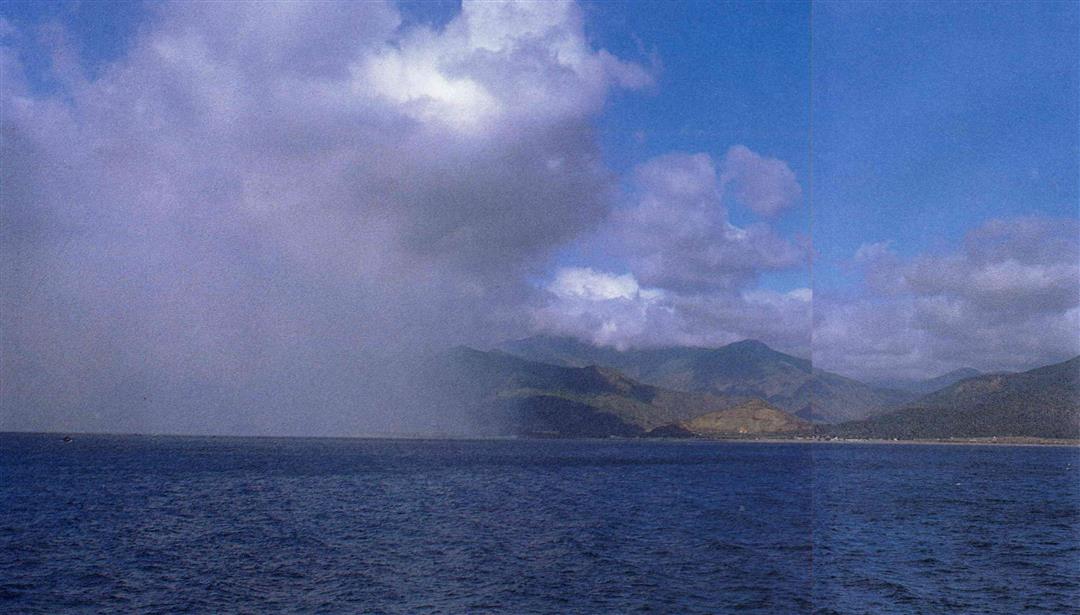
Mist on the water is often a sign of a change in the weather.
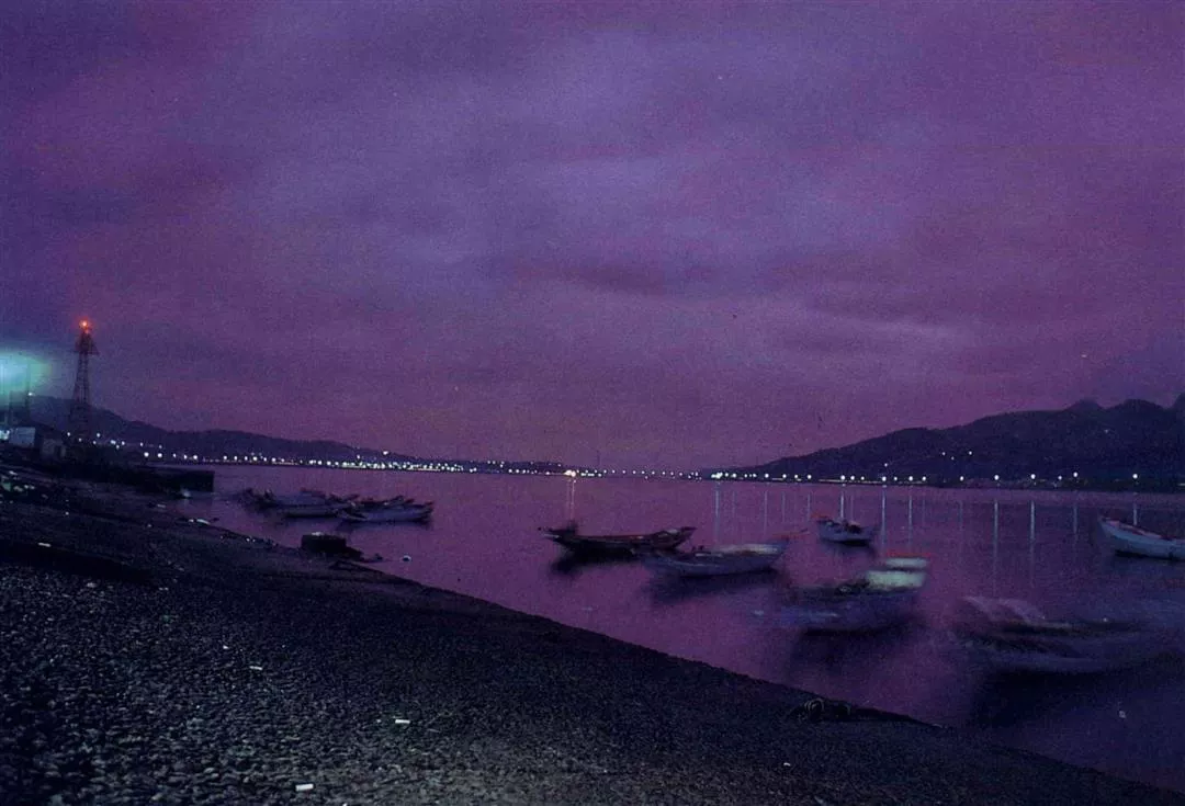
Rosy sunsets mean good weather tomorrow. (Photo by Tu Lan)
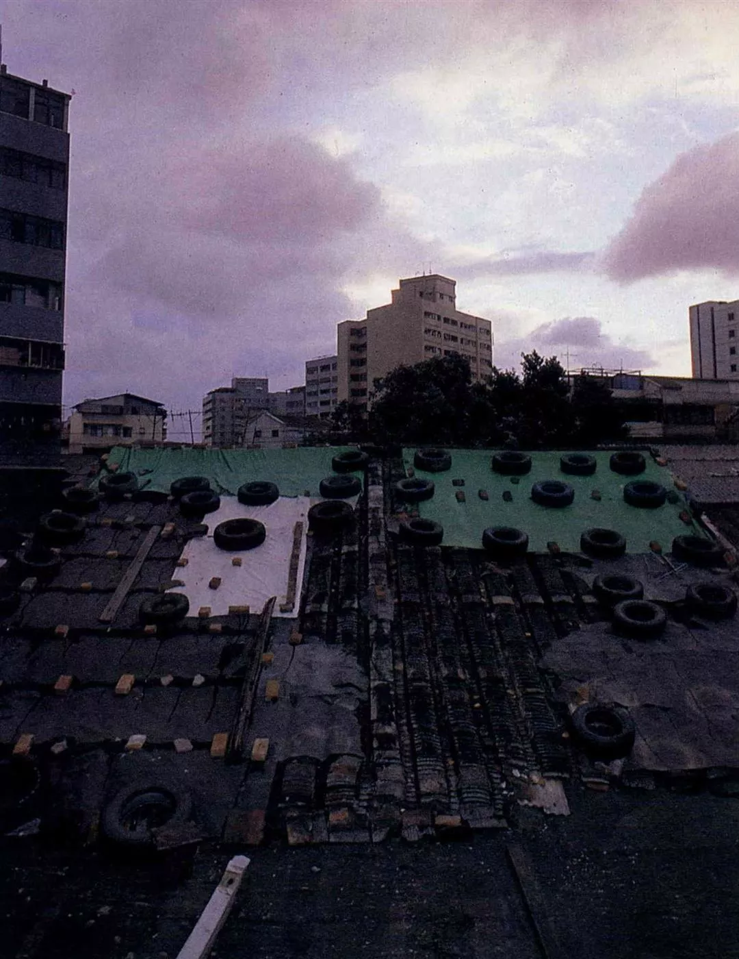
Ghost-like cloud formations presage typhoons. The tires are to prevent the roofs from flying away in the wind.
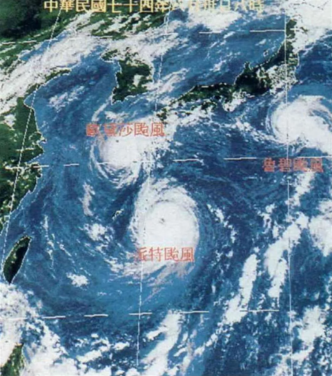
August 30th satellite photos showed three typhoons in the Western Pacific.
Chinese lore says that the number of pleats in the typhoon shrub will correspond to the number of typhoons to arrive in the coming year.
Typhoons often take the tiles off roofs and knock over storefront signs.
Mist on the water is often a sign of a change in the weather.
Ghost-like cloud formations presage typhoons. The tires are to prevent the roofs from flying away in the wind.
Rosy sunsets mean good weather tomorrow. (Photo by Tu Lan)
August 30th satellite photos showed three typhoons in the Western Pacific.