A barrier to development
Much of eastern Taiwan was virtually cut off from the outside world until 1874, when the Mudan Incident led to Qing Chinese imperial commissioner Shen Baozhen being dispatched to Taiwan to “open the mountains and pacify the savages.” The primary element of this effort involved the creation of three major roadways in northern, central, and southern Taiwan. The northern one, now known as the Suhua Old Trail, opened up a route between Su’ao and Hualien. It was only in 1875, when the trail was opened up, that the authorities made their first incursions into the east.
Later, once Taiwan was under Japanese rule, the new regime opened up another route running from Su’ao to Hualien. Finished in 1932, this coastal road forms the basis of today’s Su’ao–Hualien Highway.
These historic routes are still visible today, and offer some great views of Qingshui Cliff.
Seafront spectacle
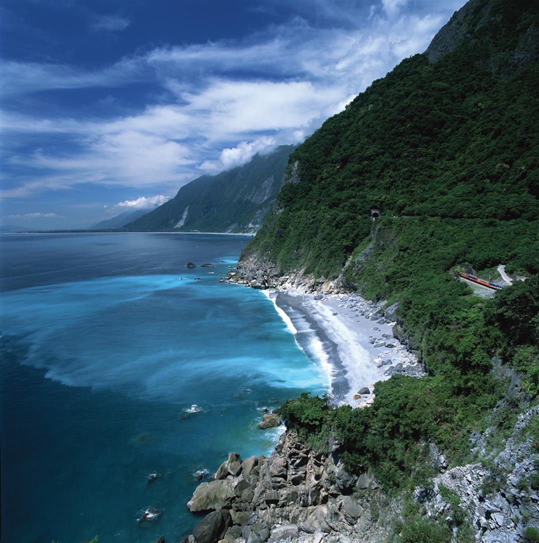
After passing through the Heren Tunnel, the Su’ao–Hualien Highway continues on through the Renqing Tunnel, and then the Heqing Tunnel. Liou Ying-san recommends looking to the north or south from the Heqing Tunnel to take in the winding lines of Qingshui Cliff. If the weather’s good, you’ll even be able to see the Liwu River delta, Mt. Meilun, and the Coastal Mountain Range. All told, it’s a spectacular vista.
On top of this, Taroko National Park also offers three trails—Heren, Huide, and Chongde—that go down to the sea. Of the three, both Professor Liou and Lin Maoyao recommend taking the Heren Trail, which starts just north of the Heren boundary marker at the entrance to Taroko National Park.
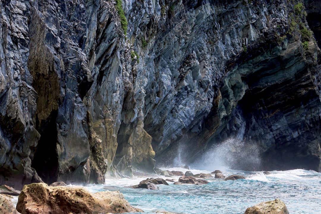
This trail runs about 160 meters down to the shore, where you will be greeted by a gravel beach and wonderful sea caves.
As you approach the cliff face, veins of quartz reveal themselves, winding through the gray rock like long white scarves.
Centuries of polish
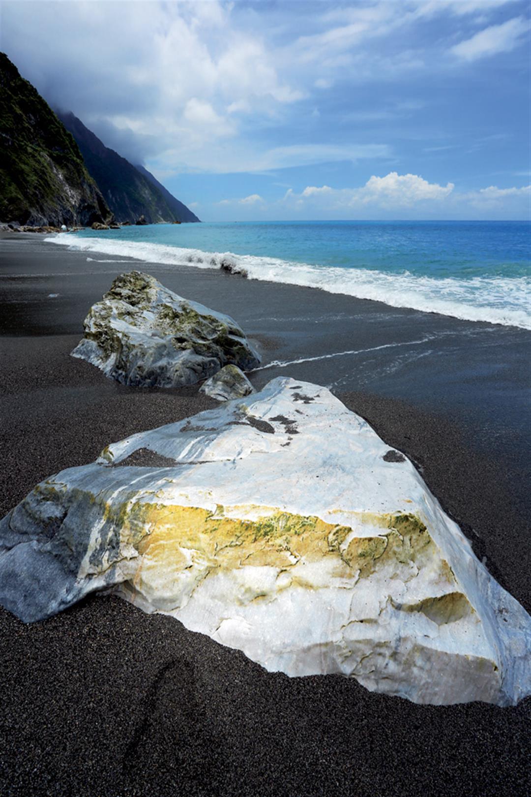
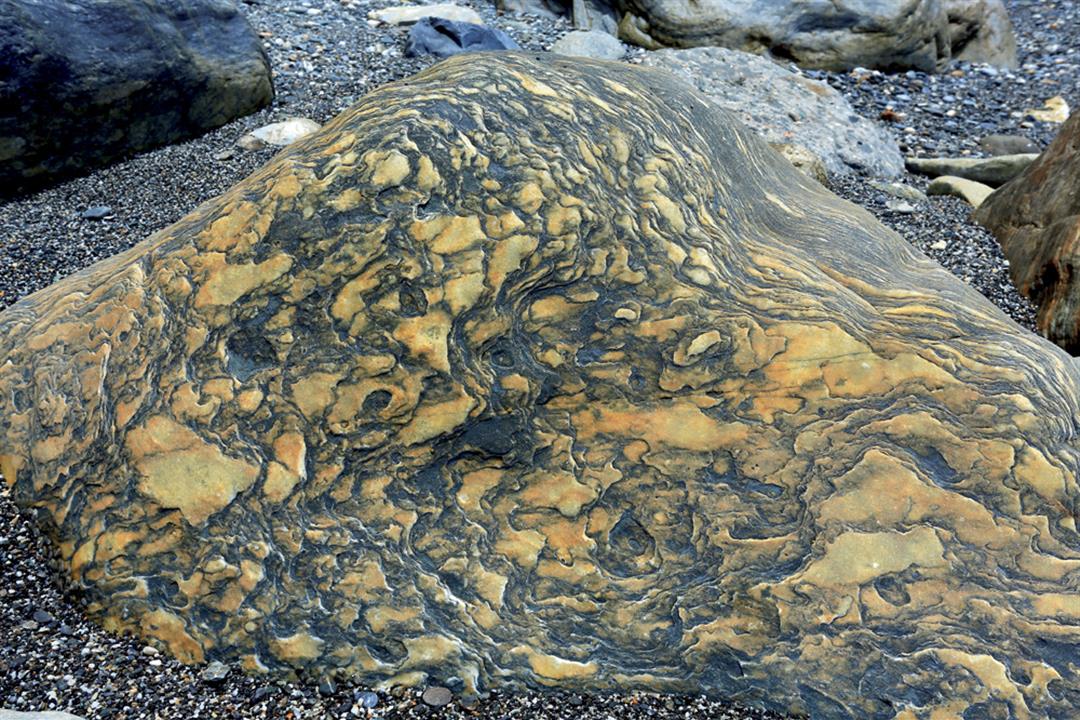
Qingshui Cliff is primarily made up of green schist, gneiss, and marble, and the cliff’s rocks can be dated to as far back as 250 million years ago.
Many places in Taiwan feature these rocks, says Liou, but only at Qingshui Cliff are they so clearly visible, thanks to the centuries of erosion and exposure the near-vertical cliff has experienced.
Tourist cruises and whale-watching boats between Hualien and Su’ao offer especially fantastic views of the soaring sea cliffs from the ocean. The sections around the northern end of the Chongde Tunnel, and between the Daqingshui and Heqing Tunnels, are particularly impressive.
Taroko Gorge loses out
The beauty of both cliff and ocean at Qingshui, a spectacular work of nature, was listed as one of Taiwan’s top eight scenic destinations by the Taiwan Provincial Government as far back as 1953, alongside the mid-autumn moon reflected in Sun Moon Lake, the snows of Yushan, the sunset at Fort Zeelandia, the sea of clouds at Alishan, the night lights of fishing boats in Penghu, and Taroko Gorge.
In 2013, the Forestry Bureau held an online vote to name “Taiwan’s Top Ten Landscapes.” To Professor Liou, Qingshui Cliff is representative of the rugged geography of Hualien; however, with Qingshui Cliff nominated, the similarly spectacular Taroko Gorge, previously a top-eight destination, was left out. “I really never expected the gorge to not be nominated,” says Liou.
Before opening up the voting, the Forestry Bureau engaged scholars to draw up a list of candidate locations for the ballot.
Liou was one of the scholars invited to participate. When the initial listing was drawn up, he remarks, Taroko Gorge, which most people think of as a single place, was unfortunately broken up into individual scenic spots, such as Yanzikou, the Cave of Nine Turns, and Zhuilu Cliff, that were nominated separately. This ended up splitting Taroko Gorge’s vote, meaning no part of it made the final ten.
If there’s another vote in the future, Liou hopes that both Qingshui Cliff and Taroko Gorge will make the list, as both are time-tested destinations of breathtaking scenic
beauty.
@List.jpg?w=522&h=410&mode=crop&format=webp&quality=80)