A familiar saying underlines people's attitudes towards the weather: "Everyone talks a lot about it, but no one does anything about it."
Recently, with the advent of modern weather forecasting methods, not only do people, especially scientists, have more to talk about, but the new knowledge helps us plan our everyday lives around the ever-changing plans of mother nature.
Weather satellites have been in use for quite some time in selected places around the world. Taiwan is a newcomer to this rather restricted group. With the installation of its own weather-satellite receiving station in January, Taiwan now receives complete, long-range forecasting data.
Weather forecasting today not only alerts the authorities to potential crop and property damage, but plays an expanded role in airport development and marine and fishing economics. Changes in weather determine fish movements. In airport construction, long-range patterns of wind velocity, cloud formation and fog development must be taken into account during the planning stages.
Lancashire, England, is one of the world's major cotton weaving centers; one reason for its success is the city's high humidity which helps stretch the weave to an expanded size. Italy and Czechoslovakia both export shoes to areas of high humidity; therefore, their planning for their products must include weather-resistance. Otherwise, the shoes would literally begin to fall apart after only a short period of use.
By understanding atmospheric pressures, a soda-bottling company can scientifically determine the limits of carbonation for soda pop at various localities—too little, and the taste will be flat; too much might result in explosion when the bottles reach their destinations. Accurate weather data are important as little thought of, but necessary aspects of our daily lives.
Be this as it may, many people mistrust modern weather forecasters. Inaccuracy, however, usually results from the complexity and variability of the factors involved, and not from undertrained or negligent forecasters.
Forecasting is a science less than 100 years old. Reports today are 70 to 80 percent accurate, because of the new technology.
Presently, there are six weather-satellites in orbit around the earth. Four revolve around the equator, and two around the earth's poles. The latter are much closer to the earth and give a clearer picture of weather phenomena, but cover limited area.
Satellites have been launched by the U.S., Japan and several European countries. Countries with receiving stations participate in use of the satellites' transmissions.
An expert in atmospheric science, Edward Rich of the United States, assisted the ROC in establishing its receiving station. Under his guidance ROC technicians were able to satisfy their intellectual curiosity; to make the most of it, they volunteered for overtime work. The station, requiring six years and US$5 million before it was officially opened January 28, is especially important to a tropical island. Previously, typhoons, could be charted only after four or five hours of steady observation. Now, only an hour is needed, and earlier warnings help people protect their lives, property and livestock.
Today, we still don't "do any thing about" the weather, but we are a lot more successful in protecting ourselves from its rampages.
[Picture Caption]
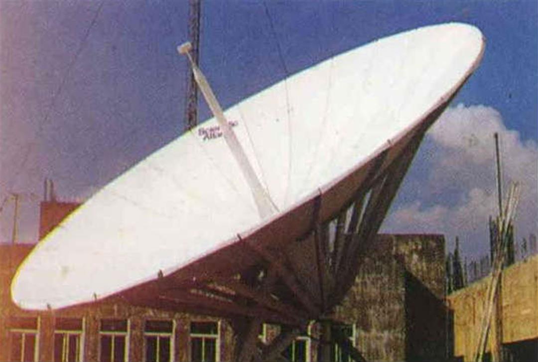
1. This antenna, about 16 feet in diameter, is used to receive signals from outer space. 2. This satellite tracking antenna serves the same function as the one in photo 1., but is situated high atop a 13-story tower. 3. An illustration of a weather satellite orbiting the earth. 4. This satellite orbits the earth in a path which takes it close to both poles, passing over Taiwan once every six hours. 5. In this picture, received at an earth tracking station, the white parts indicate swirls of wind.
1. An ocean-based meteorologic instrument. 2. President Chiang Ching-kuo discusses a weather report map with the head of the Central Weather Bureau. 3. Scientists work at a weather station in the ice and snow atop one of Jade Mountain's highest peaks, over two miles above sea level.
1. Information received from a satellite and fed through a computer is put on magnetic tape and then translated into visual images. 2. The weather map is used to explain climactic conditions to millions of TV viewers in Taiwan. 3. Pictures taken by satellites are analyzed by experts.
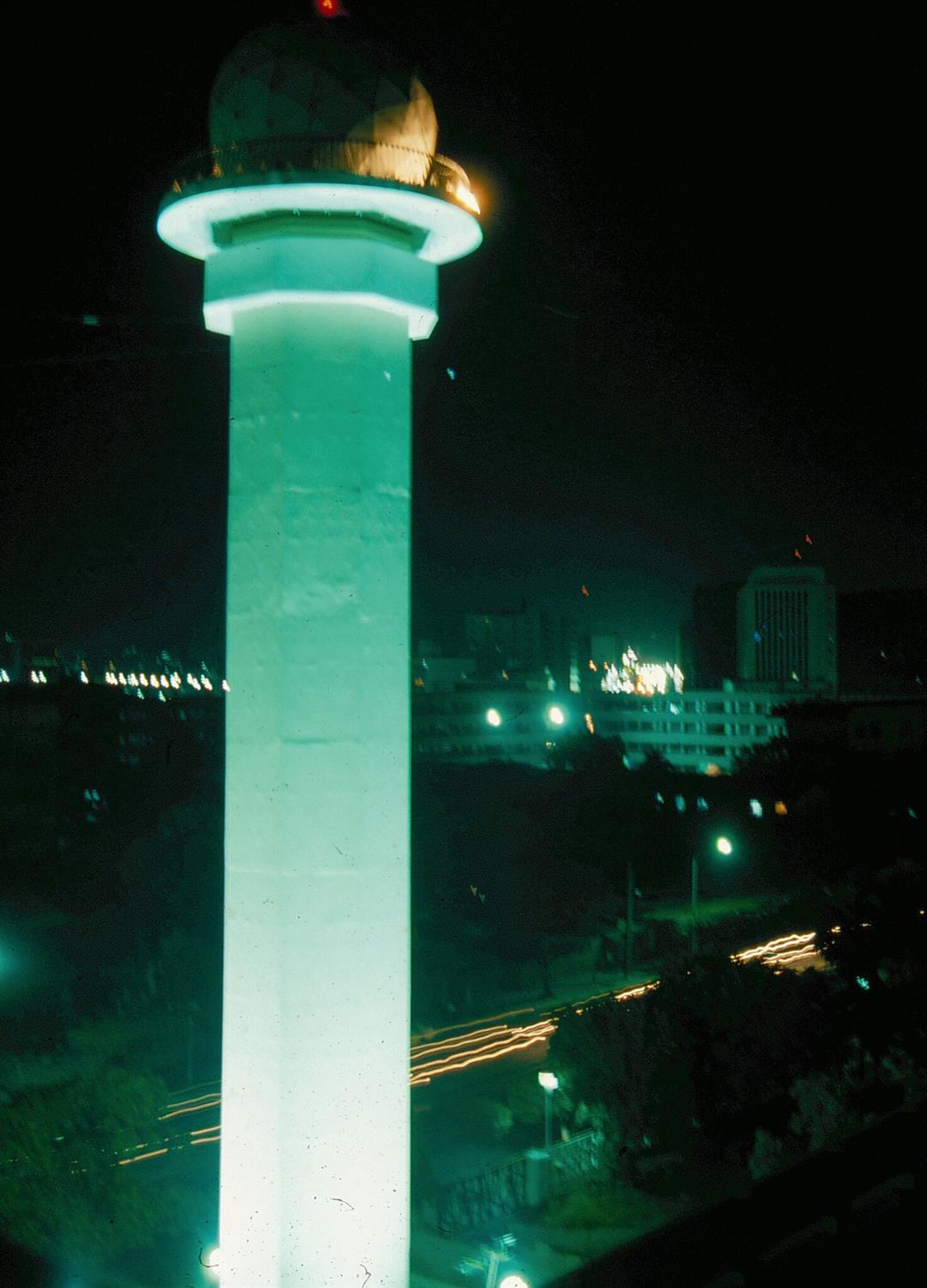
This satellite tracking antenna serves the same function as the one in photo 1., but is situated high atop a 13-story tower.

An illustration of a weather satellite orbiting the earth.
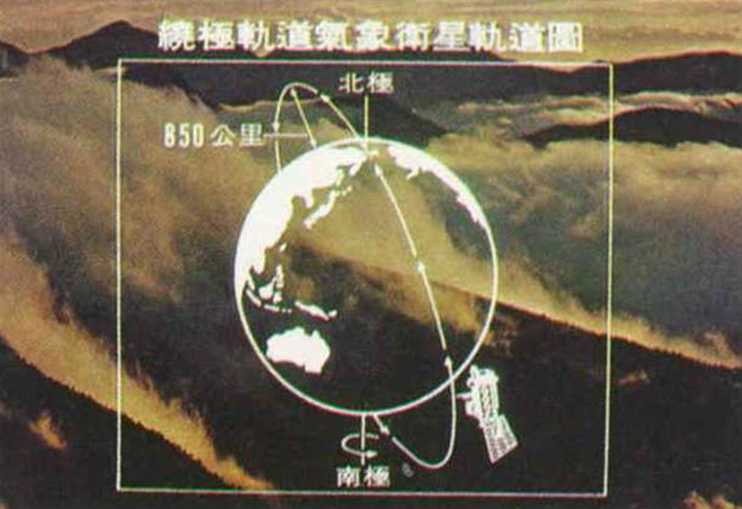
This satellite orbits the earth in a path which takes it close to both poles, passing over Taiwan once every six hours.
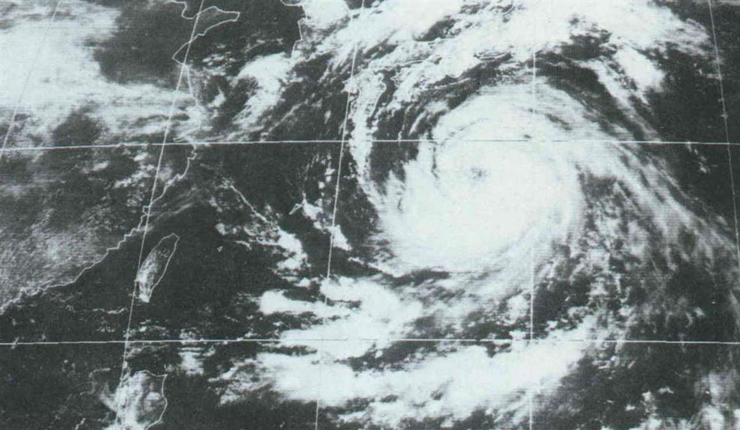
In this picture, received at an earth tracking station, the white parts indicate swirls of wind.
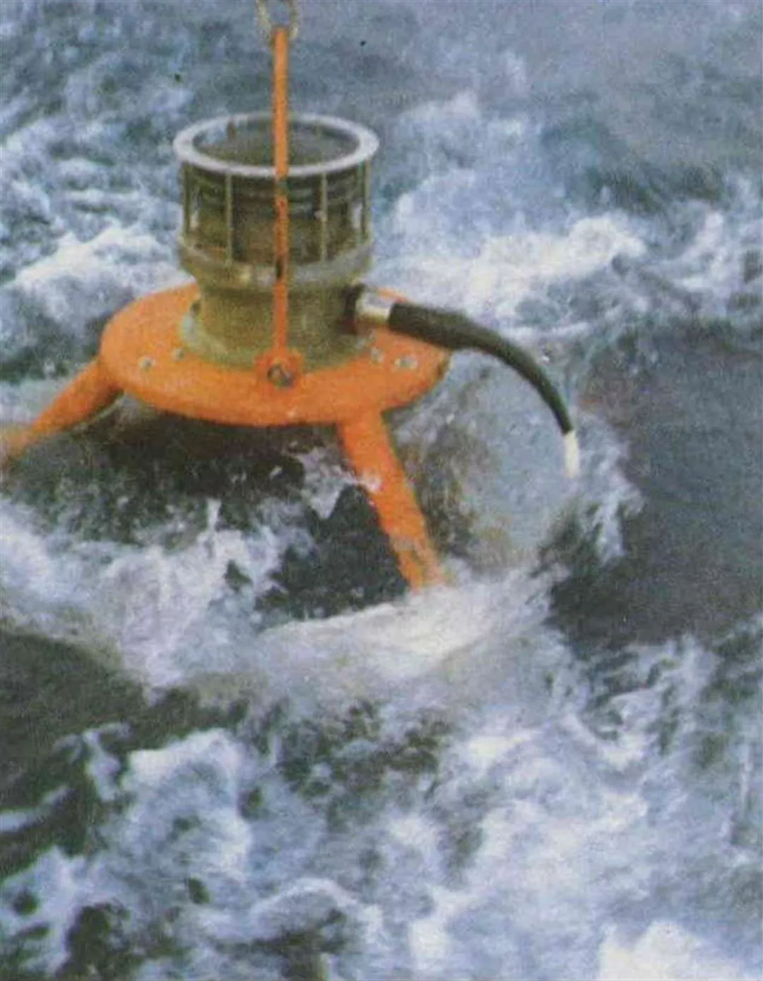
An ocean-based meteorologic instrument.
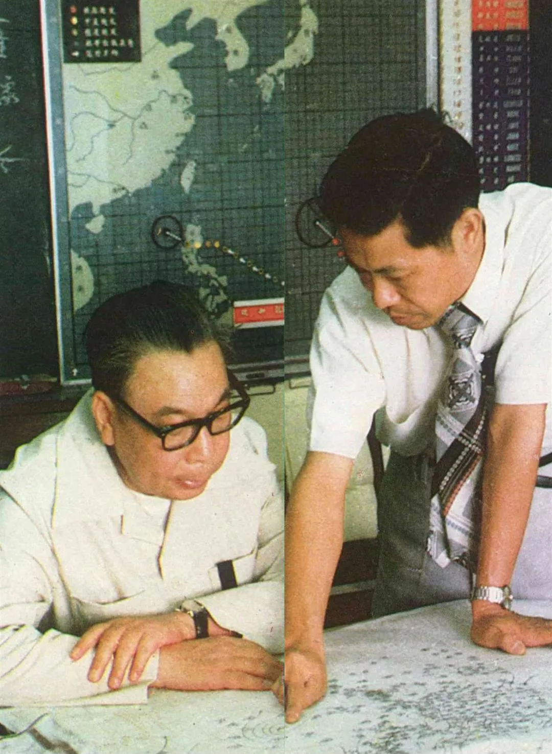
President Chiang Ching-kuo discusses a weather report map with the head of the Central Weather Bureau.
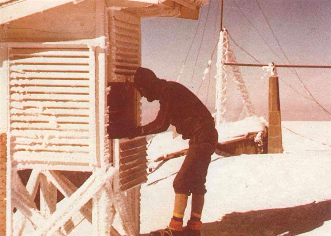
Scientists work at a weather station in the ice and snow atop one of Jade Mountain's highest peaks, over two miles above sea level.

Information received from a satellite and fed through a computer is put on magnetic tape and then translated into visual images.
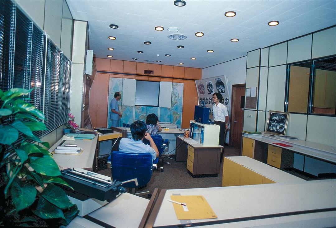
Pictures taken by satellites are analyzed by experts.
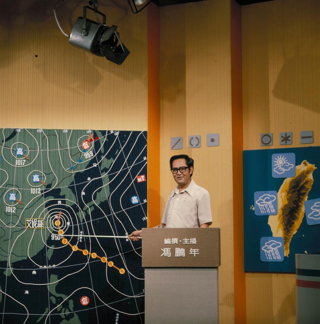
The weather map is used to explain climactic conditions to millions of TV viewers in Taiwan.