Orienteering--A Cunning Kind of Running
Kaya Huang / photos Chuang Kung-ju / tr. by Scott Williams
October 2006

The ubiquity of "football widows" during the World Cup season is a testament to soccer's incredible popularity. But now in Europe another sport is beginning to rival soccer--orienteering.
Orienteering originated in Norway, the homeland of the popular cartoon hero Vicky the Viking, but its popularity has spread far beyond its birthplace. In fact, it is slated to be among the official competitions in the 2009 World Games in Kaohsiung. Just what is it that makes the sport so appealing?
Swiss world champion Simone Niggli-Luder has said, "I really enjoy the feeling I get from orienteering. For me, running a flawless race in the fastest time... there's no pleasure on earth that can compare to it." The 28-year-old Niggli-Luder made her competitive debut in 1997, and she has been winning major international competitions ever since. The ten World Championship gold medals she won during one five-year period have earned her a legendary status within the sport.
"I found it! I found it!" shouts a Mr. Wang from beside the pond at the Chiang Kai-shek Memorial in Taipei. He hurriedly scribbles the code number of a control point onto the card he is carrying.
While fit competitors typically complete the CKS course in about ten minutes, Wang spent a full hour on the course before winning his competition. He and fellow members of the Eden Social Welfare Foundation are greatly enjoying the orienteering event in spite of their disabilities.

There is little text on an orienteering map. Instead, map-reading is made easier for competitors in the midst of a race by depict topographic features in six different colors. The map shown here was used in an international open competition held in Sweden in August.
Easy to learn
According to Emily Lien of the Culture and Education Section at the CKS Memorial, as long as you can walk you can orienteer. Age isn't an issue. Nor, for that matter, are physical disabilities, as long as wheelchairs and trails are available.
The term "orienteering" was coined in the late 19th century to describe a sport that was taking shape in the forests of Norway and Sweden. Transportation was a serious issue in the seemingly endless woods. Paths between villages were often not well established, and the very real possibility of becoming lost in unfamiliar terrain made travel dangerous. Scandinavians recognized that a good sense of direction could be crucial to their children's survival, and therefore trained them to orienteer.
What started as a survival skill transformed into a recreational pastime when Norway held the world's first orienteering competition in 1897. The sport later became popular in Britain, Canada and Australia, and is now also taught to Scouts in the US. Competitions are held regularly around the world using standardized rules developed by the sport's governing body, the International Orienteering Federation.
The IOF has 67 member nations, including Taiwan, and the sport has now made it to the Olympics, where events are being incorporated into the Winter Games.
Most people attribute orienteering's rapid growth to the ease with which novices can take it up. How simple is it? Competitors use a topographic map and a compass to make their way through an unfamiliar area, looking for control points that have been set up in advance. They record codes from the control points on a card, and try to complete the course in the shortest possible time. Courses are typically set up in forests, rural areas, city parks, and even on school campuses.
Competitors set out from a start point marked on the map with a triangle, and begin searching for control points, which are marked with circles and must be visited in sequence. At each control point, they write down its number plus a unique code on a control card provided by the organizers. After visiting all the control points, they turn in their maps and control cards. The competitor who has visited all the control points in the shortest time wins.

Competitors running orienteering courses use a compass and a map to help them make their way through a sequence of control points as quickly as possible. The competitor who completes the course in the shortest time wins.
Variations
One interesting aspect of orienteering is that there are so many variations on the basic theme. Cross-country and score orienteering are the most common variants at both international and more informal competitions.
Cross-country events involve finding in sequence each of the control points marked on a map. In score orienteering there are a great many control points (usually 30 or 40), each earning a different score depending on distance from the start point and how difficult they are to find. In this form, sequence doesn't matter; the competitor who scores the highest number of points within the time allotted wins.
Orienteering exercises the brain as well as the body--competitors must hone their sense of direction, learn to read a map, and develop good decision-making skills. Orienteering in the countryside is quite different from orienteering in a park. In a forest, a dip, a turn or even a stray fog may cause one to lose sight of the landmark one has been steering by, and one tree can look very much like another. Competitors may begin to panic as they go round in circles. If losing your way happens to coincide with some change in conditions such as a downpour or nightfall, it's important to be able to keep your cool and rely on your map and compass to find your location.

In Taiwan, spatial constraints have so far largely limited orienteering to urban parks. The photos show an event held in the Chiang Kai-shek Memorial's orienteering education area.
Teaching judgment
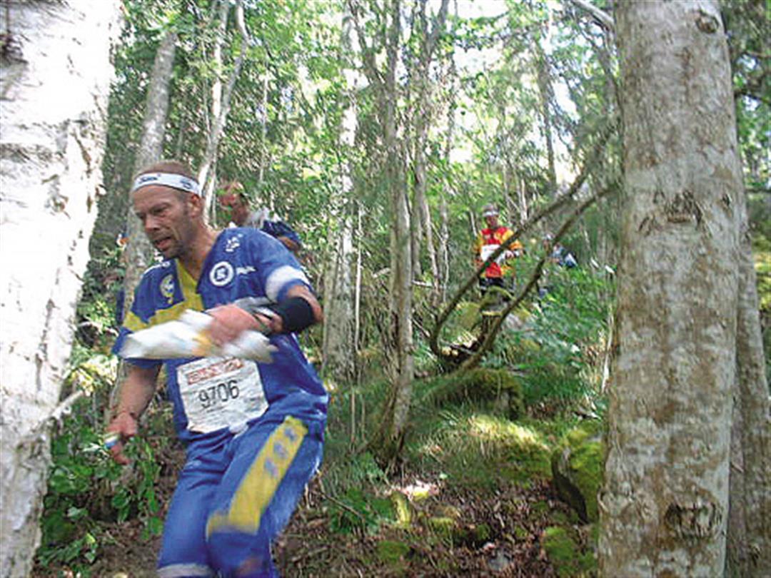
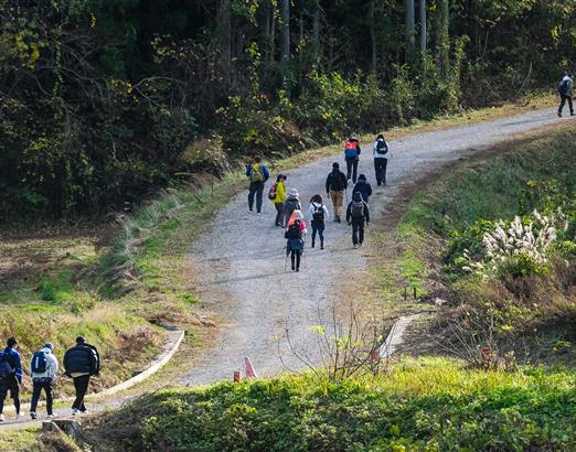
Victory often turns on a single factor: decision making. At international competitions, which can take upwards of an hour and cover more than ten kilometers, it is typically the competitor who makes the better decisions who wins.
"Competitors are thinking, 'Will the straight route get me there, or should I go around?'" says one of the coaches of the Taiwanese team that went to the World Championships in Denmark in August. "It's something you learn. In the end, winning depends on how you react and how well you make decisions."
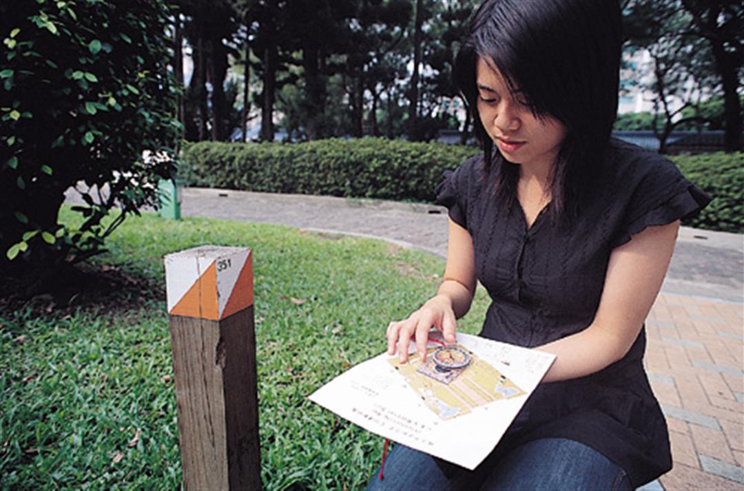
Taiwan's Chuang Pei-chi studied her map and compass in the midst of her race, and contemplated her next step. "Should I plow through the thick woods, or take the gentle slope beside them?" She ultimately elected to take the route around the woods, which was longer by 200 meters.
But wouldn't taking the longer route mean defeat? "There's a lot of variability in woodland," explains Chuang. "Running 200 meters up a slope is sometimes faster than trying to plow through dense forest."
Geographic limitations
According to Outdoor magazine, the number of orienteering enthusiasts in Scandinavia now surpasses that of the world's number-one sport--soccer. Sweden holds five major competitions every year with upwards of 15,000 people participating in each. One event actually drew more than 40,000. It seems nearly everyone in the country orienteers.
But in spite of its popularity in Europe, the sport remains relatively unknown in Taiwan. Given how few people participate and that only two organizations--the Chinese-Taipei Orienteering Association and the Chinese-Taipei Orienteering Federation--are so far promoting it, it's very clear that orienteering is barely a blip on the radar of Taiwan's sporting scene.
If the sport is to develop in Taiwan, it must overcome the constraints imposed by Taiwan's physical landscape. A good orienteering course requires at least one square kilometer of traversable land of variable topography. But it shouldn't be too steeply sloped or have too much vegetation. Few places in Taiwan meet these conditions. So far, only a bare dozen or so orienteering maps have been produced for all of Taiwan. Worse, many of these are for urban parks. There's no orienteering without maps, and Taiwan's lack of suitable maps is currently the biggest obstacle to the sport's development here.
The Chinese-Taipei Orienteering Association's Chuang Pei-chi admits that there are few orienteers in Taiwan and that her own organization has only 60 or so formal members (most of whom are mountaineers or middle- and long-distance runners). But she says that promotion of the sport in recent years has made growing numbers of people familiar with orienteering and notes that several of the island's physical education colleges now include it in their curriculum. Moreover, with orienteering slated to be among the competitions at the 2009 World Games in Kaohsiung, the government is going all out to promote the sport in Taiwan.
If you've ever lost your way in the countryside or have trouble remembering which exit to take from the metro station, you've certainly asked yourself, "Where am I?" Most people aren't born with a great sense of direction, and it's very easy to panic when you don't know where you are. Fortunately, you can train your directional sense, and orienteering can be a great first step.
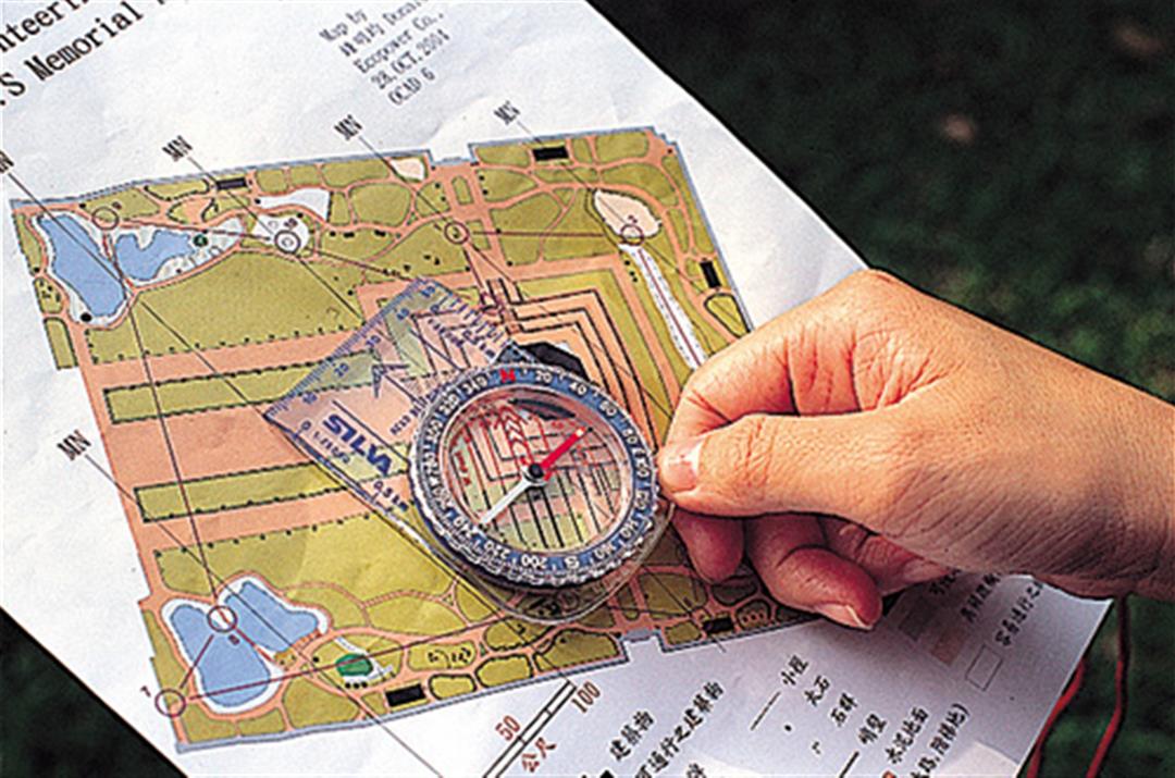
Orienteering maps do not name the specific geographic features they depict. In fact, map text is usually limited to the map's name, the name of the competition or its sponsor, and the legend. Instead of texts, the maps use a system of seven colors to denote topographic features. The International Orienteering Federation's standards for the use of color are as follows:
Brown:Landforms.
Black:Rocks and boulders; types distinguished by different symbols.
Blue:Water.
Yellow:Open land; the lighter the yellow, the more open the land.
Green:Forests and undergrowth; the lighter the green, the more passable the forest.
White: Easily traversable forest.
Purple:Course symbols.
Chinese-Taipei Orienteering Association
Website: www.orienteering.org.tw
Tel: (02) 8771-1444; (02) 8772-4715
Chinese-Taipei Orienteering Federation
Website: www.ctof.org.tw
Tel: (02) 8787-0296; (02) 3765-1700