An old map craze
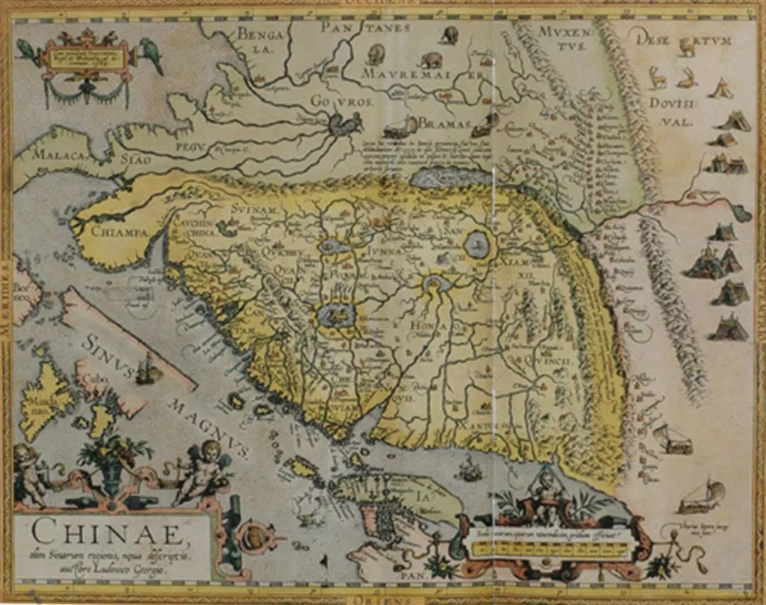
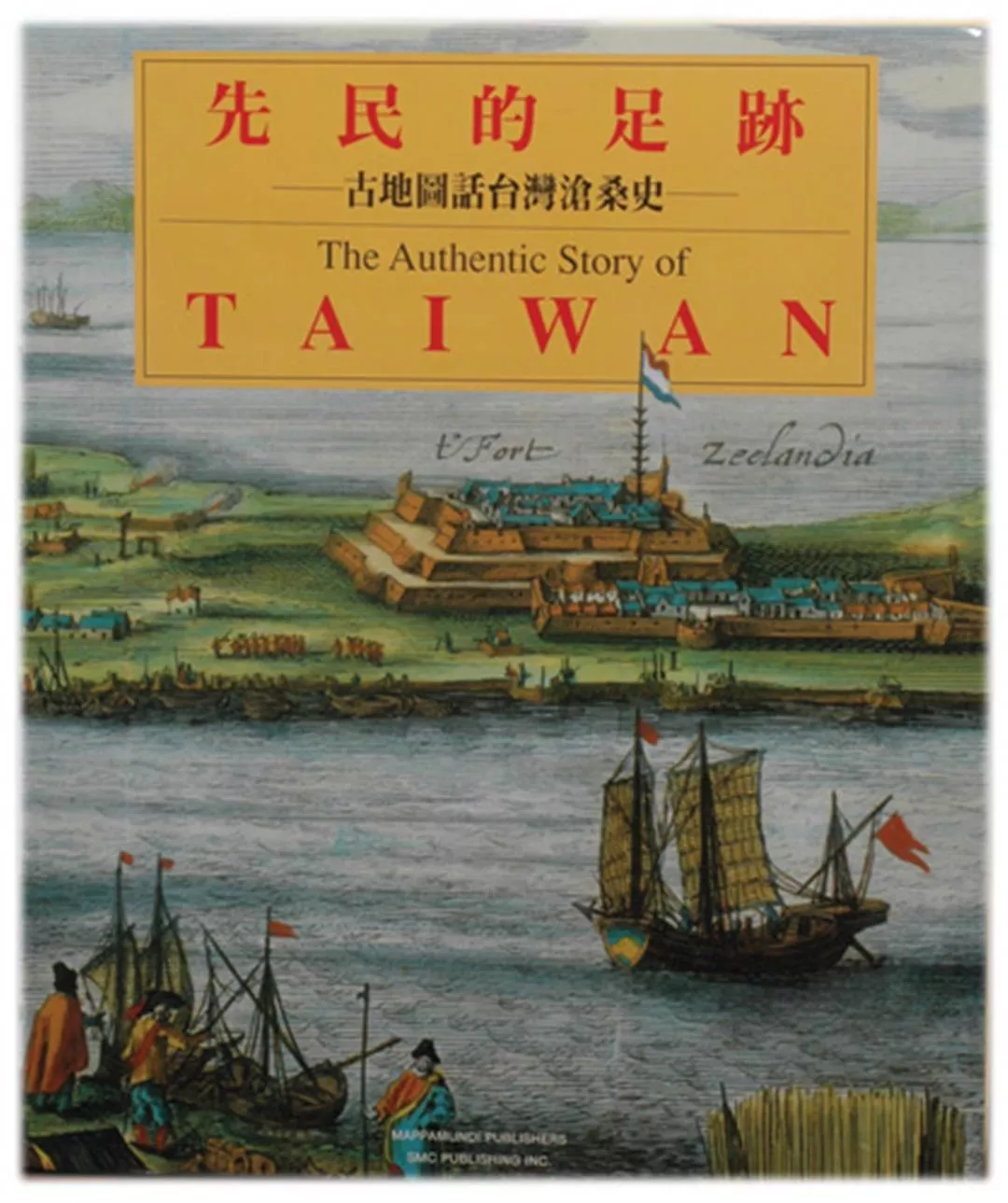
In 1991 SMC jointly published with a Belgian publisher The Authentic Story of Taiwan. The book included 80 maps made by Europeans between the 16th and 18th centuries. Moving from a wide angle and narrowing in--from the world, to Asia and then the island of Formosa off the southeast coast of China, the outlines of the island are brought into sharp focus. The book is bilingual, in Chinese and English, and is accompanied by commentary and explanations by Taiwan historians Wu Mi-cha and Hsu Hsueh-chi.
This magnificent pioneering publication, so long in preparation, completed in the face of many difficulties and the result of such highly focused effort was responsible for Wei Te-wen winning in 1999 the first Taiwan Archive Association Award for Outstanding Documentary Publication. He was also honored as a "Cultural volunteer who continues to devote his efforts to the collection of Taiwan documents, their editing, publishing and promotion." In 2004 Wei Te-wen also received a Golden Tripod for lifetime achievement.
In recent years Wei Te-wen has been invited to organize a variety of exhibitions. These have included the Taipei City Government's Urban Portraits and Through Space and Time--120th Anniversary of the City of Taipei, the Council for Cultural Affairs' exhibit Formose sous le regard des Europeens, held at a cultural center in Paris, France, and 400 Years of Yangmingshan, held in Yangmingshan National Park.
Many people are curious about just how many old maps of Asia or Taiwan there are in Western collections. According to Wei, more than a thousand years ago the Arabs introduced the spices of Southeast Asia to Europe and sold them at very high prices. It was even said that a grain of pepper was worth its weight in gold. Given this, the Europeans decided to go get the spices themselves. Subsequently, in the 13th century, came the visit to China of Marco Polo via the Silk Road. His travelogue talked about gold being used in the building of magnificent royal Chinese palaces and this filled Westerners with an insatiable yearning to travel to the East.
Wei Te-wen conservatively estimates that there are several thousand maps of Asia made by Europeans. About 40% of them were done in the 16th and 17th century in European countries for colonialism and trade. Maps from the 19th century done by zoologists, botanists and mining engineers surveying for resources account for another 40%. "The smallest number are from the 18th century because at that time China shut itself off from the outside. You can thus see that the making and existence of maps has always been intimately tied in with the international situation."
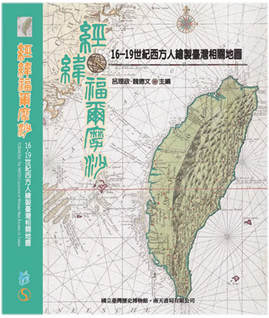
In March 2006 SMC and the planning bureau of the National Museum of Taiwan History published Formosa, The NMTH Collection of Western Maps Relating to Taiwan, 1600-1900. The book includes 207 old maps of Taiwan that will be the pride of the collection of the NMTH when it opens in Tainan in 2008.
The book analyzes the historical background, printing methods, and authentication techniques of the old maps as well as the NMTH's strategy for collecting maps. It leads us to understand how Western sailors first saw Taiwan from afar, depicted it as "a group of islands" and then accurately as "one island" as well as the process of expansion from the western shore to the eastern part of the island. It is a beginner's reference book to old maps.
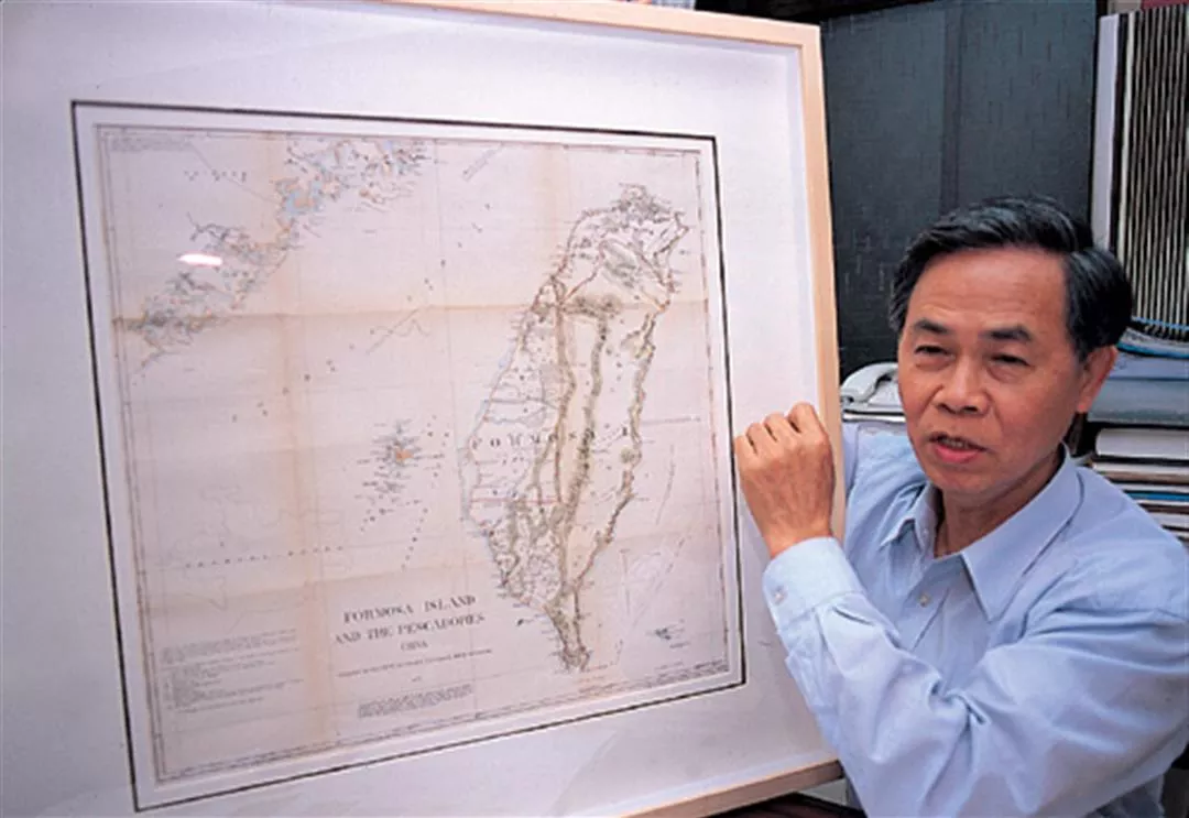
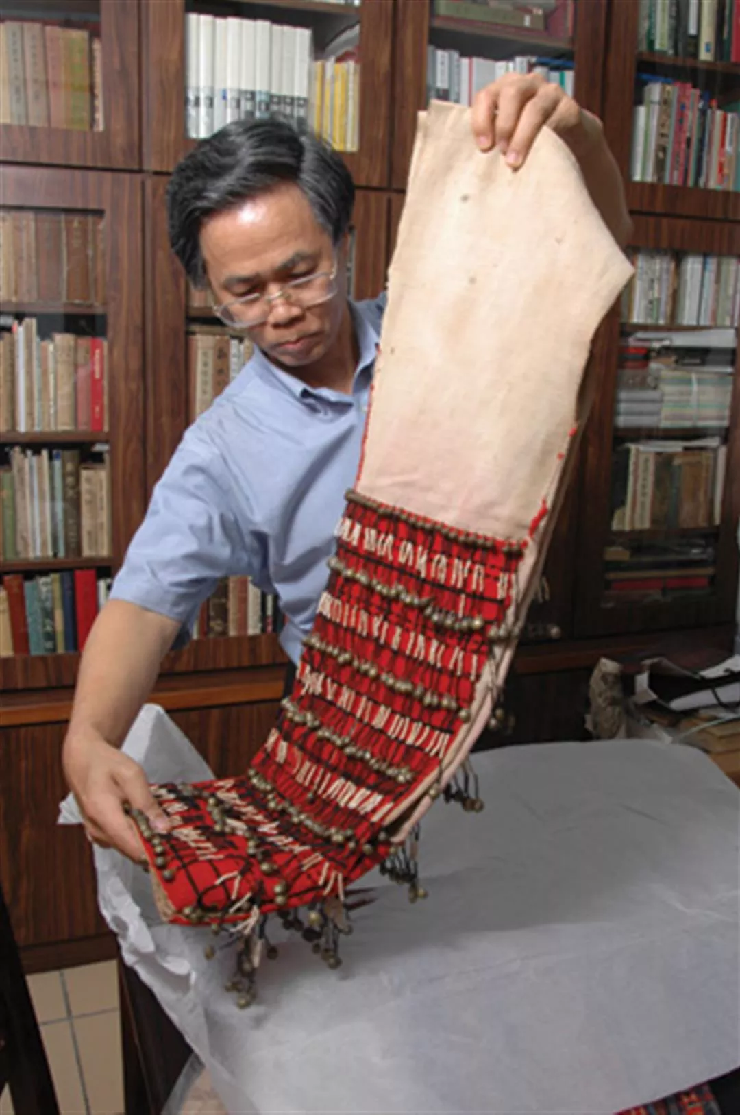
Wei Te-wen, seized by his unwillingness to just let lie old Taiwan maps wherever they might be scattered throughout the globe, frequently spares no expense and brooks no difficulty to go out and collect them. The Authentic Story of Taiwan and Formosa, The NMTH Collection of Western Maps Relating to Taiwan, 1600-1900 are premier reference books for the study of old Taiwan maps.
@List.jpg?w=522&h=410&mode=crop&format=webp&quality=80)
@List.jpg?w=522&h=410&mode=crop&format=webp&quality=80)


@List.jpg?w=522&h=410&mode=crop&format=webp&quality=80)