Data integration
Whenever a typhoon is predicted to affect Taiwan, the NCDR quickly releases an assessment of its potential impact and suggested responses. Chen is often invited to go abroad in connection with his expertise, and these trips have left him with the sense that Taiwan enjoys some of the fastest responses in the world. When the Central Emergency Operations Center (CEOC) is activated, the NCDR’s Disaster Information Service Platform provides real-time monitoring and forecasting data from around Taiwan, which enables warnings to be issued and resources deployed in a timely manner.
The NCDR has assembled a staff of experts in various fields with the mission of providing advice on disaster preparedness, response and recovery work. In normal times, they conduct research on disaster preparedness, disaster mitigation technology and other matters. They identify locations that are likely to be severely impacted by natural disasters and draw up preparedness and response plans in advance. These plans enable agencies to respond calmly and with confidence when disasters do occur.
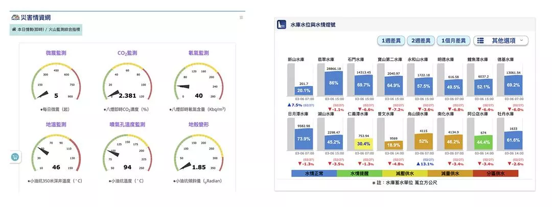
Through the Disaster Information Service Platform, the NCDR provides monitoring data gathered by various government agencies, including the Construction and Planning Agency of the Ministry of the Interior, the Central Weather Bureau and Directorate General of Highways of the Ministry of Transportation and Communications, the Water Resources Agency of the Ministry of Economic Affairs, and the Soil and Water Conservation Bureau of the Council of Agriculture. “We integrate data from various government sources, adding value with visualizations to supply the CEOC with up-to-date data on weather, water, and soil conditions nationwide.”
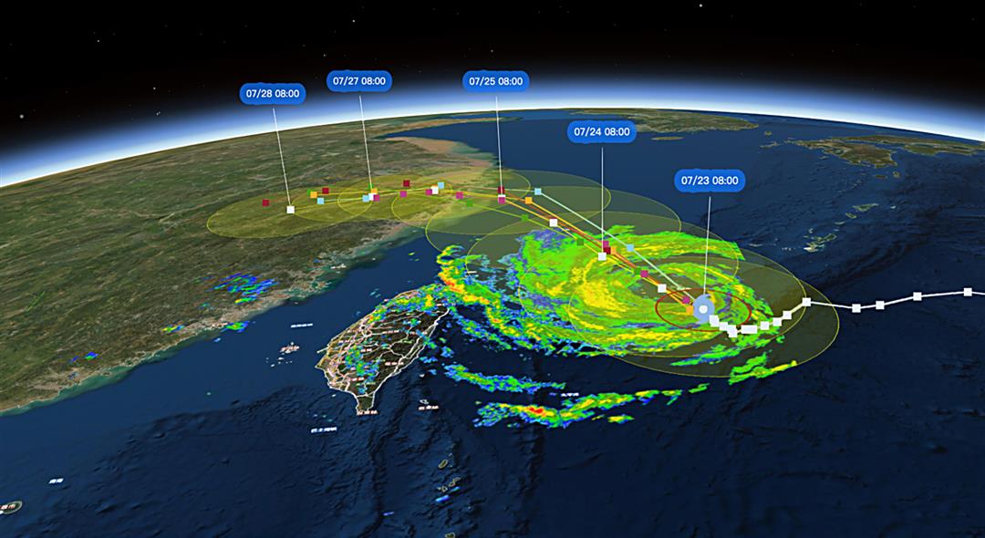
The platform also analyzes data from satellites, such as Taiwan’s own Formasat-7 and the Japan Meteorological Agency’s Himawari 8, as well as those of the European Union’s Copernicus program and the US National Oceanic and Atmospheric Administration. Demonstrating just how much information the network provides, Chen shows a Powerpoint slide detailing how the network had collected typhoon track forecasting data from at least five different nations before Typhoon Nissa made landfall in 2017. These revealed potential paths spread across a corridor 150 kilometers wide. “Before it landed, we had prepared forecasts predicting which counties and cities would be impacted by Nissa depending if it veered east or west. And we got this information to local governments as soon as possible, allowing them to start making preparations in good time.”
The NCDR also puts social media to good use for disaster response. With the growth of social media and big data, the center has developed social media intelligence platforms to gather information about disasters. Leveraging data mining, it collects information shared by the general public, lessening the time required to create situation reports and enabling rapid adjustments to the deployment of rescue and relief personnel.
In addition to regular warnings about earthquakes and destructive winds, other information affecting people’s everyday lives—including data about air quality, rainfall, reservoir levels, potential volcanic hazards, and low temperature warnings—all feature in themed maps on the platform.

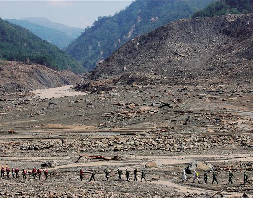
When responding to disasters, every second counts. The NCDR has been proactive in providing rapid analysis and timely warnings and advice, enabling resources to be deployed as early as possible. (courtesy of NCDR)
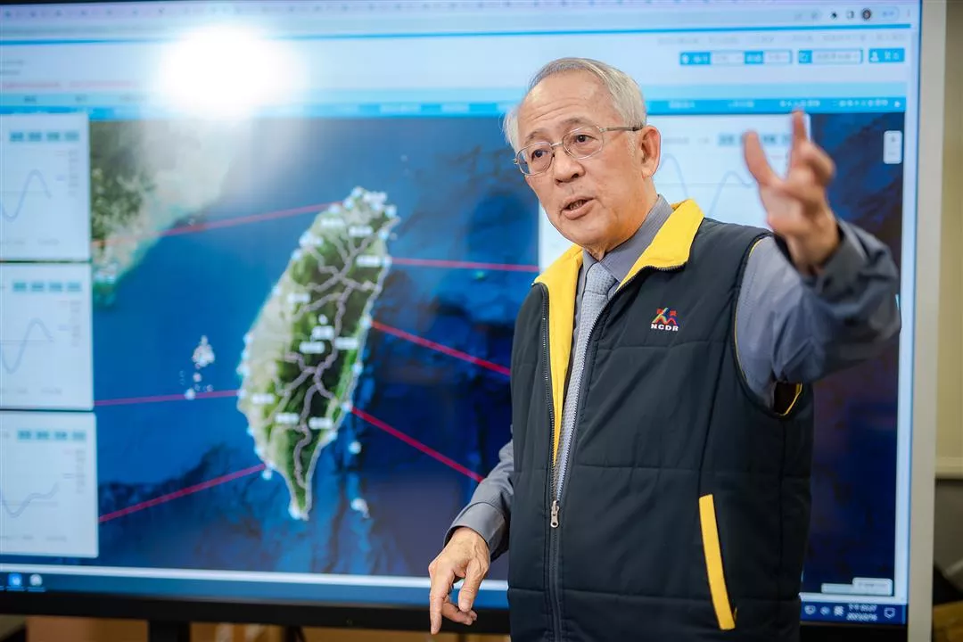
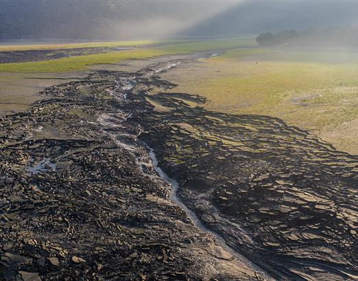
The NCDR focuses on integrating the monitoring data it collects from various sources and delivering it to central and local government agencies. By openly sharing this information, it helps raise public awareness of disaster preparedness. (courtesy of NCDR)


@List.jpg?w=522&h=410&mode=crop&format=webp&quality=80)