Taipei’s Mountain Trails: A Hiker’s Paradise
Yang Ling-yuan / photos Chuang Kung-ju / tr. by Chris Nelson
December 2014
001.jpg?w=1080&mode=crop&format=webp&quality=80)
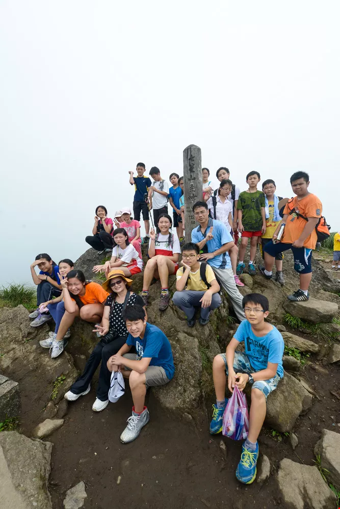
Each weekend, early in the morning, hordes of people with packs on their backs and hats on their heads flood onto the Xinyi Line of the Taipei MRT headed toward Xiangshan Station. But they’re neither groupies nor demonstrators; instead, they’re hikers on the way to hit the trails of Elephant Mountain! But Elephant Mountain isn’t the only option for hikers. Within Taipei proper there are 20 trails suitable for family hiking, ten for getting a good workout, and five that are truly strenuous. It is indeed a hiker’s paradise!
Last February, the website BuzzFeed published the article “26 Remarkable Places for Solo Travel,” placing Taipei at the top, ahead of cities like Toronto and Bangkok. The reason Taipei fared so well, besides its night-market food and numerous amazing sights, is its access to mountain wilderness. It’s easy to find secluded forests and valleys where you can escape the commotion of the workaday world.
Hiking in the mountains and communing with nature help broaden minds and change moods. Ready? Let’s hike!
Hiking is really easy in Taipei, because the city sits in a basin surrounded by mountains on three sides. These mountains include five major ranges—the Datun, Qixing, Wuzhi, Nangang, and Erge ranges. Taipei is one of the few cities in the world with such a rich natural environment. These ranges contain around 130 well-maintained trails (totaling over 100 kilometers), each one a popular hiking route.
In terms of convenience, 13 mountain trails lie within easy access of MRT stations. The Guandu, Mt. Zhongyi, Guizikeng, Mt. Zhongzheng, Junjianyan, and Mt. Jiantan trails can be reached by the Beitou Line; the Mt. Bailusi, Mt. Mingju, Mt. Kangle, Zhinan Temple–Maokong, Xianjiyan and Zhinan Tea Pickers’ trails by the Wenhu Line; the Lishan Bridge trail by the Bannan Line; and the Tiger Mountain and Elephant Mountain trails by the Xinyi Line.
As for difficulty, Mt. Nangang offers five climbing trails that are among Taipei’s most thrilling hiking routes, drawing numerous hikers wishing to test their courage. The Nangang District Hiking Trail is not difficult to walk on, being paved with granite steps. But there are shortcuts to the ridge on several extremely steep precipices where people have fastened ropes; here you can test your mettle. These cliff ropes linking the trails are numbered one through five by hikers, and at four to five stories high on an almost vertical incline, No. 2 is the hardest of all, requiring plenty of effort to scale. No. 4, however, is only 60 degrees steep, making for an easier climb, suitable for budding mountaineers wishing to use their hands and feet.
Surprisingly rich in natural settings, the Taipei Basin is surrounded by low mountains, most of which are suitable for hiking. After just 30 minutes of hiking, commanding views of the greater Taipei area will unfold before your eyes.
In its effort to promote the Healthy City initiative, the Taipei City Government has worked hard to improve the city’s hiking trails, providing better access to public transportation and installing clear signage to the trailheads.
“I like hiking around Elephant Mountain. It’s an easy hike—just 183 meters high—and it doesn’t take much more than an hour to reach the peak, where there’s a beautiful view of the city,” says avid hiker Zhang Lizhu. “To get to the Elephant Mountain trailhead from home, I used to take two buses and then walk a ways before getting there. Now it’s just a few minutes’ walk from Xiangshan Station, and outside the station there are clear signs pointing the way.”
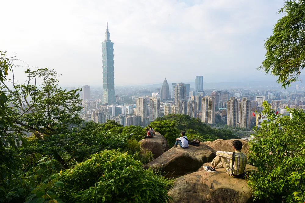
Elephant Mountain is close to Tiger Mountain, Lion Mountain and Leopard Mountain, and together they are called Sishou (“four beasts”). Many trails lead from one to the next. The peak of Elephant Mountain is the highest point on the Sishou Hiking Trail, and most hikers stop here for a break. The panoramic vista at the peak is breathtaking, affording classic views of Taipei 101 and the Xinyi Business District. After sunset, the nightscape is even more enchanting, with twinkling street lights and steady streams of car lights attesting to the city’s nocturnal activity. This is a favorite spot for photography buffs to capture nightscapes and the fireworks of New Year’s Eve.
Known as Taipei’s backyard, Yangmingshan offers copious hiking trails: Mt. Qixing Trail, Tianmu Old Trail, and the trails of Qingtiangang are prime examples. If you want, it’s a pleasure to hike just a small section of these.
Of these numerous trails, Jinbaoli Trail stands out. Also known as the northern section of the Yulu Historic Trail, it was once a main route linking Jinshan and Shilin. Back then, not only was it a path for conveying seafood, tealeaves, sulfur and cattle; if a Shilin resident wished to marry someone from Jinshan, they would also have to traverse this road.
Rich with cultural and historical relics, the Jinbaoli Trail is built with natural stone blocks. The landscape along the way is rich and varied, with terraced grasslands, Earth God shrines, houses and bridges of stone, streams, waterfalls, and ruins of cowsheds, city gates and homesteads. You’ll feel as if you’ve gone back in time.
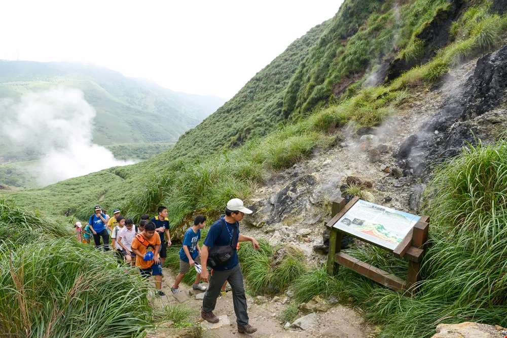
The old trail isn’t long. If you want, you can keep heading to the Tiaoliu Historic Trail, an old sulfur porters’ route. This is part of Mt. Dahuangzui, a peculiar area with fumaroles, outcrops, and a yellow-tinged sulfurous geological landscape. Not far from here is Dayoukeng, a well-known Yangmingshan landform enshrouded in coiling white mists, inducing fanciful thoughts. Many people come in the autumn, when the silvergrass is tinged red by the sulfurous fumes. There’s something special about walking among the red silvergrass.
001.jpg?w=1080&mode=crop&format=webp&quality=80)
Of the mountains that encircle Taipei, Yangmingshan remains the favorite with its varied geological features and ample public amenities. It offers old trails shrouded in sulfurous mists, and old bridges steeped in history.
The strenuous Mt. Zhongzheng Hiking Trail, paved to the top with steep stone steps, is a good place for experienced hikers to get a workout. Located in Beitou, the trail is part of Yangmingshan National Park, and along the way you get commanding views of the Beitou cityscape and the Keelung River. Now and then, swallowtails flutter along with you, making this trail a favorite of many hikers.
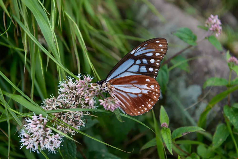
Li Youqing, who often goes there to work out, treats the stone steps as exercise equipment. But when climbing the stairs, he has little time to take in the flowers and foliage of the well-vegetated wilderness or to stop and observe the more than 100 butterfly species, a quarter of all such species in Taiwan, that can be found here. Thankfully, there are a number of open spaces en route where you can stop and take a breather, and gaze at views of downtown Taipei and the Keelung River. At the top, there’s a rather narrow viewing platform where you can get a clear view of Mt. Qixing and Mt. Shamao. Beitou’s renowned Longfeng Valley, at the base of the mountain, is also clearly visible. Look a bit farther and you can see the Keelung River snaking toward the Tamsui River, backed by Mt. Guanyin. This captivating scene of mountains and rivers inspires carefree and relaxed feelings.
The pace eases up considerably on the way down, and the scenery changes a lot. On the way you can see the distinctive blue roofs of the Beitou MRT maintenance depot, the multicolored Beitou incinerator stack, the expansive Guandu Plain, and Mt. Guanyin in the background. On the last section of the descent you can also follow a bamboo forest trail and walk a stretch of access road for a different mountain path experience.
Of the mountains that encircle Taipei, Yangmingshan remains the favorite with its varied geological features and ample public amenities. It offers old trails shrouded in sulfurous mists, and old bridges steeped in history.
Taipei’s unique Huangxi Hot Spring Hiking Trail is hidden within a sulfurous wilderness. This trail used to be a simple path by the side of a stream, but now that it’s been refurbished, it’s a trail where you can exercise, soak in a hot spring, and enjoy its literary air. Built alongside an irrigation channel, the trail is paved with concrete and is an easy hike. Walking along it, you’ll hear a pleasing murmuring of water now and then, and the green canopy of vegetation makes it comfortable and pleasant. Plaques mounted on the wall beside the trail bear the words of poems and songs praising Beitou hot springs over the years: the earliest poem was penned by Yu Yonghe over 300 years ago. Other works include those of Qing and Japanese era literati Hong Yinan, Liang Qichao, and Gengo Hirata (founder of Tengu Cabin, Beitou’s first hot spring hotel), as well as a piece by modern poet Cheng Chou-yu and the lyrics of the old Taiwanese song “Guitar of the Hot Springs Village,” as sung by Kuo Chin-fa.
The second section of the trail features interpretive signs introducing the history of Mt. Shamao and the Beitou hot springs, as well as general facts about hot springs. At the end of the trail there’s a stretch of elevated boardwalk you can walk along. This is the Huangxi Mountain Hot Spring Outcrops Boardwalk. On the way there are four viewing platforms where you can view an otherworldly geological landscape of sulfur fumarole outcrops and oddly shaped crags, and experience the peculiar sulfur-laden atmosphere of this hot spring village.
Taiwan is 70% mountainous, with over 200 peaks over 3,000 meters high, making it an ideal hiking paradise. And beyond the easily accessible mountains that encircle the Taipei Basin, there are over 160 trails rich with natural landscapes in neighboring New Taipei City that are well worth exploring. If Taipei’s 130 trails aren’t enough, you can try the trails of New Taipei City and enjoy more hiking delights!

@List.jpg?w=522&h=410&mode=crop&format=webp&quality=80)

@List.jpg?w=522&h=410&mode=crop&format=webp&quality=80)


