Shake, Rattle. . .and Roll out the Mountains
Chang Chin-ju / photos Hsueh Chi-kuang / tr. by David Mayer
November 1999

A month after the September 21 Chichi earthquake many people are still feeling the psychological strains caused by the rumble, but the fact remains that Taiwan has been rocked regularly by earthquakes since the moment of its creation. It is said that in eastern Taiwan there is a small earthquake every three days and a big one every five. Earthquakes too small to be felt are recorded almost every day by the Central Weather Bureau.
These earthquakes happen because two tectonic plates-the Philippine Sea plate and the Eurasian plate-have been pushing against each other for the past six million years, sending powerful vibrations barreling through the earth's crust from time to time. It is these earthquakes which have thrust Taiwan's four big mountain ranges from the ocean floor to heights of 4,000 meters above sea level. These mountains have been weathering ever since, with rivers slowly carrying sediment to lower elevations and building up the fertile plains on which we live today. Taiwan had pretty much taken its current shape by two million years ago, thus setting the stage for habitation by living beings and the eventual arrival of man, who in his time on the island has left behind many a tale of weal and woe.
Through it all, earthquakes have continued to rock the island, bringing repeated disasters that have been duly noted in historical records. Earthquakes are a part of life in Taiwan. There is nothing we can do to keep them from occurring. After an earthquake hits, the government must identify active faults and carry out zoning work to specify areas that are too dangerous to build in. Members of the general public, for their part, must try to settle their jangled nerves, rebuild their communities, and learn more about disaster preparedness. To do these things, we must first understand something about the geology of Taiwan. Only by learning more about our island will we be able to live in harmony with our natural surroundings and come to terms with earthquakes.
Looking back over the vast reaches of geological time, it is clear that earthquakes are what gave birth to the island of Taiwan.
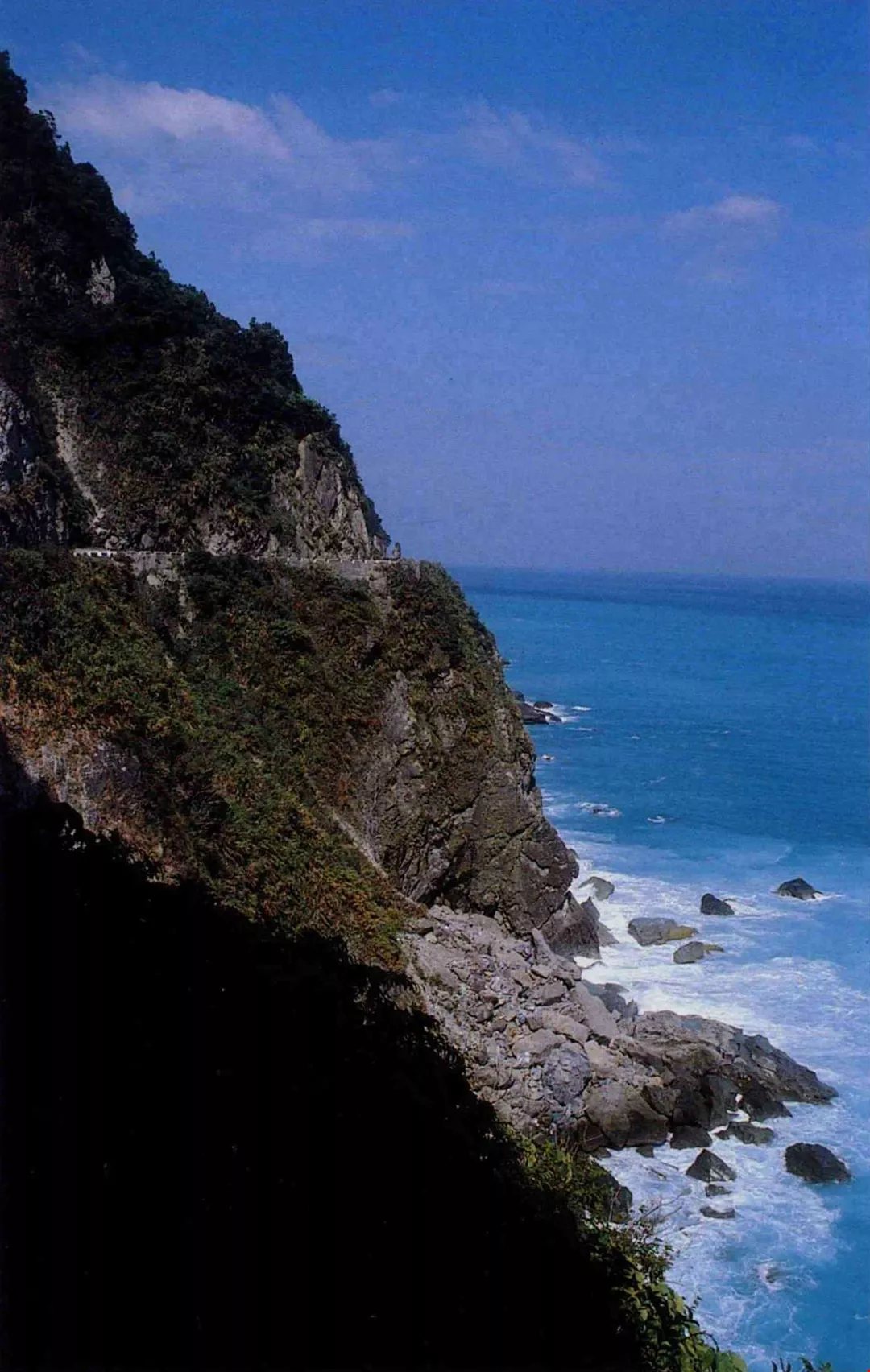
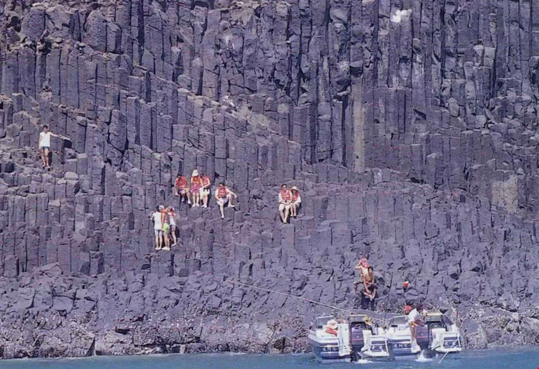
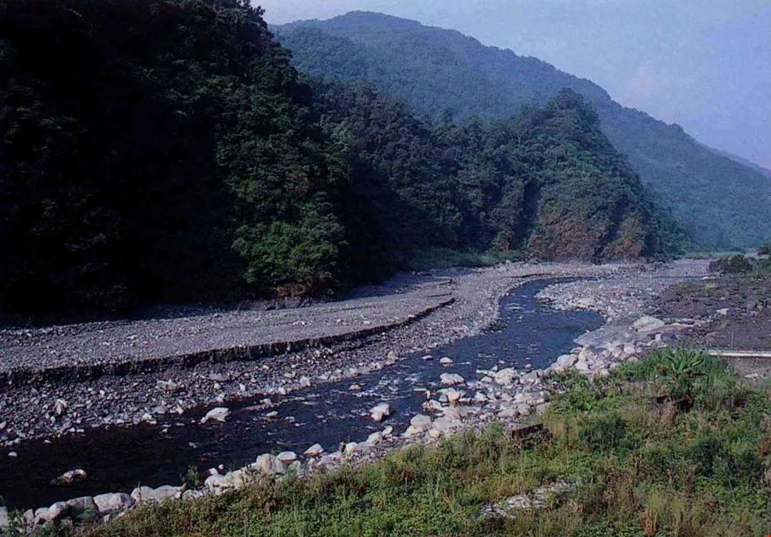
Powerful mountain-forming processes forged the metamorphic rock of Taroko Gorge. The ancient marble here plunges dramatically into the pounding surf.
Geologist's dream
Taroko National Park is located in Hualien County on the eastern tip of the huge Central Mountain Range. Besides being the most famous tourist attraction in all of Taiwan, it is also a paradise for geologists from around the world. After passing through the Chinma Tunnel on the Central Cross-island Highway, one comes upon the world-famous Taroko Gorge. To the trained eye, the geological history of the island is written in bold letters on the precipitous slopes here.
It was here that Yen Tsang-po, who has long been a leading light among Taiwanese geologists, discovered sedimentary rock dating back 200 million years, the oldest ever found in Taiwan. An analysis of what he found tells us the basic story of Taiwan's formation. For untold eons, what is now Taiwan lay upon the ocean floor collecting sediment that had been washed out to sea from the Asian mainland. At the ocean bottom it would still be today but for the fact that six million years ago the Philippine plate, which had long been moving northwest across the Pacific Ocean, slammed into the Eurasian plate, the largest tectonic plate on earth. The submerged rock at the edge of the Eurasian plate was thrust upward, forming Taiwan's Central Mountain Range.
The process of mountain formation in Taiwan was never more violent than immediately after the collision between the two tectonic plates. Mountains rose high and fast. Sedimentary rock buried as much as ten kilometers deep buckled at first before further compression sent it deep into the earth's crust, where a combination of high temperature and pressure turned it into metamorphic rock. It was then thrust upward to become the Central Mountain Range.
One type of metamorphic rock familiar to us all is marble, a mainstay of the local economy in Hualien County today. Sculpture exhibits attract many tourists to the area every year, and artists from around the world choose to work here.
The ancient marble of the Taroko Gorge once plunged directly into the sea, which pounded out the spectacular escarpment found today on Mount Chingshui. The mountain towers to a height of 2,167 meters less than ten kilometers from the coast. When 16th-century Portuguese sailors dubbed Taiwan ilha formosa (beautiful island), they were sailing along the northeast coast gazing at this very mountain.
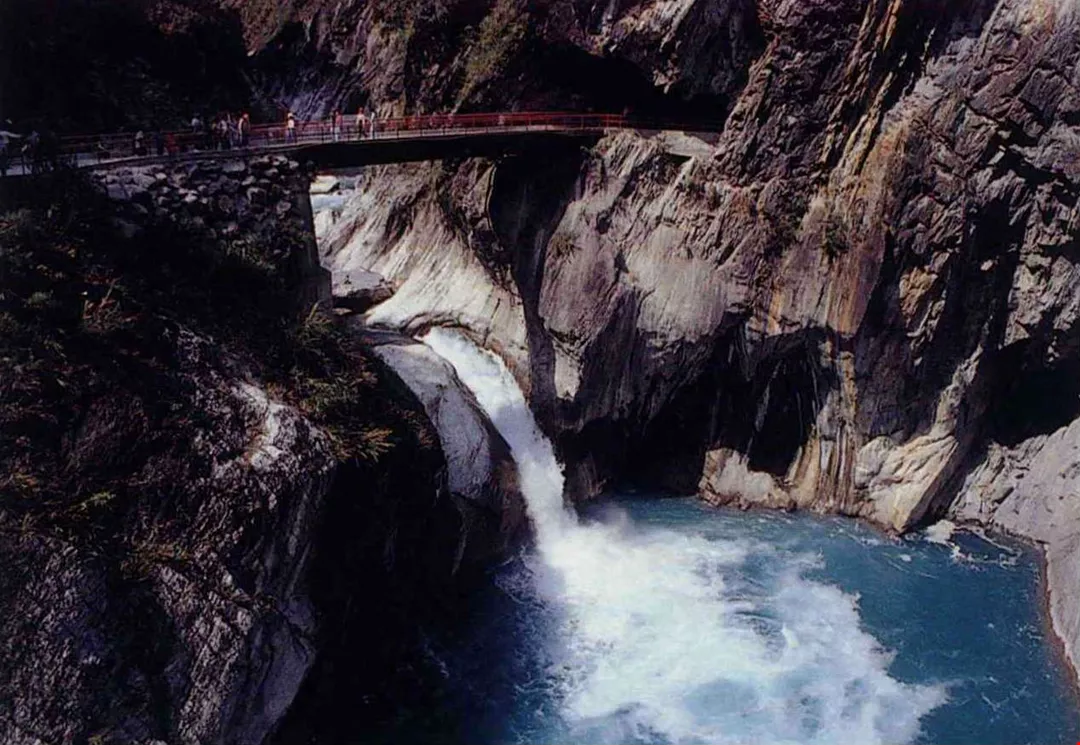
400 years after the first arrival of Han Chinese, how many of Taiwan's 151 rivers continue to run as clear as the Taroko River? (photo by Diago Chiu)
Straddling the plates
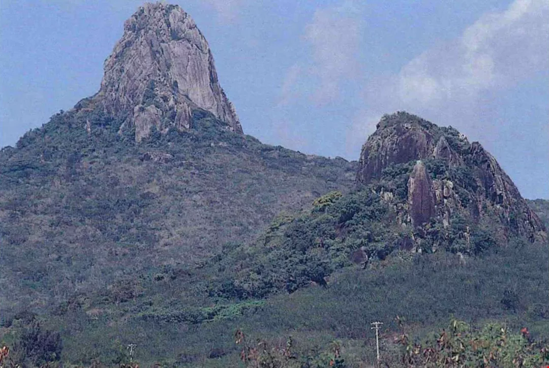
Just three kilometers to the east of Taroko Gorge lies the northern tip of the East Longitudinal Valley. Following the valley south, some 50 kilometers distant you reach the northern tip of the East Coastal Range. A mere two million years old, this mountain range is a geological youngster in comparison with the gorge. The delicate beauty of the scenery here, especially in such areas as Sanhsientai and Pahsientung, contrasts sharply with the rough grandeur of Taroko Gorge.
It isn't just the many different ethnic groups on Taiwan who arrived here at different times. Different chunks of the island itself were thrust up from the ocean floor millions of years apart from each other. The young mountain range along the east coast is a "new arrival."
The story of the island's formation involves more than just a collision between two tectonic plates. At the same time that the Philippine plate was ramming into the Eurasian plate, its westward movement also brought it into collision with the South China Sea plate further south. The Philippine plate was subducted beneath the South China Sea plate, and at high pressure and temperatures became magma which then burst to the surface in a string of volcanoes. The East Coastal Range, Orchid Island, Green Island, the Batan Islands, the Babuyan Islands, and the island of Luzon all resulted from the same system of volcanic activity.
As the Philippine plate moved northwest, a string of volcanic islands moved toward Taiwan. Explains Chen Wen-shan, a professor of geology at National Taiwan University, "These islands drifted thousands of kilometers over a period of ten million years and eventually became part of Taiwan."
The East Longitudinal Valley marks the line where the coastal mountain range butts up against the Eurasian plate. When you go to Taitung, you can announce with a straight face, "I now stand astride two of the greatest tectonic plates on earth!" But be careful! You'll be standing astride the huge East Longitudinal Valley fault line, where earthquakes occur more frequently than anywhere else in Taiwan.
Most earthquakes in Taiwan measuring 7 or greater on the Richter scale happen east of the island, but the destructive power of these quakes is somewhat lessened by the fact that the epicenter is generally located off the coast and deep beneath the ocean floor, where the denser Philippine plate is subducted beneath the Eurasian plate. Earthquakes in western Taiwan, on the other hand, generally occur close to the surface and cause tremendous disasters.
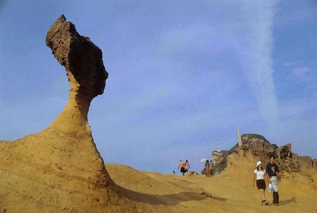
2,000 years of rain and wind have sculpted out the famed Queen's Head of Yehliu. (photo by Diago Chiu)
Longitudinal valley changes shape
When sufficient stress builds up in the earth's crust as the result of tectonic movement, displacement occurs along fault lines, thus triggering an earthquake. In fact, earthquakes happen much more frequently in Taiwan than we are aware. Most of them-some 500 per year, in fact-are too minor to be felt.
Yu Shui-pei, a researcher at the Academia Sinica's Institute of Earth Sciences, is intimately acquainted with the wriggling, writhing ways of this island we live on. In 1990 he began installing sensitive instruments around the island to measure their precise positions using a satellite positioning system. The instruments are now installed at 200 locations.
He has found that the Philippine plate is pushing the eastern coast of Taiwan eight centimeters to the west every year, prompting some to worry whether the reunification of Taiwan and mainland might not be accomplished through "geological means."
Actually, that is not going to happen, for the Eurasian plate of which Taiwan is a part is holding its own, pushing the western coast of Taiwan one centimeter to the east every year. If ever anyone or anything was "caught between a rock and a hard place," it was Taiwan! The East Longitudinal Valley is only one or two kilometers across at its narrower points, and is being compacted at the rate of four centimeters per year. If it continues "slimming down" at that rate, the valley may eventually disappear altogether.
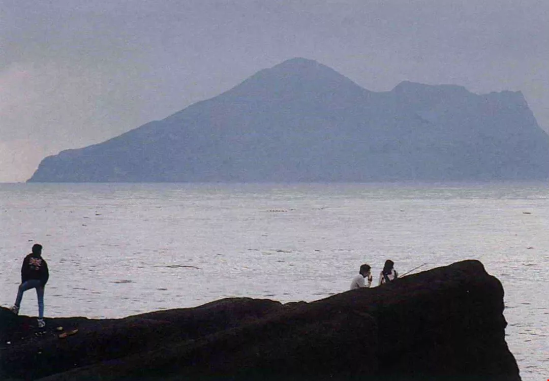
Kuishan Island ("turtle island") dominates the horizon as one looks out to sea from Ilan. It was once a fire-belching volcano, and still has hot springs today. (photo by Diago Chiu)
Fault lines criss-cross western Taiwan
Not all the power of the Philippine plate is expended in the East Longitudinal Valley. Much of it gets transmitted across the Central Mountain Range to alter the geology of western Taiwan.
To the north of the Central Mountain Range lies the Mount Snow Range. It is via this range that the force of tectonic activity has thrust up the foothills and tablelands of Miaoli and Hsinchu, where much of Taiwan's Hakka population is concentrated. Just south of there lie the tablelands of central Taiwan. This area is criss-crossed by numerous fault lines, and it was here that the Chichi Earthquake of September 21 struck. For various historical reasons, great numbers of Hakka immigrants settled in this part of Taiwan, and Hakka communities were hit hardest by the quake. Many localities noted for the preservation of traditional Hakka culture sustained heavy damage.
A cutaway view of central Taiwan's geological structure in east-west cross section reveals that the mountain ranges, plains, and foothills sit atop an extravagantly folded layer of rock cloven by numerous reverse faults. The resulting surface topography brings to mind the image of roof tiles, starting with the "eaves" in the west and running up the western face of the mountains to the peak.
How does Taiwan's tectonic activity compare with that observed elsewhere on the planet? The California coast is moving eastward, but only about three or four centimeters every year. Japan moves three centimeters a year due to activity along the boundary between two tectonic plates off the coast. Tectonic movement in Taiwan is clipping along at twice that pace.
According to Chen Cheng-hung, a geology professor at National Taiwan University who once coordinated a large ROC-US joint geological survey, earth science experts around the world like to take part in geological surveys in Taiwan because the island is much more geologically active than the Himalayas, for example, which are 60 to 70 million years old.
The Penghu Islands are volcanic in origin, but rather than exploding forth suddenly, the comparatively thin and runny magma there spilled out slowly and formed basaltic columns, an ideal material for the stone lions and columns used at temples. (photo by Huang Li-li)
Cypress forest saves the mountain
Some people use terms like and "father" and "son" to distinguish Taiwan's mountain ranges by relative age. The Central Mountain Range, which is the oldest, is called the "father." To the west, the mercurial "son" (the Mount Jade Range) rose later and actually towered higher than the 8000-meter Mount Everest for a time, but the upper half slid completely away to the west to form the Mount Ali Range, which is known as the "grandson." Even in its reduced state, however, the Mount Jade Range still boasts the highest mountain on the western Pacific rim, and avid mountain climbers have been flocking here ever since the period of Japanese colonial rule.
The botanist Chen Yu-feng has written: "The process of mountain formation in Taiwan has already passed its most active phase, and the arrangement of its tall mountains has basically been established. These provide a wide range of climates and habitats for many different forms of plant and animal life." The island has an astounding array of ecological diversity.
Successive ice ages have chased animals all the way from the Himalayas to Taiwan. Writes Chen Yu-feng: "With the southward migration of northern ecosystems, Taiwan offered an excellent place for refuge. As the ice caps subsequently retreated and temperatures rose, animals moved to higher altitudes. They unknowingly adopted Taiwan as their home, and have since evolved into many unique life forms." From the coral reefs in Kenting to the silver fir forests of Mount Jade, Taiwan supports everything from equatorial to arctic life forms.
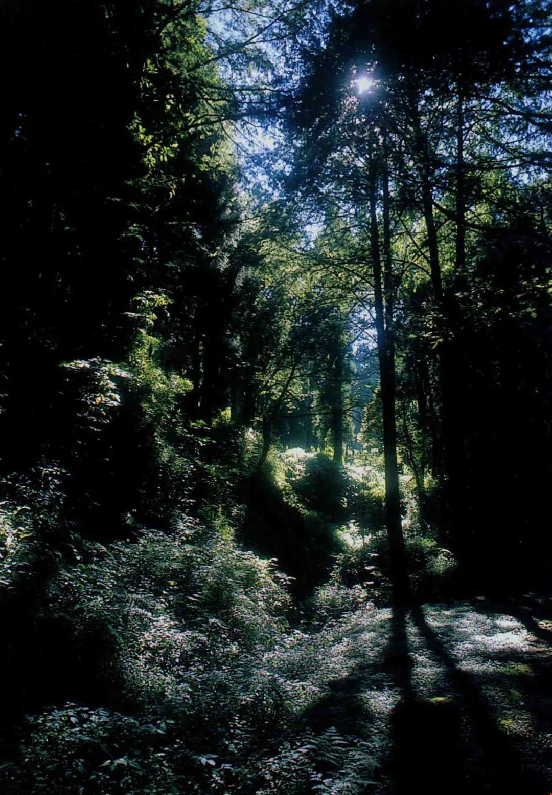
Formosan cypress, Japan cypress, and many other such species can be found throughout Taiwan in cloud forests from 1,500 to 2,800 meters above sea level. These unstable areas receive very high amounts of precipitation, and soil is eroded very rapidly. Each cypress holds on for dear life by its roots even as it towers majestically into the sky. These forests have brought verdant life to land that had been totally barren when it was first thrust up from the ocean floor. In the virgin forests that used to cover the island, 3,000-year-old cypresses could be found everywhere, and the first Japanese to arrive in Taiwan exclaimed of Mount Ali: "It's a sea of green!"
Kenting National Park in southern Taiwan sits stop an ancient coral reef that was thrust upward as the result of crustal deformation. Unlike Panpingshan in Kaohsiung, which became a major cement manufacturing zone, Kenting was declared a national park. (photo by Diago Chiu)
Creative destruction
Although incessant seismic activity wreaks occasional havoc in Taiwan, it has also created the very conditions necessary for sustained existence here. The rapidly rising mountains quickly erode and provide silt for the island's fertile plains.
Where there are mountains, furthermore, there is rain. Chen Lai-fa, director of the Weather Forecasting Center at the Central Weather Bureau, explains that when vapor drifting through the atmosphere runs into a mountain, it is forced to higher altitudes where cooler temperatures cause it to condense into rain. Moisture from the Pacific Ocean provides the island with plentiful precipitation.
Ecology expert Huang Jui-hsiang uses the metaphor of an airplane ride to describe the behavior of airborne moisture: "It flies over the plains without delivering its life-giving rain, and nothing can bring it back to earth except the mountains!"
Chen Yu-feng writes: "Taiwan enjoys plentiful water resources. If we developed all our hydroelectric resources to their full potential we would be able to generate over 5 gigawatts of electric power. It is our high mountains that bring down the rain and give us our abundant water. Average annual precipitation comes to 90 billion cubic meters, which gives the island a humid climate and luscious greenery. At the same time, our plant life traps and retains the moisture that falls here, thereby conserving soil and water resources."
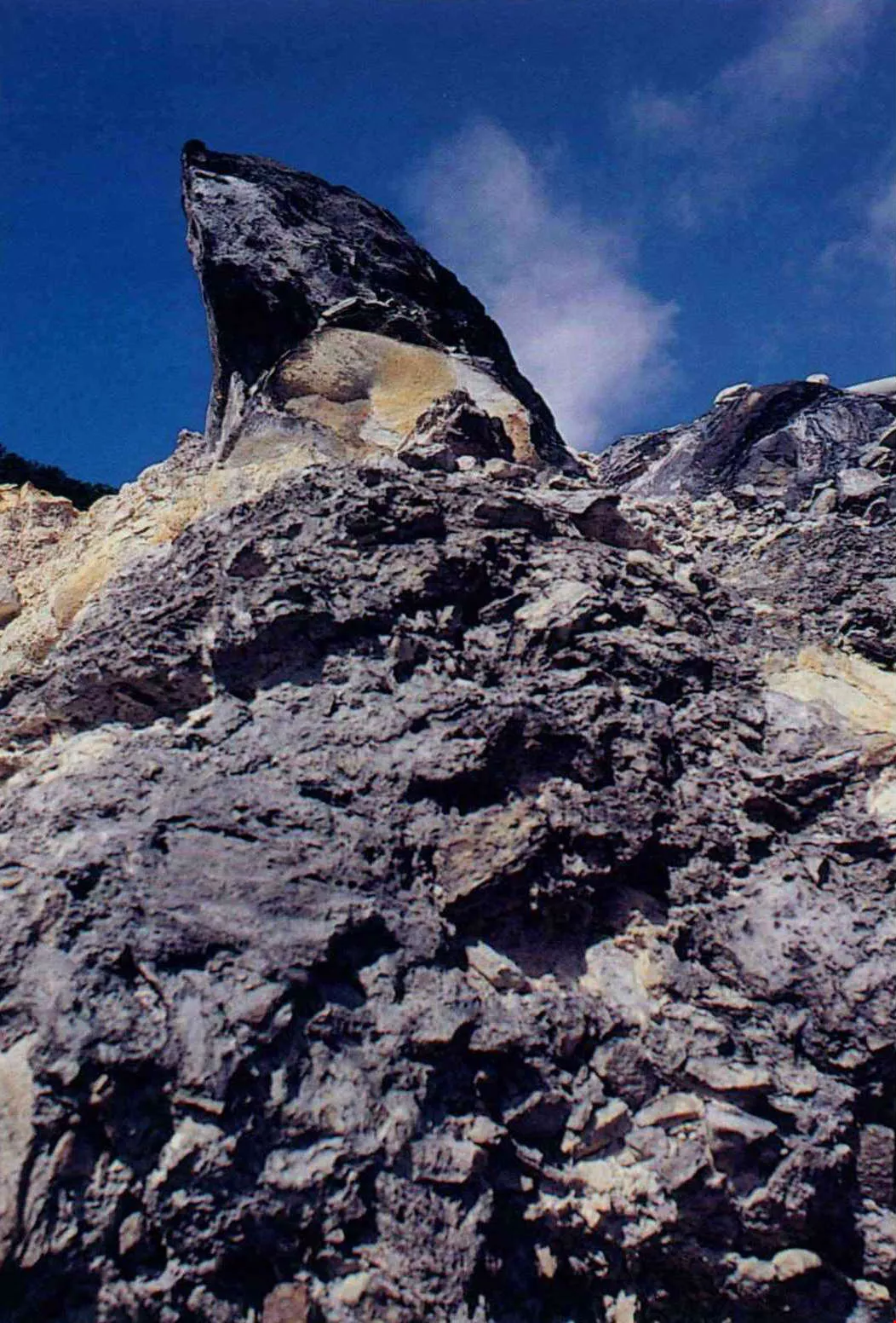
The earth's crust wriggles and writhes every which way. Besides convergent plates ramming into each other, the Eurasian plate in some places pulls apart at the edges, opening up gaps that give rise to volcanic activity. The beautiful Tatun mountains of northern Taipei are dormant volcanoes.
Nature's own "land reclamation"
Colliding tectonic plates thrust sharp, easily eroded mountains up to high elevations from whence heavy rainfall, landslides, and river action carry the mountains back to sea bit by bit. Taiwan's 151 rivers, which total nearly 3,000 kilometers in length, are a key part of this "wheel of life." They have carved out some of the world's most unique gorges in the east, and in the west have deposited the soil that makes up the most productive and beautiful plains on the island.
The Choshui River exemplifies this process perhaps better than any other river in Taiwan. It roars down through the Central Mountain Range past thirty peaks of greater than 3,000 meters on its way to the sea, where it dumps prodigious amounts of loose gravel and sand every year. In the last 2,000 to 3,000 years the river has built up huge new coastal flats in the counties of Changhua and Yunlin. The student of history will be well familiar with the results of this process. When early Han Chinese settlers first arrived in Kupenkang (modern-day Peikang) in the early 17th century, they saw a shoreline that is now 18 kilometers inland, which means that the tidal flats here have been expanding outward at an average of 48 meters every year.
The same process has been observed in the Chiayi-Tainan Plain to the south. The Ming loyalist general Zheng Chenggong (Koxinga) bombarded the Dutch from Anping Harbor, which today the inhabitants of Tainan City call Anping Ward! Property is now being built quickly there.
These alluvial plains were the first footholds for the island's earliest human inhabitants. Not every city that sits on an alluvial plain, however, is seeing its land area increase every year. The county of Ilan on the northeast coast has had something very different occur thanks to the way Taiwan is being buffeted and deformed by tectonic action.
It took millions of years for the mountains of Taiwan to rise from the ocean floor and grow a carpet of conifers to cover the crumbly soil. Unfortunately, it only took humans about a century to chop down almost all of the island's virgin forests. The remnants of the once-vast coniferous forests of Mount Ali look a bit lonely today.
Now you see it, now you don't
When one thinks of earthquakes, the first image that comes to mind is two fault blocks grinding against each other, but the earth offers many variations on this theme. The counties of Ilan and Hualien in northeastern Taiwan were the first parts of Taiwan to rise from the ocean floor when the Philippine plate rammed into the Eurasian plate six million years ago. After the Philippine plate began being subducted underneath the Eurasian plate, however, the force of the collision gradually shifted southward. Instead of being pushed upward, the earth's crust in northeastern Taiwan then began to pull apart under tensile stress. Volcanic activity ensued. Most anyone born in Taiwan is familiar with the delicious vegetables served at Ilan's hot spring resorts, but were you aware of the submerged volcanoes off the coast of Ilan? The next time you go for a dip in an Ilan hot spring, don't forget "who" heated your water for you, and when you gaze across the waters to Kuishan Island ("turtle island"), remember that this lumbering old tortoise was once a hot-headed youth!
So just how quickly is the Ilan Plain is getting stretched? The town of Toucheng lies some 50 kilometers to the north of Suao Harbor, and this distance increases by 3.5 centimeters per year. The mouth of the Lanyang River is being pulled apart faster than the silting process can fill it in, so while rivers around the world extend their deltas outward, this area finds the sea biting further inland every year. The earth's crust turns out to be quite the practical joker!
The effects of this crustal action extend to Taipei, where the Yangmingshan and Tatun mountain ranges remained volcanically active until just 200,000 years ago. Even today, the thermal vents and sulfuric vapors of the Tatun mountains continue to hint at the area's fiery past.
Every time a major earthquake hits, no matter where the epicenter is located people always end up talking about the geology of the Taipei basin. The city sits atop a former lake bed where the loose, soft soil jiggles like jello when an earthquake occurs. Earthquakes on this type of soil are especially dangerous. But how is it that the area was once a big lake? Did tectonic activity have anything to do with it?
The answer is affirmative. As the northern part of Taiwan pulled slowly apart, the land in this area subsided and then filled with water at the end of an ice age. The lake bed was later silted in completely by sediment carried in from the Mount Snow Range by the Tamsui River. The city sits on 100 meters of mud, but there is really no reason to get especially worried. While it is true that four reverse faults run through the Taipei basin as the result of ancient geological stresses, mountain-forming processes in this area have come to an end, and the faults in the Taipei basin are no longer subject to major stress. Geologists do not consider these faults very dangerous.
The Choshui River roars down through the mountains, bearing the sediment that has formed one of Taiwan's most productive plains. We have the Choshui River to thank for the delicious Choshui rice that is grown in central Taiwan.
An earthquake-free zone
Tectonic activity has been classified into seven main types. A treatment of this complex subject goes well beyond the scope of this article, but suffice it to say that nearly every type of tectonic activity can be observed on the small island of Taiwan. And then there's another interesting phenomenon-areas of almost no seismic activity at all. A map of all the earthquakes that have occurred in Taiwan over the past century shows a few such places.
One of the more notable ones is centered on the Penghu Islands and extends to Changhua and Yunlin. This area is underlain by an arched geological structure known as the Peikang High. Because the Peikang High is so resistant to deformation, the stress produced by crustal movement has always built up on its margins, and many earthquakes have tended to occur in this region. Earthquakes occur relatively frequently in Chiayi, for example, which is on the cusp of the Peikang High. The Meishan fault dates back to an earthquake that occurred in Chiayi in 1906. Many more large quakes have hit Chiayi since then, including a 6.4 temblor this past October 22. The Peikang High also prevents a lot of silt and sediment from flowing to southern Taiwan, and has thus had a great impact on the unique topography of the Kaohsiung-Pingtung region.
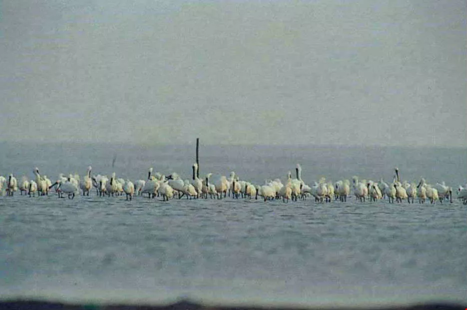
Soil carried down from the mountains continually settles along the coast, building up new tidal flats. This land is home to major fish-farming operations and provides a rich environment for wildlife. The Chiku coastal flats in Tainan are a major stopover for the black-faced spoonbill. (photo by Diago Chiu)
Cement-the gift of life
A trip from Tainan to Kaohsiung takes the traveler through one of Taiwan's key cement-producing areas. For many years, cement manufacturers quarried large quantities of limestone from this area, which offers scenery that is very different from that found in the Chiayi-Tainan Plain.
According to Professor Chen Wen-shan, the area just off Taiwan's southwest coast from Kaohsiung to Hengchun was lifted up due to fault action. Because it is located below 23.5 degrees north latitude, that part of the sea bottom within 10-20 meters of the water's surface supported a thriving coral reef. As the coastal region continued to thrust upward, the shallowest sections of coral reef rose above sea level, resulting in a layer of limestone. This rock has been mined for many years by the cement industry, but has begun to be depleted in recent years. As a result, cement manufacturers have begun to move their operations to Hualien County.
What is it about Hualien with its marble that attracts cement manufacturers to move there? The marble of Hualien, it turns out, once lay on the ocean floor collecting the remains of marine life for eons. The quantity of limestone in Kaohsiung pales in comparison with Hualien, and the Heping cement industrial zone is gradually replacing Kaohsiung and Pingtung as Taiwan's top cement-producing area.
Taiwan's many mist-enshrouded mountains are a favorite destination of naturalists. Mountain climbers come from near and far for the exhilaration of conquering the highest peak in East Asia.
Quick erosion
The rocks beneath our feet provide more than just cement. They also provide the footholds for dams that enable us to take maximum advantage of our water resources. It is important, of course, to be sure that dams are built on solid ground, which is one reason why geologists seek to understand what lies beneath our feet, from the metamorphic rock beneath the Central Mountain Range to the igneous formations of the East Coastal Range and the sedimentary layers in the west.
When the Shihmen Reservoir was in the planning stages some 30 years ago, a great controversy erupted over the question of dam design. Some favored an arch dam, while others argued for an embankment dam. Those against building an arch dam maintained that the sandstone geology of the Taoyuan tableland was not strong enough to withstand the tremendous pressure exerted by an arch dam. They summed up their argument as follows: "Put your left hand on my shoulder and your right hand on my neighbor's. Now lean against us. You're a dam, and we are mountains. As long as the mountains hold firm, you're ok. If we don't hold up, neither will you. That's precisely the problem. These mountains are not something you want to be leaning on."
The arch dam at Techi Reservoir in Taichung County did the engineers proud by escaping damage in the Chichi earthquake, for it was built on the very firm rock of the Mount Snow Range. Unfortunately, most of the island is made of sedimentary rock. Mount Chiuchiu in Shuangtung, which stands 400 to 500 meters high, is a loose mix of boulders and gravel that is especially vulnerable to the effects of an earthquake. In the words of geology professor Wang Hsin: "Just give it a good shake and it'll come crashing down."
No one knows better than geologists just how "collapsible" Taiwan is. During his days as a university student, Wang Hsin once looked all over Mount Ali for an area with some firm bedrock where he could study the mountain's geological strata, but everything he found was too crumbly to do him any good. The results of a study carried out in 1975 indicate that the rate of soil erosion in Taiwan's upper elevations is 44 times that of Asia as whole, 152 times that of North America, and 13.6 times that of the Alps. Rapid erosion is typical of young mountain ranges, and nowhere is this phenomenon demonstrated more clearly than in Taiwan. The pinnacle of achievement for Taiwan's highway engineers is undoubtedly Taiwan's three cross-island highways, each of which cuts east-west across the rugged mountains of the interior. It was a heady achievement for the engineers to blast and bore their way through the mountains, but nature seems to be exacting a measure of revenge, for it cannot be denied that these highways are extremely expensive to maintain due to the frequent landslides caused by heavy rains, especially during typhoons.
Rapacious logging of the coniferous forests of Mount Ali continued throughout the Japanese colonial period and on into the 1960s. When a heavy rain fell in the high mountains 50 years ago, it took a week for the water to arrive at the lower reaches of the various drainage basins. Today, however, a mountain downpour can cause a flood in Chiayi within two hours.
The geographer Chang Shih-chiao laments the wanton disregard of the Taiwanese people for the environment, and feels that we have exacerbated the damage of the recent earthquake through our own recklessness. In the end we are the ones who pay the price.
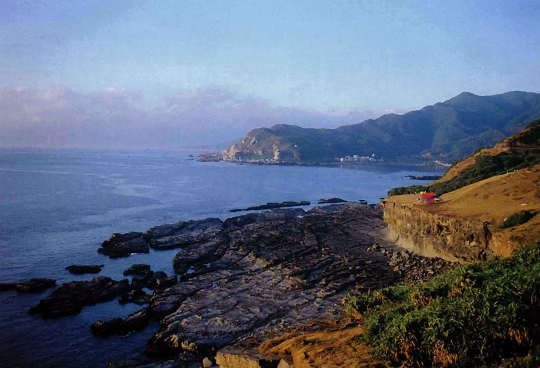
How many years of wind and rain did it take to create Taiwan's wildly weathered northeast coast?
Getting to know Taiwan
For architectural planning expert Ma Yi-kung, every mountain, river, hill, and valley holds infinite fascination, for he is intimately familiar with how the island was formed. Comments Ma: "The stunning string of mountains on Taipei's north side was formed through volcanic eruptions from 2 million through 200,000 years ago. The northeast coast was only thrust out of the ocean 10,000 years ago, and it then took 2,000 years for the forces of erosion to turn a flat sandstone shoreline into the baroque shapes along the coast in Yehliu. The formation of the Taroko Gorge can be traced back to tectonic activity that took place 70 million years ago. . . ."
We tend to forget the real relationship between man and nature. Perhaps if we open our eyes one day to the fact that we play out our lives on a stage constructed by the forces of nature, we will at last understand what it means to co-exist with nature.

_DSC2938@List.jpg?w=522&h=410&mode=crop&format=webp&quality=80)

@List.jpg?w=522&h=410&mode=crop&format=webp&quality=80)


