A Perilous Playground--Taichi Gorge
Florence Li / photos Chien Yun-ping / tr. by Mark Halperin
January 1986
In 1983, the Taiwan Forest Bureau designated the bamboo forests of Taan in Chushan in Nantou County as a central attraction in their forest recreation area project. Be that as it may, when visitors came to Taan, the forest found itself upstaged by neighboring Taichi Gorge, originally relegated to a supporting role. After 10 million of years of having its hard sandstone surface eaten away by the Chiatsouliao Creek, Taichi Gorge today presents an impressive sight of steep cliffs and quick-flowing waterfalls. Only those with expert mountain and rock climbing skills and raft navigating ability, can fully explore the sights of this area.
Three years ago, eleven mountain climbers, first made their way to Wanp'ing Landing in the upper section, descended the 50-meter cliff down to the creek, swam through Hell's Gorge, and then rock climbed their way to the top of the waterfall. This effort marked the first time the team had conquered this part of the gorge. The distance covered was a mere 400-500 meters, but their trek required six hours. Such tales contribute in no small way to the spot's reputation.
With the unusual ruggedness of the terrain, most people should spend three days and two nights to properly explore Taichi Gorge. From Taipei the visitor can take the train to Taichung and then take the bus to Chushan, or take another bus directly from Chunglun to Chushan. The whole trip takes about four hours. From Chushan, arrangements can be made with the mountain villa to take the local bus, which after passing through groves of betel nut palms and ascending a steep, serpentine gravel road, arrives at Tinglin Road. The local foliage is thick with broad-leafed cedars, camphor trees, and Taiwan elms. After half an hour, visitors arrive at the villa, 1050 meters above sea level.
The next day, the newcomers ride to the mountain entrance. Along the way is a moso-bamboo forest, whose fragrance is extraordinary. Winter bamboo shoots are grown from October to Chinese New Year. Spring bamboo shoots, grown from January until harvest in early April, lack the beauty and sweetness of their winter cousins and thus are less expensive. Summer is the peak season for pickled bamboo shoots, when their sour fragrance fills the air. Workers feed ma-bamboo into large cooking ranges and then cover them with banana leaves, pressing with big stones to let the water flow out. Though far from elegant, the scene, with its wooden shed, bamboo cage, and cooking range, does have its own simple kind of beauty.
At the other end of the bamboo forest lies the mountain entrance. After 40 minutes, visitors reach a crossroads from which lead five different paths. Right leads to the center section, while a turn left takes one to the upper section.
Accompanied by the gurgling sounds of Chiatsouliao Creek, visitors entering the center section, descend a stone stairway of over 1000 steps. Rocks of all sizes lay strewn everywhere, they being the original riverbed of Chiatsouliao Creek. Passing past the shoal, one encounters cliffs so sheer as to appear to have been cut with a knife. Traversing the many-colored creek is made easier by the placement of iron rings in the cliff for balance. The boulders are quite slippery and the swift creek water cold, and many met with a frigid accident before the installation of the rings. The old hand holds may still be seen.
Those negotiating the cliff may be forgiven for believing no road lies ahead, but actually at the summit is a waterfall. During late fall and early winter when the water level is neither too high nor too low, a small rainbow can be seen there on sunny days between 10 a.m. and noon, giving the site its name, Rainbow Falls. Beyond the waterfall and up a stone stairway, visitors can find a large natural run, created by erosion and full of creek water, trickling out the bottom. The whole formation reminds one of a large wine vase.
From here, visitors can walk a short way and after pausing by dark Bat Cave, turn, and find Taichi Falls, which marks the end of the middle section. The width of the span is quite short, so much so that from the front the cliffs on either side appear to touch. Below the cliffs two rocks jut out from either bank, presenting a gate-like appearance.
For the third day, attention turns to the upper section. (The lower section is not open and visitors are few.) A half-hour walk from the crossroads leads to a mountain path whose sides are strewn with dried-out bamboo leaves. Walking on them produces a crunching sound, the sound of autumn in these parts. The upper section is 520 meters above sea level, 480 meters above the middle section. The road leading to this section is also more humid. Visitors cross the chasm between 52-meter cliffs on T'ienchangtichiu bridge, from which they can see the dark green creek snake its way below.
Stepping off the bridge and turning left, we come to a broad sandstone platform, Wanp'ing Landing. The stretch from here to Hell's Gorge is the most spectacular part of the upper section. The drop is almost completely vertical, from the rock above to the water below, with no ledges along the way. Before, visitors could only marvel at Hell's Gorge from the bridge, but now the creek below is open to boats. There is a precipitous drop, however, and visitors must carry their craft over slippery rocks. Cotton socks are recommended to increase traction.
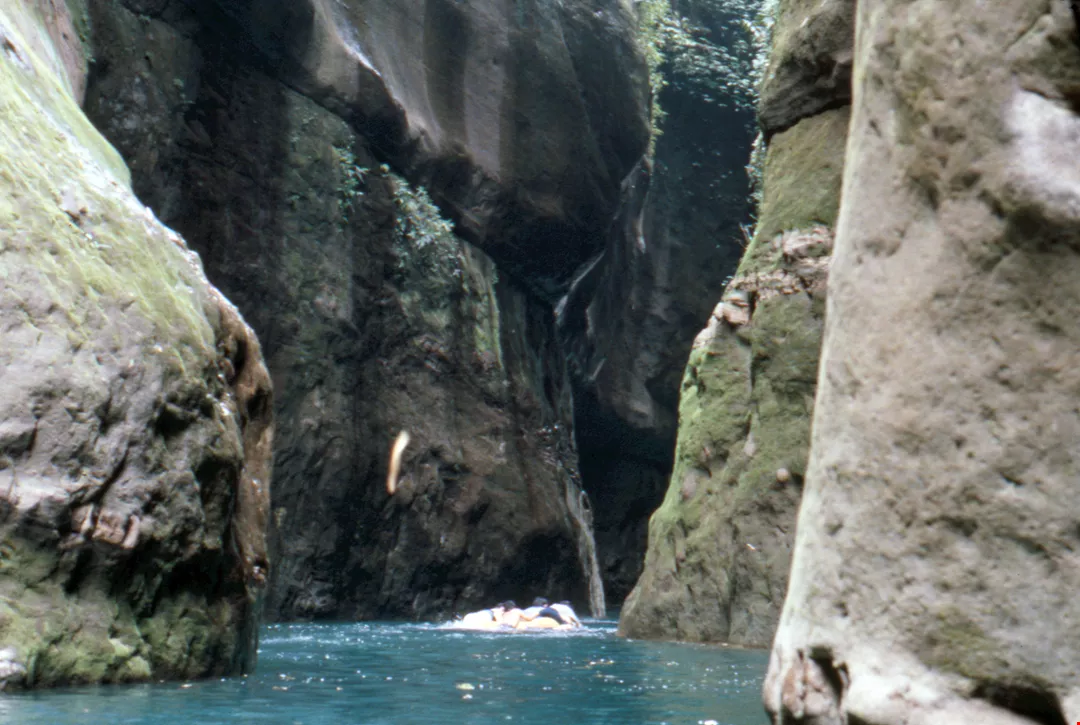
After gaining entry into Hell's Gorge, visitors leave a swiftly flowing torrent for a tranquil, dark stream. From below, the distance between cliffs looks so narrow as to admit only a thin line of light, and thus the nickname, "The Thread of Light." Gloomy, still, and wet, Hell's Gorge well deserves its title, frequently prompting visitors to contemplate the possibilities of life in the underworld.
From Hell's Gorge back to the mountain entrance, allow for at least four hours. At the end of three days in Taichi Gorge, visitors feel that their flesh and spirit have undergone an ordeal, but for those who like a challenge, there is no better feeling.
[Picture Caption]
"The Thread of Light" as seen from Hell's Gorge.
The entrance to Taichi Gorge is but the first challenge.
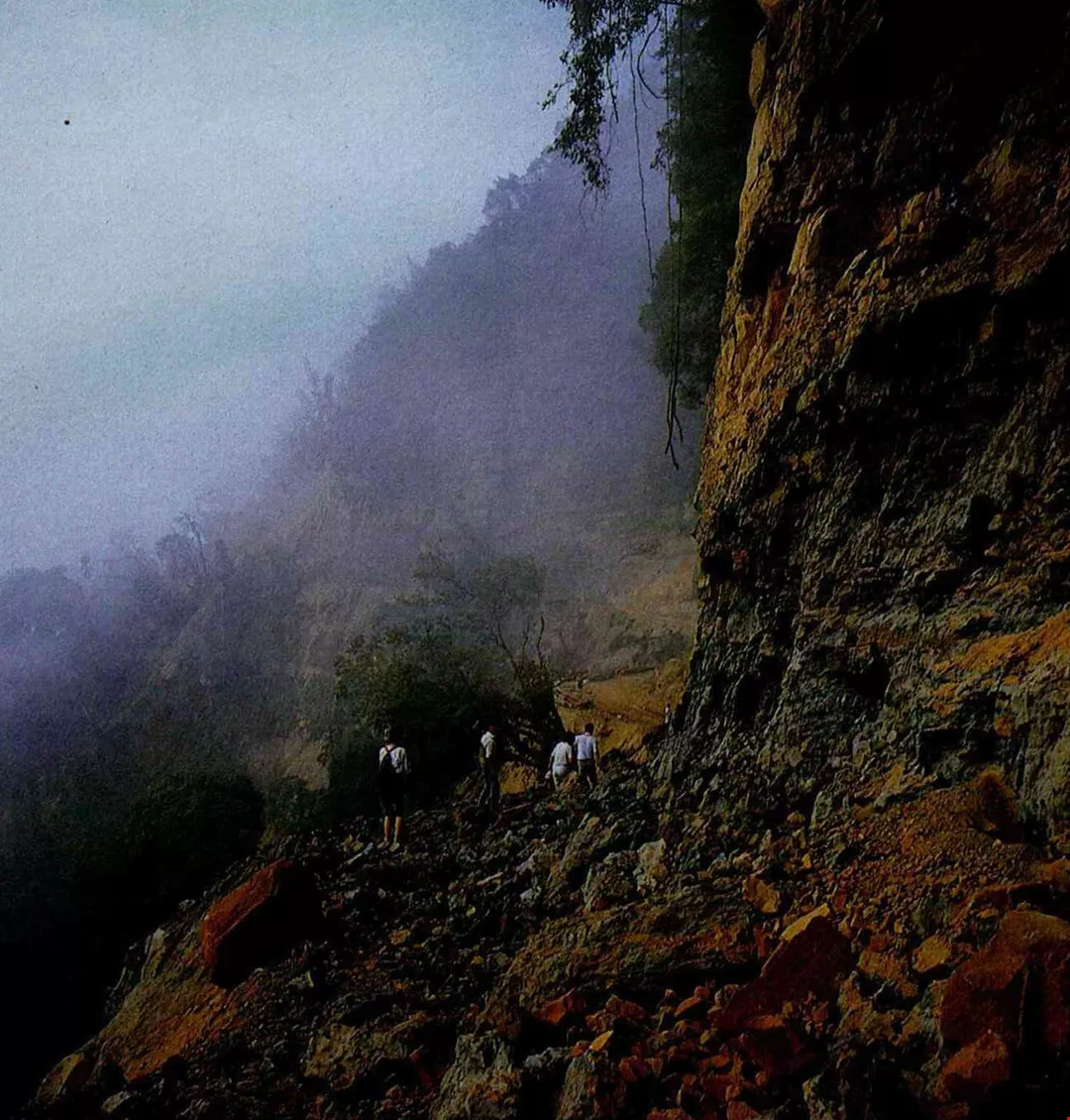
Elementary school students pose in the mist of dawn.
Dramatic cliffs, rushing torrents, massive boulders--a landscape fit for T'ang poets.
Above. 400-500 meters above sea level, visitors can find moist alocasia growing by the path. Below. Creek water reflection produces a delicate, lacy effect.
Whirlpool Falls are best viewed from a distance.
Passage through peaceful Hell's Gorge.
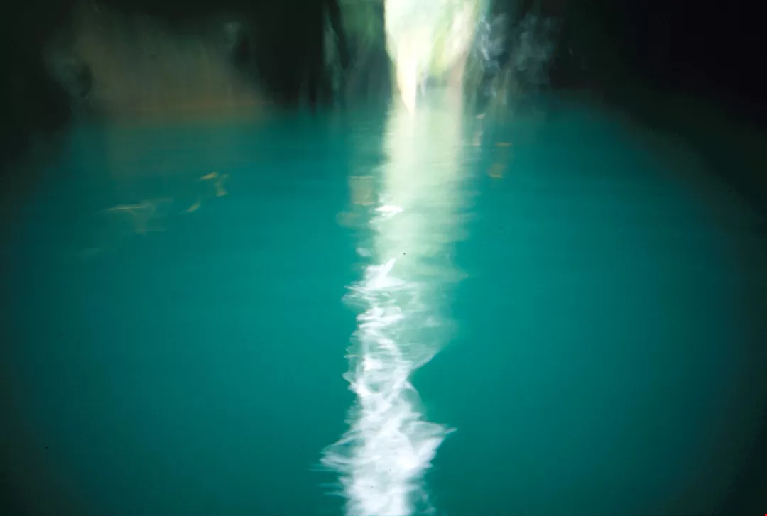
The Thread of Light" as seen from Hell's Gorge.
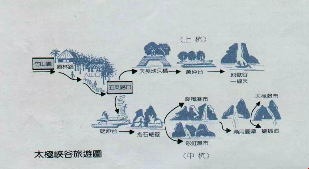
Tourist map to Tai-Chi canyon.
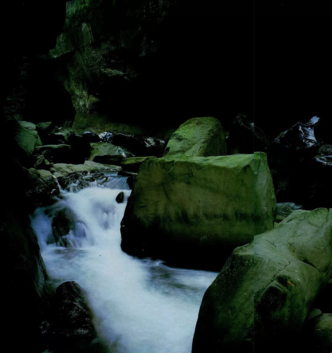
Dramatic cliffs, rushing torrents, massive boulders--a landscape fit for T'ang poets.
The entrance to Taichi Gorge is but the first challenge.
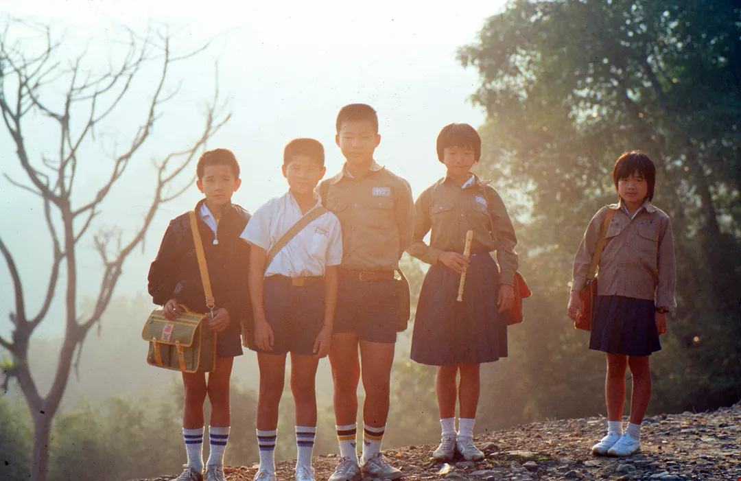
Elementary school students pose in the mist of dawn.
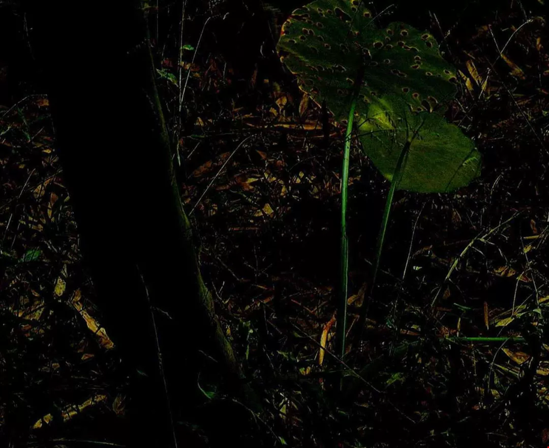
Above. 400-500 meters above sea level, visitors can find moist alocasia growing by the path. Below. Creek water reflection produces a delicate, lacy effect.
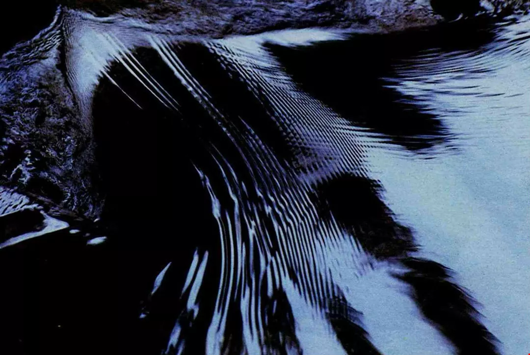
Creek water reflection produces a delicate, lacy effect.
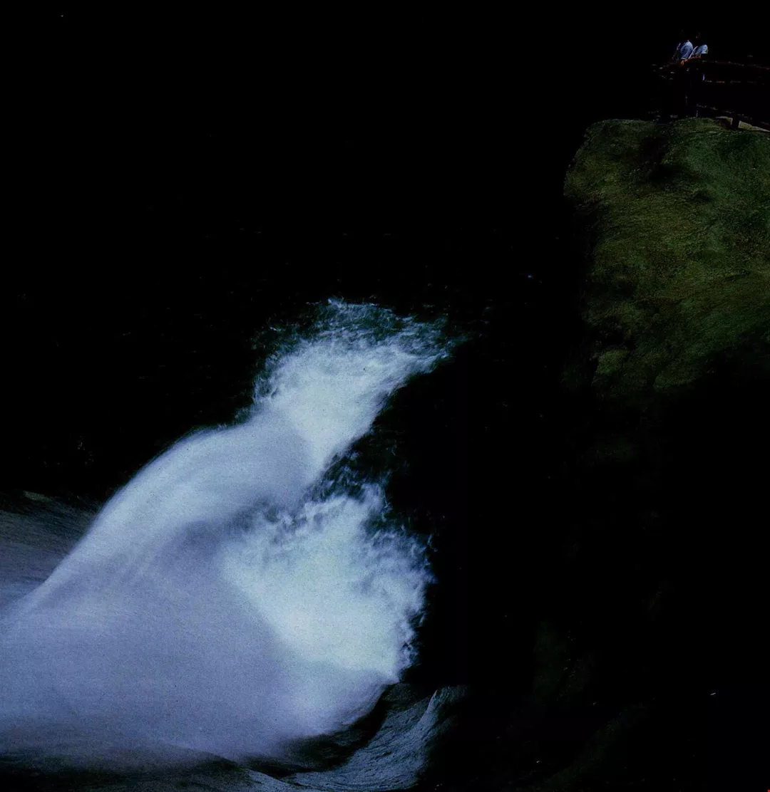
Whirlpool Falls are best viewed from a distance.
Passage through peaceful Hell's Gorge.


_DSC2938@List.jpg?w=522&h=410&mode=crop&format=webp&quality=80)


@List.jpg?w=522&h=410&mode=crop&format=webp&quality=80)