The Mainland: The Sands Move South
Gypsy Chang / photos Chin-Show Ltd. / tr. by Peter Eberly
December 1986


"China: The Good Earth" is series of reports on the environmental problems facing the Chinese land, whether on the mainland, Taiwan, or Hainan Island. This issue examines the changes that have occurred to China's forests.
The Yellow River, true to its name, annually carries as much as 1.6 billion tons of silt into the sea, more than any other river in the world.
The saying "the Yellow River has a hundred ways to hurt you and only one to help," the quip "jump into the Yellow River and you won't wash clean," and the nickname "little Yellow Rivers" given to its flood channels--all point to the degree of damage done by the river.
Nevertheless, the Yellow River is the birthplace of Chinese civilization. How did the Chinese people manage to establish themselves in an area apparently so lacking in natural resources as the valley of the turbid Yellow River?
The results of research prove rather surprising: the victim over the past several thousands of years has not been Man--but the river.
Research shows that the loess plain, traversed by the Yellow River and covering six provinces and one territory in northern China, was once a region rich in forests and vegetation, and that the river, as described in the ancient Shih ching, or Book of Songs, was once "clear and rippling." Forests provided the protection from wind and water erosion to make this an excellent agricultural area.
But as mankind exploited the region, the forest cover was reduced from an original 53 percent to under five percent. And the river responded accordingly. Studies show that, dividing the past 2,500 years into four periods, the river burst its banks just 29 times over the first two periods, but 230 times during the third, and 1,300 during the last.
Having lost one agricultural area, China can rely on another abundant food basket: the Yangtze River Valley. Or can it?
According to 1981 figures, the Yangtze now washes away 500 million tons of silt a year, the fourth highest quantity in the world. Largely because of deforestation, the Yangtze may be turning into another "yellow" river.
Chinese forests met with widespread destruction during "The Great Leap Forward" campaign initiated in 1958, when millions of trees were cut down to serve as fuel for primitive "backyard" furnaces producing useless pig iron.
The movement "in agriculture learn from Tachai," begun in 1964, spelled further devastation for China's forests. And the ten disastrous years of the Cultural Revolution were a Dark Ages for China's forests, which, in the absence of any management authority whatever, were hacked and burned indiscriminately.
The repeated series of shocks has left none of the mainland's major forest areas unthreatened.
China's largest forestry region, containing two-thirds of the country's forest resources, has always been the Northeast. And now? A mainland publication in March 1986 reported that timber reserves in eight of Heilungkiang Province's 40 forestry districts have been completely exhausted, that 22 have less than 12 years of life remaining, and that only 10, if properly maintained, still have a chance to be permanently useful.
China's second and third largest forest regions are in Szechwan and Sikang Provinces and in southeast Tibet. Yet a February 1986 report in "People's Daily" said that the forest cover of the 53 counties through which the major tributaries of the Yangtze River flow now falls below three percent--one reason why the Yangtze River is turning "yellow." And China's fourth largest forest, in Yunnan, has shrunk by three-fourths in less than 30 years.
This massive deforestation has had a devastating impact on two crucial environmental factors: water and soil.
Because of their ability to retain water and to moderate temperature and rainfall, forests are excellent natural reservoirs. So, looking at the Northeast, the serious reduction in forests there has led to a drop in annual precipitation from over 600 mm. to around 300 mm. and to unprecedented spring droughts, as reported in the magazine Red Flag.
Floods have also increased in frequency. The Associated Press wire service reported in August 1986 that two months of flooding in Kilin Province had left 800,000 homeless and caused US$1.2 billion in damage.
Floods have also increasingly struck the Yangtze River, due to wanton exploitation of the river's upper reaches and to the diminishment of riverine lakes from excessive land reclamation (see last month's issue).
The combination of droughts and floods has also led to serious soil erosion, silting up dams and muddying river waters. According to a Peking report published in November 1986, erosion causes a loss of 10 billion tons of soil a year and affects l.5 million sq. km., or nearly one-sixth of the mainland's total land area.
What's worse, the eroded soil is chiefly high-quality topsoil. A mainland article in 1985 estimated that 40 million tons of nitrogen, potassium, sulfur, and other natural fertilizers are washed away each year--more than the total quantity of fertilizers applied annually.
With water resources unstable and soil less fertile, agricultural production per acre has naturally dropped. To make up for the decline, the reaction has been to open up more land by chopping down more forests, creating a vicious cycle.
Under these circumstances, with a growing population, "per capita agricultural land on the mainland is only one-half what it was in 1949," Cheng Chu-yuan of Ball State University points out.
Nor is this the worst consequence of deforestation. The final stage of soil deterioration is--desertification.
"Deserts are man-made" is no alarmist exaggeration.
The Northeast and Inner Mongolia are the regions most seriously affected. In March 1986 the vice-director of the Communists' National Meteorological Bureau stated that the forests on the two major mountain ranges of the Northeast, which had originally acted as a giant screen against the winds of Siberia, were so exhausted that drifting sands were turning eastern Inner Mongolia and western Manchuria into a vast barren wasteland.
And the winds continue on southward. In May 1986, the New China News Agency reported the first case of desertification south of the Yangtze, including a 48-km.- long "sand dragon" which is swallowing up cropland.
In the face of the desert's epidemic-like spread, the Communists in 1978 began to plant a series of forests they styled the "Green Great Wall" stretching, they claim, some 7,000 km. across northern China.
If this is true, it's good news for our country's forests. But Western scholars have raised doubts about the effectiveness of the program.
Huang Jui-hsiang of the University of Hawaii says that the infertility of the soil and the aridity of the climate caused by desertification will make it extremely difficult for saplings to take root and survive.
Besides the "Green Great Wall," the Chinese Communists have periodically encouraged farmers around the country to plant trees, but what with the "backyard" furnace campaign, the policy of "grain is the key link," and the Cultural Revolution, the speed of restoration has fallen far behind that of destruction. Poor technology has hampered efforts even further.
Most frustrating to those concerned about the environment on the mainland has not been the lack of effectiveness of afforestation efforts but that the indiscriminate deforestation seems to show no signs of abating. The reason is that timber is a major material in producing machinery, furniture, paper, and other products needed for the Communists' "Four Modernizations."
"In all, over the past five years, the forest area on the mainland has decreased by over 20 million mu a year, as much as the total forested area on Taiwan," Professor Cheng Chu-yuan says.
Geographers say that an even distribution of forests over 30 percent of a country's land can stabilize climate and reduce the occurrence of droughts and floods so as to provide a solid basis for agricultural development. The mainland's is just 9 percent, one of the lowest in the world.
Lumbering technology has advanced continually with the development of new tools, but trees can grow only at a fixed rate. In the past, people could perhaps maintain a forest's area by replacing the trees chopped down each year with a year of planting, but today Man can cut down the trees planted over a century in a single year.
History doesn't stop. The Yellow River's becoming "yellow" may perhaps be ascribed to ignorance; if the Yangtze should change color, what excuse will this generation have to offer history?
[Picture Caption]
After it leaves the mountains and enters the plain, the Yellow River becomes even muddier. The photograph shows residents of the Chengchou area, in Honan Province, raising dikes.
Chinese Mainland Forest Overview
(Sinorama files)
The harbor at Chungking, a major commercial and industrial center on the Yangtze River, is afflicted by serious silting.
The Yellow River is clearest at Liuchiahsia, on its upper reaches.
The forests of the Northeast, China's largest forestry region, have been exploited in great quantities; at right is a forest near the Amur River.
Three scenes of erosion in Shensi Province. (photo courtesy of Huang Jui-hsiang)
Drifting sands have invaded the Hulunpeier Highlands, originally a vast grassland. (photo courtesy of Huang Jui-hsiang)
Southern Yunnan, the region of China richest in tropical flora and fauna, is home to the T'ai people, who still preserve a unique culture and way of life.

The forests of the Northeast, China's largest forestry region, have been exploited in great quantities; at right is a forest near the Amur River.
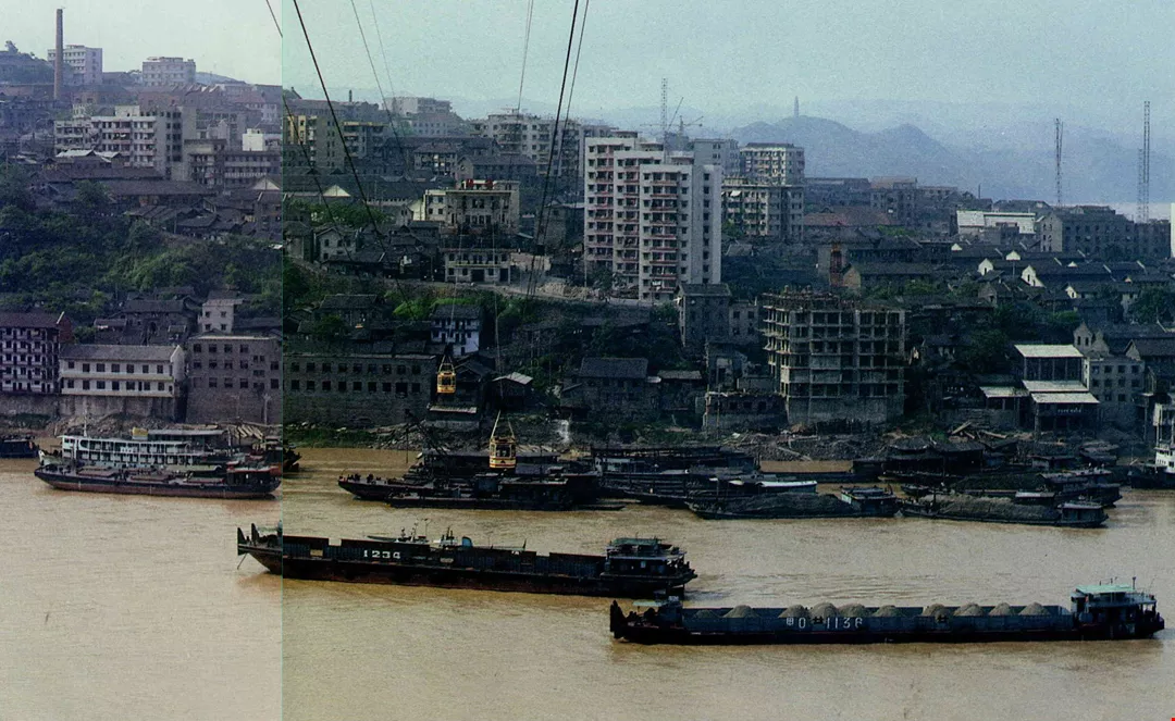
The harbor at Chungking, a major commercial and industrial center on the Yangtze River, is afflicted by serious silting.

The forests of the Northeast, China's largest forestry region, have been exploited in great quantities; at right is a forest near the Amur River.

at right is a forest near the Amur River.
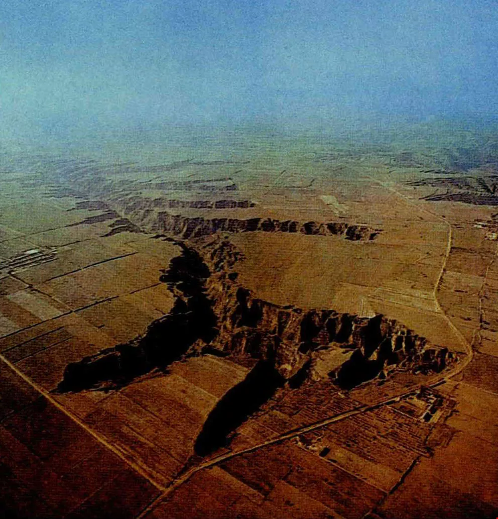
Three scenes of erosion in Shensi Province.

Three scenes of erosion in Shensi Province.

Three scenes of erosion in Shensi Province.
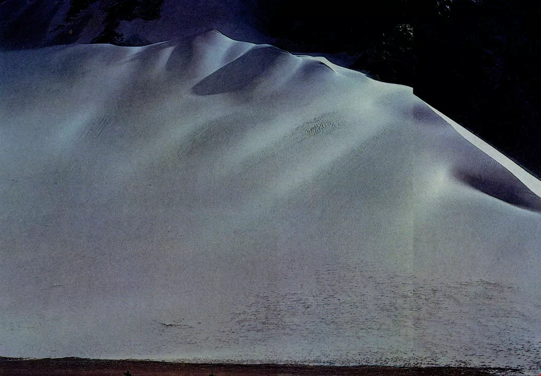
Drifting sands have invaded the Hulunpeier Highlands, originally a vast grassland. (photo courtesy of Huang Jui-hsiang)

Southern Yunnan, the region of China richest in tropical flora and fauna, is home to the T'ai people, who still preserve a unique culture and way of life.
@List.JPG?w=522&h=410&mode=crop&format=webp&quality=80)